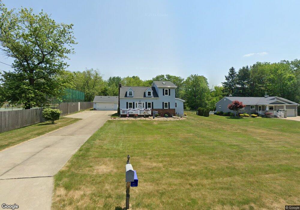
9333 Webster Rd Strongsville, OH 44136
Estimated Value: $302,000 - $387,000
4
Beds
3
Baths
2,401
Sq Ft
$143/Sq Ft
Est. Value
About This Home
This home is located at 9333 Webster Rd, Strongsville, OH 44136 and is currently estimated at $344,106, approximately $143 per square foot. 9333 Webster Rd is a home located in Cuyahoga County with nearby schools including Strongsville High School, The Academy of St. Bartholomew, and Bethel Christian Academy.
Ownership History
Date
Name
Owned For
Owner Type
Purchase Details
Closed on
Sep 1, 1978
Sold by
Jervinsky Thomas S
Bought by
Allen Edward L
Current Estimated Value
Purchase Details
Closed on
Jul 15, 1977
Sold by
Jervinsky Thomas S
Bought by
Jervinsky Thomas S
Purchase Details
Closed on
Feb 25, 1976
Sold by
Zawadski Raymond A and Zawadski Helen M
Bought by
Jervinsky Thomas S
Purchase Details
Closed on
Jan 1, 1975
Bought by
Zawadski Raymond A and Zawadski Helen M
Create a Home Valuation Report for This Property
The Home Valuation Report is an in-depth analysis detailing your home's value as well as a comparison with similar homes in the area
Home Values in the Area
Average Home Value in this Area
Purchase History
| Date | Buyer | Sale Price | Title Company |
|---|---|---|---|
| Allen Edward L | $46,000 | -- | |
| Jervinsky Thomas S | -- | -- | |
| Jervinsky Thomas S | $32,000 | -- | |
| Zawadski Raymond A | -- | -- |
Source: Public Records
Tax History Compared to Growth
Tax History
| Year | Tax Paid | Tax Assessment Tax Assessment Total Assessment is a certain percentage of the fair market value that is determined by local assessors to be the total taxable value of land and additions on the property. | Land | Improvement |
|---|---|---|---|---|
| 2024 | $4,387 | $103,250 | $16,940 | $86,310 |
| 2023 | $3,980 | $72,730 | $18,760 | $53,970 |
| 2022 | $3,977 | $72,730 | $18,760 | $53,970 |
| 2021 | $3,946 | $72,730 | $18,760 | $53,970 |
| 2020 | $3,650 | $61,110 | $15,750 | $45,360 |
| 2019 | $3,543 | $174,600 | $45,000 | $129,600 |
| 2018 | $3,135 | $61,110 | $15,750 | $45,360 |
| 2017 | $3,204 | $57,050 | $12,390 | $44,660 |
| 2016 | $3,754 | $56,250 | $12,390 | $43,860 |
| 2015 | $3,643 | $56,250 | $12,390 | $43,860 |
| 2014 | $3,643 | $54,600 | $12,040 | $42,560 |
Source: Public Records
Map
Nearby Homes
- 9531 Nicole Cir
- 9890 Webster Rd
- 10010 Chevy Chase
- 9129 Tahoe Cir
- Buchanan Plan at The Enclave at Pine Lakes Crossing
- Belleville Plan at The Enclave at Pine Lakes Crossing
- 0 Webster Rd
- 14069 Basswood Cir
- 9945 Twelve Oaks Cir
- 13976 W Sprague Rd
- 14015 Byron Blvd
- 15485 Albion Rd
- 10369 Council Bluff
- 8761 Windfall Ct
- 7685 Saratoga Rd
- 14584 Baywood Ln
- 14557 Baywood Ln
- 14644 Baywood Ln
- 13402 Bridgecreek Cir
- 12721 Patricia Dr
- 9377 Webster Rd
- 9417 Webster Rd
- 9461 Webster Rd
- 9336 Webster Rd
- 9210 Webster Rd
- 9290 Webster Rd
- 9376 Webster Rd
- 9416 Webster Rd
- 9507 Webster Rd
- 9424 Webster Rd
- 14849 Whitney Rd
- 9547 Webster Rd
- 14577 Whitney Rd
- 14889 Whitney Rd
- 9530 Webster Rd
- 14489 Whitney Rd
- 9502 Webster Rd
- 14937 Whitney Rd
- 14720 Whitney Rd
- 14712 Whitney Rd