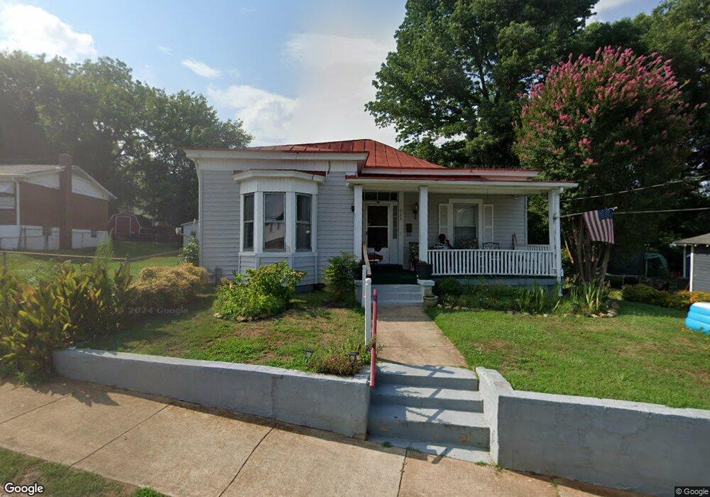
934 Colquhoun St Danville, VA 24541
Estimated Value: $42,000 - $86,000
2
Beds
1
Bath
1,084
Sq Ft
$65/Sq Ft
Est. Value
About This Home
This home is located at 934 Colquhoun St, Danville, VA 24541 and is currently estimated at $70,339, approximately $64 per square foot. 934 Colquhoun St is a home located in Danville City with nearby schools including Sacred Heart Catholic School, Epiphany Episcopal School, and White Oak School.
Ownership History
Date
Name
Owned For
Owner Type
Purchase Details
Closed on
Aug 23, 2007
Sold by
Emc Mortgage Corp
Bought by
Atkins Randy W
Current Estimated Value
Home Financials for this Owner
Home Financials are based on the most recent Mortgage that was taken out on this home.
Original Mortgage
$18,000
Outstanding Balance
$11,466
Interest Rate
6.78%
Mortgage Type
New Conventional
Estimated Equity
$58,873
Purchase Details
Closed on
May 11, 2007
Sold by
Samuel I White Pc Sub Tr
Bought by
Wells Fargo Bank Na
Create a Home Valuation Report for This Property
The Home Valuation Report is an in-depth analysis detailing your home's value as well as a comparison with similar homes in the area
Home Values in the Area
Average Home Value in this Area
Purchase History
| Date | Buyer | Sale Price | Title Company |
|---|---|---|---|
| Atkins Randy W | $18,000 | -- | |
| E M C Mortgage Corp | $18,000 | -- | |
| Wells Fargo Bank Na | $34,200 | -- |
Source: Public Records
Mortgage History
| Date | Status | Borrower | Loan Amount |
|---|---|---|---|
| Open | Wells Fargo Bank Na | $18,000 |
Source: Public Records
Tax History Compared to Growth
Tax History
| Year | Tax Paid | Tax Assessment Tax Assessment Total Assessment is a certain percentage of the fair market value that is determined by local assessors to be the total taxable value of land and additions on the property. | Land | Improvement |
|---|---|---|---|---|
| 2024 | $245 | $29,500 | $2,400 | $27,100 |
| 2023 | $205 | $24,400 | $2,400 | $22,000 |
| 2022 | $205 | $24,400 | $2,400 | $22,000 |
| 2021 | $181 | $21,600 | $2,400 | $19,200 |
| 2020 | $181 | $21,600 | $2,400 | $19,200 |
| 2019 | $186 | $22,200 | $2,400 | $19,800 |
| 2018 | $178 | $22,200 | $2,400 | $19,800 |
| 2017 | $208 | $26,000 | $2,400 | $23,600 |
| 2016 | $190 | $26,000 | $2,400 | $23,600 |
| 2015 | $196 | $26,900 | $2,400 | $24,500 |
| 2014 | $196 | $26,900 | $2,400 | $24,500 |
Source: Public Records
Map
Nearby Homes
- 507 Holbrook Ave
- 169 Holbrook Ave
- 408 Sutherlin Place
- 902 Paxton St
- 931 Paxton St
- 135 Sutherlin Ave
- 727 Holbrook Ave
- 854 Stokes St
- 863 Stokes St
- 827 Stokes St
- 1111 Paxton St
- 730 Temple Ave
- 718 E Green St
- 724 Temple Ave
- 620 Berryman Ave
- 1218 Paxton St
- 1206 Forest St
- 625 Berryman Ave
- 157 Broad St
- 0 Lee St
- 934 Colquohoun St
- 920 Colquohoun St
- 896 Colquohoun St
- 935 Green St
- 918 Colquohoun St
- 916 Colquohoun St
- 927 Green St
- 937 Green St Unit 939
- 605 Holbrook Ave
- 925 Green St
- 941 Green St
- 907 Colquohoun St
- 619 Holbrook Ave
- 910 Colquohoun St
- 901 Colquhoun St
- 923 Green St
- 919 Green St Unit 921
- 940 Green St
- 162 Sutherlin Ave
- 908 Colquohoun St Unit A