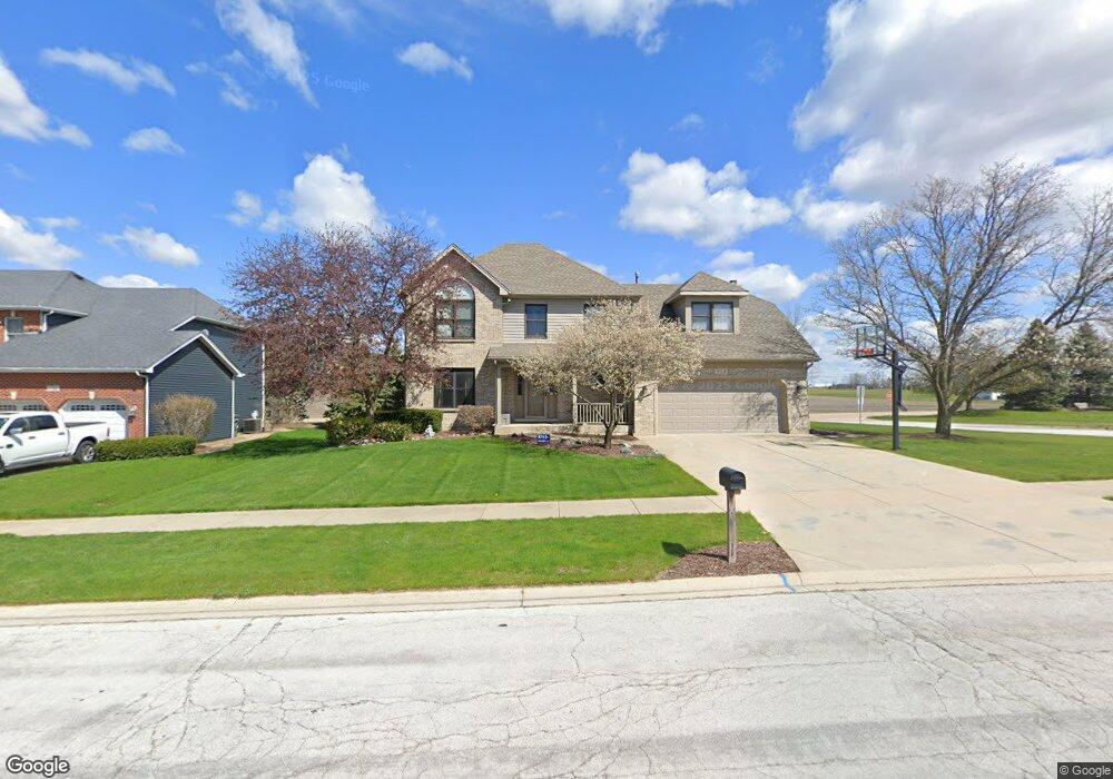
934 Merrill New Rd Unit 1 Sugar Grove, IL 60554
Estimated Value: $467,000 - $520,000
--
Bed
--
Bath
2,481
Sq Ft
$196/Sq Ft
Est. Value
About This Home
This home is located at 934 Merrill New Rd Unit 1, Sugar Grove, IL 60554 and is currently estimated at $485,941, approximately $195 per square foot. 934 Merrill New Rd Unit 1 is a home located in Kane County with nearby schools including Kaneland Mcdole Elementary School, Harter Middle School, and Kaneland High School.
Ownership History
Date
Name
Owned For
Owner Type
Purchase Details
Closed on
Jun 6, 1997
Sold by
Nagel Siebert Trucking Inc
Bought by
Siebert Trent and Siebert Dawn
Current Estimated Value
Purchase Details
Closed on
Apr 11, 1997
Sold by
Prairie Land Investment Inc
Bought by
Nagel Seibert Trucking Inc
Purchase Details
Closed on
Dec 13, 1994
Sold by
St Paul Financial Development Corp
Bought by
Prairie Land Investments Inc
Home Financials for this Owner
Home Financials are based on the most recent Mortgage that was taken out on this home.
Original Mortgage
$26,175
Interest Rate
9.06%
Create a Home Valuation Report for This Property
The Home Valuation Report is an in-depth analysis detailing your home's value as well as a comparison with similar homes in the area
Home Values in the Area
Average Home Value in this Area
Purchase History
| Date | Buyer | Sale Price | Title Company |
|---|---|---|---|
| Siebert Trent | $49,000 | Law Title Insurance Co Inc | |
| Nagel Seibert Trucking Inc | -- | -- | |
| Prairie Land Investments Inc | $35,000 | First American Title Insuran |
Source: Public Records
Mortgage History
| Date | Status | Borrower | Loan Amount |
|---|---|---|---|
| Previous Owner | Prairie Land Investments Inc | $26,175 |
Source: Public Records
Tax History Compared to Growth
Tax History
| Year | Tax Paid | Tax Assessment Tax Assessment Total Assessment is a certain percentage of the fair market value that is determined by local assessors to be the total taxable value of land and additions on the property. | Land | Improvement |
|---|---|---|---|---|
| 2024 | $11,050 | $138,175 | $32,234 | $105,941 |
| 2023 | $10,686 | $124,617 | $29,071 | $95,546 |
| 2022 | $10,280 | $115,045 | $26,838 | $88,207 |
| 2021 | $9,908 | $109,484 | $25,541 | $83,943 |
| 2020 | $9,768 | $107,148 | $24,996 | $82,152 |
| 2019 | $9,128 | $98,683 | $24,179 | $74,504 |
| 2018 | $9,133 | $96,474 | $24,242 | $72,232 |
| 2017 | $8,852 | $92,135 | $23,152 | $68,983 |
| 2016 | $8,640 | $88,075 | $22,132 | $65,943 |
| 2015 | -- | $81,946 | $20,592 | $61,354 |
| 2014 | -- | $78,357 | $19,690 | $58,667 |
| 2013 | -- | $79,181 | $19,897 | $59,284 |
Source: Public Records
Map
Nearby Homes
- 905 Merrill New Rd
- 868 Edgewood Dr
- 933 Lakeridge Ct
- 954 Black Walnut Dr
- 947 Lakeridge Ct
- 611 Pine St
- 757 Merrill New Rd Unit 7
- 778 Black Walnut Ct
- 781 Manor Hill Place
- 706 Brighton Dr
- 684 Greenfield Rd
- 670 Sheffield Cir
- 693 Greenfield Rd
- 1070 Wheatfield Ave
- 7 Douglas Dr Unit 3
- Lot 30 Chestnut Hill Ln
- 966 Wheatfield Ave
- 917 Wheatfield Ave
- 905 Wheatfield Ave
- 352 Normandie Dr
- 932 Merrill New Rd Unit 1
- 839 Queens Gate Cir
- 930 Merrill New Rd Unit 1
- 935 Merrill New Rd
- 937 Merrill New Rd
- 933 Merrill New Rd
- 837 Queens Gate Cir Unit 1
- 939 Queens Gate Cir Unit 1
- 931 Merrill New Rd
- 923 Abbey Ct
- 835 Queens Gate Cir Unit 1
- 937 Stamford Place
- 939 Stamford Place
- 921 Abbey Ct Unit 1
- 832 Queens Gate Cir
- 833 Queens Gate Cir Unit 1
- 935 Stamford Place Unit 1
- 925 Merrill New Rd Unit 1
- 830 Queens Gate Cir
- 919 Abbey Ct