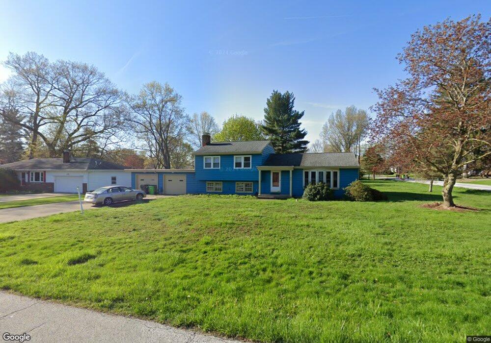
934 Norton Dr Tallmadge, OH 44278
Estimated Value: $263,000 - $313,000
3
Beds
2
Baths
1,224
Sq Ft
$239/Sq Ft
Est. Value
About This Home
This home is located at 934 Norton Dr, Tallmadge, OH 44278 and is currently estimated at $292,951, approximately $239 per square foot. 934 Norton Dr is a home located in Summit County with nearby schools including Tallmadge Middle School, Tallmadge High School, and Cornerstone Community School.
Ownership History
Date
Name
Owned For
Owner Type
Purchase Details
Closed on
Jun 30, 2010
Sold by
Nord Rosemary P
Bought by
Filous Joseph A and Filous Angela R
Current Estimated Value
Purchase Details
Closed on
May 1, 1998
Sold by
Cole Etta L
Bought by
Nord Charles L and Nord Rosemary A
Home Financials for this Owner
Home Financials are based on the most recent Mortgage that was taken out on this home.
Original Mortgage
$114,000
Interest Rate
7.18%
Mortgage Type
New Conventional
Create a Home Valuation Report for This Property
The Home Valuation Report is an in-depth analysis detailing your home's value as well as a comparison with similar homes in the area
Home Values in the Area
Average Home Value in this Area
Purchase History
| Date | Buyer | Sale Price | Title Company |
|---|---|---|---|
| Filous Joseph A | -- | None Available | |
| Nord Charles L | $128,000 | -- |
Source: Public Records
Mortgage History
| Date | Status | Borrower | Loan Amount |
|---|---|---|---|
| Previous Owner | Nord Charles L | $114,000 |
Source: Public Records
Tax History Compared to Growth
Tax History
| Year | Tax Paid | Tax Assessment Tax Assessment Total Assessment is a certain percentage of the fair market value that is determined by local assessors to be the total taxable value of land and additions on the property. | Land | Improvement |
|---|---|---|---|---|
| 2025 | $4,153 | $80,130 | $17,616 | $62,514 |
| 2024 | $4,153 | $80,130 | $17,616 | $62,514 |
| 2023 | $4,153 | $80,130 | $17,616 | $62,514 |
| 2022 | $3,655 | $54,583 | $11,984 | $42,599 |
| 2021 | $3,486 | $54,583 | $11,984 | $42,599 |
| 2020 | $3,460 | $54,580 | $11,980 | $42,600 |
| 2019 | $3,286 | $46,290 | $11,140 | $35,150 |
| 2018 | $3,465 | $46,290 | $11,140 | $35,150 |
| 2017 | $2,863 | $46,290 | $11,140 | $35,150 |
| 2016 | $3,083 | $46,290 | $11,140 | $35,150 |
| 2015 | $2,863 | $46,290 | $11,140 | $35,150 |
| 2014 | $2,844 | $46,290 | $11,140 | $35,150 |
| 2013 | $2,926 | $48,530 | $11,140 | $37,390 |
Source: Public Records
Map
Nearby Homes
- 810 Norton Dr
- 206 Fawnwood Dr
- 988 Beechwood Dr
- 821 Olde Orchard Dr
- 330 Hanna Dr
- 1075 Amy Trail
- 1029 Maple St
- 243 S Munroe Rd
- 288 S Munroe Rd
- 1239 Glenoak Dr
- 523 S Munroe Rd
- 549 S Munroe Rd
- 490 Vandalia Dr
- 1289 Peartree Ct
- 0 East Ave
- 187 Oakview Cir
- 1168 East Ave
- 786 Southeast Ave
- 1034 Southeast Ave
- 750 Danner Rd