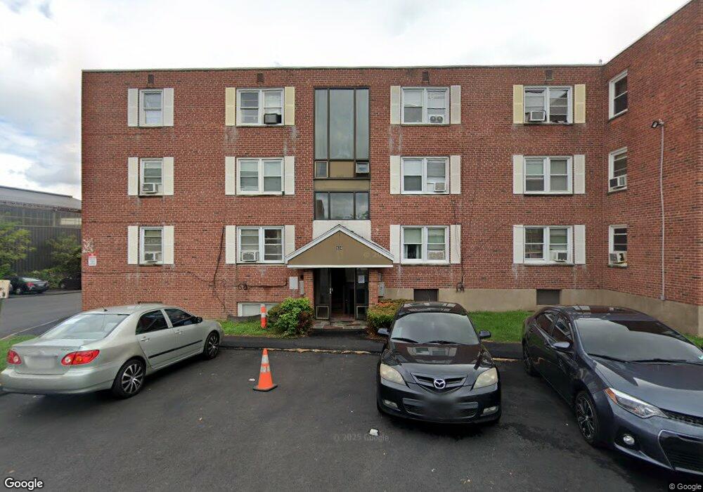
934 Wethersfield Ave Unit 5 Hartford, CT 06114
Estimated Value: $72,000 - $120,827
2
Beds
1
Bath
654
Sq Ft
$140/Sq Ft
Est. Value
About This Home
This home is located at 934 Wethersfield Ave Unit 5, Hartford, CT 06114 and is currently estimated at $91,609, approximately $140 per square foot. 934 Wethersfield Ave Unit 5 is a home located in Hartford County with nearby schools including Dr. James H Naylor/Ccsu Leadership Academy, Asian Studies School At Dwight/Belizzi School, and M. D. Fox School.
Ownership History
Date
Name
Owned For
Owner Type
Purchase Details
Closed on
Jul 18, 2007
Sold by
Parmanand Richard and Parmanand Anita
Bought by
Gauba Yuvraj
Current Estimated Value
Purchase Details
Closed on
Feb 11, 2004
Sold by
Allen Re Invest
Bought by
Parmanand Richard and Parmanand Anita
Home Financials for this Owner
Home Financials are based on the most recent Mortgage that was taken out on this home.
Original Mortgage
$13,600
Interest Rate
5.82%
Create a Home Valuation Report for This Property
The Home Valuation Report is an in-depth analysis detailing your home's value as well as a comparison with similar homes in the area
Home Values in the Area
Average Home Value in this Area
Purchase History
| Date | Buyer | Sale Price | Title Company |
|---|---|---|---|
| Gauba Yuvraj | $50,000 | -- | |
| Parmanand Richard | $17,000 | -- |
Source: Public Records
Mortgage History
| Date | Status | Borrower | Loan Amount |
|---|---|---|---|
| Previous Owner | Parmanand Richard | $13,600 |
Source: Public Records
Tax History Compared to Growth
Tax History
| Year | Tax Paid | Tax Assessment Tax Assessment Total Assessment is a certain percentage of the fair market value that is determined by local assessors to be the total taxable value of land and additions on the property. | Land | Improvement |
|---|---|---|---|---|
| 2025 | $1,067 | $15,472 | $0 | $15,472 |
| 2024 | $1,067 | $15,472 | $0 | $15,472 |
| 2023 | $1,067 | $15,472 | $0 | $15,472 |
| 2022 | $1,067 | $15,472 | $0 | $15,472 |
| 2021 | $520 | $7,000 | $0 | $7,000 |
| 2020 | $520 | $7,000 | $0 | $7,000 |
| 2019 | $520 | $7,000 | $0 | $7,000 |
| 2018 | $502 | $6,764 | $0 | $6,764 |
| 2016 | $483 | $6,506 | $0 | $6,506 |
| 2015 | $460 | $6,197 | $0 | $6,197 |
| 2014 | $449 | $6,046 | $0 | $6,046 |
Source: Public Records
Map
Nearby Homes
- 839 Wethersfield Ave
- 71 Hanmer St
- 24 Stillman Rd
- 70 Stillman Rd
- 53 Wolcott Hill Rd Unit C23
- 92 Reed Dr
- 21 Wayland St
- 126 Tredeau St
- 7 Harmund Ct
- 61 Preston St Unit 63
- 147 Preston St Unit 1
- 18 Avalon Place
- 183 Preston St Unit 185
- 9 Avalon Place
- 326 South St Unit 328
- 152 Otis St
- 308 Brown St
- 26 Barker St Unit 28
- 17 Bond St
- 15 Bond St
- 934 Wethersfield Ave Unit 7
- 934 Wethersfield Ave Unit 6
- 934 Wethersfield Ave Unit 4
- 934 Wethersfield Ave Unit 3
- 934 Wethersfield Ave Unit 2
- 934 Wethersfield Ave Unit 1
- 934 Wethersfield Ave Unit B3
- 932 Wethersfield Ave Unit 6
- 932 Wethersfield Ave Unit 5
- 932 Wethersfield Ave Unit 4
- 932 Wethersfield Ave Unit 3
- 932 Wethersfield Ave Unit 2
- 932 Wethersfield Ave Unit 1
- 930 Wethersfield Ave Unit 5
- 930 Wethersfield Ave Unit 3
- 930 Wethersfield Ave Unit 1
- 928 Wethersfield Ave Unit 6
- 928 Wethersfield Ave Unit 5
- 928 Wethersfield Ave Unit 4
- 928 Wethersfield Ave Unit 3