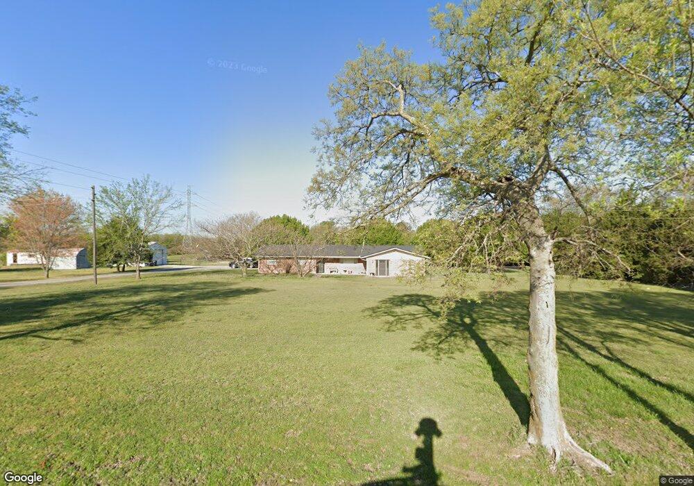
9340 N Birmingham Ave Sperry, OK 74073
Estimated Value: $205,044 - $327,000
--
Bed
2
Baths
2,078
Sq Ft
$122/Sq Ft
Est. Value
About This Home
This home is located at 9340 N Birmingham Ave, Sperry, OK 74073 and is currently estimated at $254,511, approximately $122 per square foot. 9340 N Birmingham Ave is a home located in Tulsa County with nearby schools including Sperry Elementary School, Sperry Middle School, and Sperry High School.
Ownership History
Date
Name
Owned For
Owner Type
Purchase Details
Closed on
Feb 1, 2018
Sold by
Maybee Family Limited Liability Company
Bought by
Maybee Rebecca
Current Estimated Value
Purchase Details
Closed on
Mar 30, 2016
Sold by
Maybee Family Limited Liability Co Llc
Bought by
Maybee Charles H and Maybee Rebecca L
Purchase Details
Closed on
Jan 5, 2001
Sold by
Burgess Carl and Burgess Arnie
Bought by
Maybee Charles H
Purchase Details
Closed on
Oct 1, 1995
Create a Home Valuation Report for This Property
The Home Valuation Report is an in-depth analysis detailing your home's value as well as a comparison with similar homes in the area
Home Values in the Area
Average Home Value in this Area
Purchase History
| Date | Buyer | Sale Price | Title Company |
|---|---|---|---|
| Maybee Rebecca | -- | None Available | |
| Maybee Charles H | -- | None Available | |
| Maybee Charles H | $12,500 | -- | |
| -- | $4,000 | -- |
Source: Public Records
Tax History Compared to Growth
Tax History
| Year | Tax Paid | Tax Assessment Tax Assessment Total Assessment is a certain percentage of the fair market value that is determined by local assessors to be the total taxable value of land and additions on the property. | Land | Improvement |
|---|---|---|---|---|
| 2024 | $1,278 | $11,495 | $1,364 | $10,131 |
| 2023 | $1,278 | $11,495 | $1,364 | $10,131 |
| 2022 | $1,287 | $11,495 | $1,364 | $10,131 |
| 2021 | $1,281 | $11,495 | $1,364 | $10,131 |
| 2020 | $1,282 | $11,495 | $1,364 | $10,131 |
| 2019 | $1,290 | $11,495 | $1,364 | $10,131 |
| 2018 | $1,290 | $11,495 | $1,364 | $10,131 |
| 2017 | $1,251 | $11,495 | $1,364 | $10,131 |
| 2016 | $1,280 | $11,814 | $1,364 | $10,450 |
| 2015 | $1,272 | $11,814 | $1,364 | $10,450 |
| 2014 | $1,258 | $11,814 | $1,364 | $10,450 |
Source: Public Records
Map
Nearby Homes
- 9104 N Delaware Ave
- 9839 N Lewis Ave
- 7668 N Harvard Ave E
- 8705 N Harvard Ave
- 9839 N Peoria Ave
- 9610 N Peoria Ave
- 2911 E 106th St N
- 4122 E 101st St N
- 4132 E 101st St N
- 9833 N 43rd East Ave
- 10003 N 43rd East Ave
- 4211 E 101st St N
- 11027 N Yale Ave
- 4787 E 106th St N
- 0003 E 84th St N
- 109 N Coal St
- 5303 E 86th St N
- 308 S Cincinnati Ave
- 10201 N Cincinnati Ave
- 9545 S Cincinnati St
- 9341 N Birmingham Ave
- 9150 N Birmingham Ave
- 9327 N Lewis Ave
- 9562 N Birmingham Ave
- 2632 E 96th St N
- 2502 E 96th St N
- 9281 N Lewis Ave
- 9321 N Lewis Ave
- 9392 N Lewis Ave
- 9416 N Lewis Ave
- 9200 N Lewis Ave
- 2611 E 96th St N
- 2420 E 96th St N
- 2617 E 96th St N
- 2625 E 96th St N
- 9300 N Lewis Ave
- 9404 N Delaware Ave
- 9324 N Lewis Ave
- 9422 N Lewis Ave