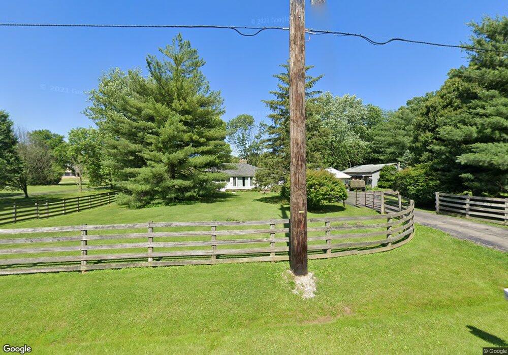
9345 Bellbrook Rd Waynesville, OH 45068
Wayne Township NeighborhoodEstimated Value: $319,055 - $495,000
4
Beds
1
Bath
1,624
Sq Ft
$264/Sq Ft
Est. Value
About This Home
This home is located at 9345 Bellbrook Rd, Waynesville, OH 45068 and is currently estimated at $429,264, approximately $264 per square foot. 9345 Bellbrook Rd is a home located in Warren County with nearby schools including Waynesville Elementary School, Waynesville Middle School, and Waynesville High School.
Ownership History
Date
Name
Owned For
Owner Type
Purchase Details
Closed on
Nov 8, 1990
Sold by
Clark Clark and Clark Anthony L
Bought by
Neal Woolf and Neal J.
Current Estimated Value
Purchase Details
Closed on
Feb 17, 1989
Sold by
Hawk Hawk and Hawk Richard L
Bought by
Clark Clark and Clark Anthony L
Purchase Details
Closed on
Aug 1, 1983
Sold by
Praeter Praeter and Praeter David R
Bought by
Hawk Hawk and Hawk Richard L
Create a Home Valuation Report for This Property
The Home Valuation Report is an in-depth analysis detailing your home's value as well as a comparison with similar homes in the area
Home Values in the Area
Average Home Value in this Area
Purchase History
| Date | Buyer | Sale Price | Title Company |
|---|---|---|---|
| Neal Woolf | $75,000 | -- | |
| Clark Clark | $67,500 | -- | |
| Hawk Hawk | $55,000 | -- |
Source: Public Records
Tax History Compared to Growth
Tax History
| Year | Tax Paid | Tax Assessment Tax Assessment Total Assessment is a certain percentage of the fair market value that is determined by local assessors to be the total taxable value of land and additions on the property. | Land | Improvement |
|---|---|---|---|---|
| 2024 | $3,105 | $77,660 | $25,300 | $52,360 |
| 2023 | $2,714 | $59,549 | $12,985 | $46,564 |
| 2022 | $2,654 | $59,549 | $12,985 | $46,564 |
| 2021 | $2,545 | $59,549 | $12,985 | $46,564 |
| 2020 | $2,400 | $48,412 | $10,556 | $37,856 |
| 2019 | $2,401 | $48,412 | $10,556 | $37,856 |
| 2018 | $2,402 | $48,412 | $10,556 | $37,856 |
| 2017 | $2,356 | $44,310 | $9,811 | $34,500 |
| 2016 | $2,199 | $44,310 | $9,811 | $34,500 |
| 2015 | $2,202 | $44,310 | $9,811 | $34,500 |
| 2014 | $2,110 | $40,290 | $8,920 | $31,360 |
| 2013 | $2,106 | $47,650 | $10,550 | $37,100 |
Source: Public Records
Map
Nearby Homes
- 9510 Bellbrook Rd
- 0 Mount Holly Rd
- 8519 Old Stage Rd
- 8976 Ferry Rd
- 7364 Cook Jones Rd
- 2 Acres Mount Holly Rd
- 4001 E Social Row Rd
- 4103 Middle Run Rd
- 1198 Lytle Rd
- 1106 Lytle Rd
- 7902 N US Rt 42
- 7219 N Route 42
- 7219 U S 42
- 7219 N Us Rt 42
- 1036 Bayberry Dr
- 363 Victoria Place
- 1106 Brookfield Dr Unit 1106
- 437 N Main St
- 8881 Route 42
- 60 E Ellis Dr
- 9387 Bellbrook Rd
- 9417 Bellbrook Rd
- 9445 Bellbrook Rd
- 9253 Bellbrook Rd
- 9319 Bellbrook Rd
- 9475 Bellbrook Rd
- 9256 Bellbrook Rd
- 9245 Bellbrook Rd
- 9313 Bellbrook Rd
- 9173 Bellbrook Rd
- 9543 Bellbrook Rd
- 9254 Bellbrook Rd
- 9310 Bellbrook Rd
- 9599 Bellbrook Rd
- 5917 Thomas Dr
- 9083 Bellbrook Rd
- 5588 Chenoweth Rd
- 5879 Thomas Dr
- 5841 Thomas Dr
- 9646 Bellbrook Rd