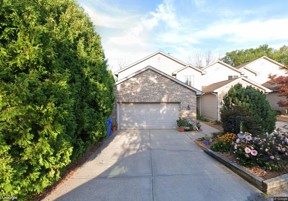
935 High Meadow Dr Unit 1 Crown Point, IN 46307
Estimated Value: $283,000 - $352,007
3
Beds
2
Baths
2,233
Sq Ft
$142/Sq Ft
Est. Value
About This Home
This home is located at 935 High Meadow Dr Unit 1, Crown Point, IN 46307 and is currently estimated at $317,502, approximately $142 per square foot. 935 High Meadow Dr Unit 1 is a home located in Lake County with nearby schools including Solon Robinson Elementary School, Colonel John Wheeler Middle School, and Crown Point High School.
Ownership History
Date
Name
Owned For
Owner Type
Purchase Details
Closed on
Dec 27, 2024
Sold by
Mcbride Jennifer and Poulton Jessica
Bought by
Costello Lisa K
Current Estimated Value
Home Financials for this Owner
Home Financials are based on the most recent Mortgage that was taken out on this home.
Original Mortgage
$103,000
Outstanding Balance
$102,096
Interest Rate
6.78%
Mortgage Type
New Conventional
Estimated Equity
$215,406
Purchase Details
Closed on
Sep 15, 2015
Sold by
Grdinich Jon R
Bought by
Hitchcock Debbie L
Purchase Details
Closed on
Oct 29, 2012
Sold by
Rudman Milena
Bought by
Grdinich Jon R
Create a Home Valuation Report for This Property
The Home Valuation Report is an in-depth analysis detailing your home's value as well as a comparison with similar homes in the area
Home Values in the Area
Average Home Value in this Area
Purchase History
| Date | Buyer | Sale Price | Title Company |
|---|---|---|---|
| Costello Lisa K | -- | Liberty Title | |
| Hitchcock Debbie L | -- | Attorney | |
| Grdinich Jon R | -- | None Available |
Source: Public Records
Mortgage History
| Date | Status | Borrower | Loan Amount |
|---|---|---|---|
| Open | Costello Lisa K | $103,000 |
Source: Public Records
Tax History Compared to Growth
Tax History
| Year | Tax Paid | Tax Assessment Tax Assessment Total Assessment is a certain percentage of the fair market value that is determined by local assessors to be the total taxable value of land and additions on the property. | Land | Improvement |
|---|---|---|---|---|
| 2024 | $6,126 | $251,500 | $10,300 | $241,200 |
| 2023 | $2,115 | $222,900 | $8,900 | $214,000 |
| 2022 | $2,280 | $217,900 | $8,900 | $209,000 |
| 2021 | $2,359 | $213,000 | $8,000 | $205,000 |
| 2020 | $2,251 | $203,500 | $8,000 | $195,500 |
| 2019 | $2,204 | $195,400 | $8,000 | $187,400 |
| 2018 | $2,379 | $185,900 | $8,000 | $177,900 |
| 2017 | $2,269 | $177,600 | $8,000 | $169,600 |
| 2016 | $2,235 | $173,300 | $8,000 | $165,300 |
| 2014 | $1,825 | $162,600 | $8,200 | $154,400 |
| 2013 | $1,812 | $160,500 | $8,200 | $152,300 |
Source: Public Records
Map
Nearby Homes
- 772 Courtney Dr
- 991 Greenview Dr
- 801 Courtney Dr
- 905 S Indiana Ave
- 622 E Brookside Dr
- 936 Seneca Dr
- 1150 Greenview Place
- 901 Iroquois Dr
- 642 Omega Dr
- 1191 Churchill Ln
- 1152 S Ridge St
- 1270 E Greenview Place
- 508 W 117th Place
- 300 Omega Dr
- 1285 Greenview Place
- 416 Las Olas Dr
- 617 Helen Ct
- 1593 Edith Way
- 206 U S 231
- 924 W Crestview Ct
- 937 High Meadow Dr
- 937 High Meadow Dr Unit 2
- 915 High Meadow Dr
- 917 High Meadow Dr
- 919 High Meadow Dr
- 939 High Meadow Dr
- 913 High Dr
- 913 High Meadow Dr
- 983 High Meadow Dr
- 999 High Meadow Dr
- 967 High Meadow Dr
- 961 High Meadow Dr
- 961 High Meadow Dr
- 961 High Meadow Dr Unit 967
- 941 High Meadow Dr Unit B
- 941 High Meadow Dr Unit A-D
- 941 High Meadow Dr
- 927 High Meadow Dr
- 927 High Dr
- 931 High Meadow Dr