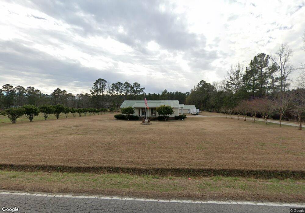
935 Highway 548 Conway, SC 29527
Estimated Value: $278,000 - $291,000
3
Beds
2
Baths
1,423
Sq Ft
$199/Sq Ft
Est. Value
About This Home
This home is located at 935 Highway 548, Conway, SC 29527 and is currently estimated at $282,549, approximately $198 per square foot. 935 Highway 548 is a home located in Horry County with nearby schools including Conway Elementary School, Conway Middle School, and Conway High School.
Ownership History
Date
Name
Owned For
Owner Type
Purchase Details
Closed on
Dec 20, 2019
Sold by
Brown Melvin E
Bought by
Brown Joann
Current Estimated Value
Purchase Details
Closed on
Apr 16, 2017
Sold by
Brown Joann H
Bought by
Brown Melvin E
Create a Home Valuation Report for This Property
The Home Valuation Report is an in-depth analysis detailing your home's value as well as a comparison with similar homes in the area
Home Values in the Area
Average Home Value in this Area
Purchase History
| Date | Buyer | Sale Price | Title Company |
|---|---|---|---|
| Brown Joann | -- | -- | |
| Brown Melvin E | -- | -- |
Source: Public Records
Tax History Compared to Growth
Tax History
| Year | Tax Paid | Tax Assessment Tax Assessment Total Assessment is a certain percentage of the fair market value that is determined by local assessors to be the total taxable value of land and additions on the property. | Land | Improvement |
|---|---|---|---|---|
| 2024 | $2,316 | $14,960 | $4,068 | $10,892 |
| 2023 | $2,316 | $9,631 | $1,891 | $7,740 |
| 2021 | $2,138 | $9,631 | $1,891 | $7,740 |
| 2020 | $2,020 | $9,631 | $1,891 | $7,740 |
| 2019 | $569 | $9,631 | $1,891 | $7,740 |
| 2018 | $446 | $6,714 | $840 | $5,874 |
| 2017 | $431 | $4,476 | $560 | $3,916 |
| 2016 | $0 | $4,476 | $560 | $3,916 |
| 2015 | -- | $4,476 | $560 | $3,916 |
| 2014 | $399 | $4,476 | $560 | $3,916 |
Source: Public Records
Map
Nearby Homes
- 1009 Kinness Dr
- 12 Cape Point Dr
- 1005 Kinness Dr
- 1012 Kinness Dr
- 36 Cape Point Dr
- 21 Cape Point Dr
- 1008 Kinness Dr
- 25 Cape Point Dr
- 32 Cape Point Dr
- 40 Cape Point Dr
- 1052 Kinness Dr
- Vision Plan at Rivertown Landing
- Prelude Plan at Rivertown Landing
- Embark Plan at Rivertown Landing
- Vantage Plan at Rivertown Landing
- Venture Plan at Rivertown Landing
- Engage Plan at Rivertown Landing
- Wayfare Plan at Rivertown Landing
- Efficient Plan at Rivertown Landing
- 16 Cape Point Dr
- 809 Rivas Way
- 805 Rivas Way
- 89 Cape Point Dr Unit Lot 237 - Prelude D
- 108 Cape Point Dr Unit Lot 2 - Embark A
- 76 Cape Point Dr Unit Lot 206 - Embark D
- 80 Cape Point Dr Unit Lot 205 - Prelude B
- 104 Cape Point Dr Unit Lot 1 - Venture D
- 88 Cape Point Dr Unit Lot 203 - Venture B
- 92 Cape Point Dr Unit Lot 202 - Engage B
- 96 Cape Point Dr Unit Lot 201 - Wayfare D
- TBD Cape Point Dr Unit Lot TBD - Efficient
- 112 Cape Point Dr Unit Lot 3 - Efficient Pl
- 550 Wilbur Rd Unit Lot 19 - Prelude A
- 116 Cape Point Dr Unit Lot 4 - Vision Plan
- 912 Highway 548
- 845 Highway 548
- 120 Cape Point Dr Unit Lot 05 - Prelude A
- 133 Cape Point Dr Unit Lot 17 - Engage Plan
- 73 Cape Point Dr
- 85 Cape Point Dr Unit Lot 236 - Venture B