Estimated Value: $272,344 - $311,000
3
Beds
3
Baths
1,425
Sq Ft
$204/Sq Ft
Est. Value
About This Home
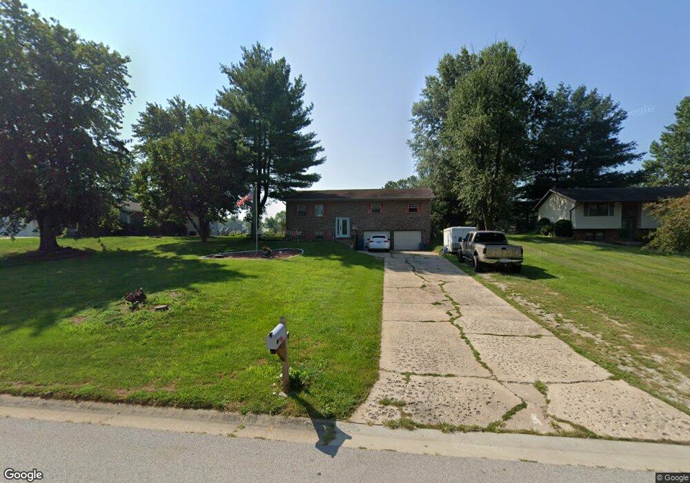
This home is located at 935 Long Branch Rd, Troy, IL 62294 and is currently estimated at $291,336, approximately $204 per square foot. 935 Long Branch Rd is a home located in Madison County with nearby schools including Silver Creek Elementary School, Triad Middle School, and Triad High School.
Ownership History
Date
Name
Owned For
Owner Type
Purchase Details
Closed on
Apr 29, 2022
Sold by
Vogt Stephenie Ann
Bought by
Kirk Joseph and Kirk Nichole
Current Estimated Value
Home Financials for this Owner
Home Financials are based on the most recent Mortgage that was taken out on this home.
Original Mortgage
$170,101
Outstanding Balance
$161,044
Interest Rate
4.88%
Mortgage Type
New Conventional
Estimated Equity
$130,292
Purchase Details
Closed on
Jun 21, 2014
Sold by
Ross Brian L and Ross Stephenie
Bought by
Vogt Stephenie Ann
Home Financials for this Owner
Home Financials are based on the most recent Mortgage that was taken out on this home.
Original Mortgage
$132,000
Interest Rate
4.62%
Mortgage Type
New Conventional
Create a Home Valuation Report for This Property
The Home Valuation Report is an in-depth analysis detailing your home's value as well as a comparison with similar homes in the area
Home Values in the Area
Average Home Value in this Area
Purchase History
| Date | Buyer | Sale Price | Title Company |
|---|---|---|---|
| Kirk Joseph | $165,000 | First American Title | |
| Vogt Stephenie Ann | -- | Proper Title Llc |
Source: Public Records
Mortgage History
| Date | Status | Borrower | Loan Amount |
|---|---|---|---|
| Open | Kirk Joseph | $170,101 | |
| Previous Owner | Vogt Stephenie Ann | $132,000 |
Source: Public Records
Tax History
| Year | Tax Paid | Tax Assessment Tax Assessment Total Assessment is a certain percentage of the fair market value that is determined by local assessors to be the total taxable value of land and additions on the property. | Land | Improvement |
|---|---|---|---|---|
| 2024 | $5,214 | $80,640 | $19,110 | $61,530 |
| 2023 | $5,214 | $73,210 | $17,350 | $55,860 |
| 2022 | $4,825 | $67,420 | $15,980 | $51,440 |
| 2021 | $4,924 | $64,080 | $15,190 | $48,890 |
| 2020 | $4,936 | $62,430 | $14,800 | $47,630 |
| 2019 | $4,862 | $61,150 | $14,500 | $46,650 |
| 2018 | $4,753 | $56,650 | $13,430 | $43,220 |
| 2017 | $4,118 | $55,470 | $13,150 | $42,320 |
| 2016 | $4,084 | $55,470 | $13,150 | $42,320 |
| 2015 | $3,661 | $53,630 | $12,710 | $40,920 |
| 2014 | $3,661 | $53,630 | $12,710 | $40,920 |
| 2013 | $3,661 | $53,630 | $12,710 | $40,920 |
Source: Public Records
Map
Nearby Homes
- 963 Long Branch Rd
- 1819 Robins Mill Ct
- 1831 Crimson Oak Dr
- 1824 Appleton Ct
- 17 Augusta Ct
- 205 Eisenhower Blvd
- 6 Grant Ct
- 224 George Bush Blvd
- 5 Grant Ct
- 189 Meyer Dr
- 404 Rumsfeld Dr
- 0 Homes of Liberty Place
- 2024 Serenade Ln
- Winchester A Plan at Homes of Liberty Place
- Winchester B Plan at Homes of Liberty Place
- Herndon Plan at Homes of Liberty Place
- Hannah Plan at Homes of Liberty Place
- Alexandria Plan at Homes of Liberty Place
- Culpepper Plan at Homes of Liberty Place
- Titan Plan at Homes of Liberty Place
- 933 Long Branch Rd
- 937 Long Branch Rd
- 929 Long Branch Rd
- 939 Long Branch Rd
- 935 Wheatridge Dr
- 933 Wheatridge Dr
- 941 Long Branch Rd
- 925 Harvestyme Ln
- 927 Long Branch Rd
- 937 Wheatridge Dr
- 928 Long Branch Rd
- 116 Pinewood Ct
- 120 Pinewood Ct
- 934 Wheatridge Dr
- 923 Harvestyme Ln
- 943 Long Branch Rd
- 929 Wheatridge Dr
- 936 Wheatridge Dr
- 114 Pinewood Ct
- 939 Wheatridge Dr