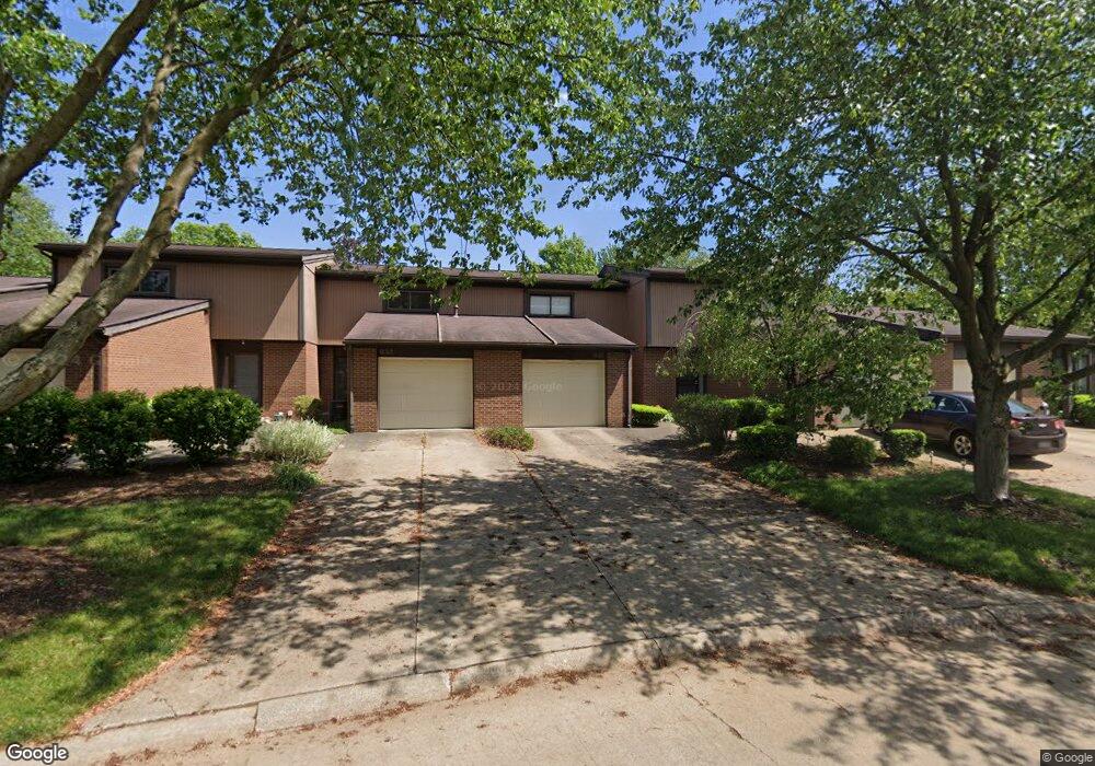
935 Morningstar Dr Unit 935 Akron, OH 44307
Downtown Akron NeighborhoodEstimated Value: $152,870 - $160,000
2
Beds
2
Baths
1,240
Sq Ft
$127/Sq Ft
Est. Value
About This Home
This home is located at 935 Morningstar Dr Unit 935, Akron, OH 44307 and is currently estimated at $156,968, approximately $126 per square foot. 935 Morningstar Dr Unit 935 is a home located in Summit County with nearby schools including St. Bernard-St. Mary Elementary School.
Ownership History
Date
Name
Owned For
Owner Type
Purchase Details
Closed on
Mar 4, 2011
Sold by
Mager Thomas G and Mager Christina M
Bought by
Williams Amber
Current Estimated Value
Home Financials for this Owner
Home Financials are based on the most recent Mortgage that was taken out on this home.
Original Mortgage
$63,327
Outstanding Balance
$44,938
Interest Rate
5.5%
Mortgage Type
FHA
Estimated Equity
$112,030
Purchase Details
Closed on
Jun 19, 2001
Sold by
Joseph Rajesh A
Bought by
Mager Thomas G and Mager Christina M
Home Financials for this Owner
Home Financials are based on the most recent Mortgage that was taken out on this home.
Original Mortgage
$77,600
Interest Rate
7.11%
Purchase Details
Closed on
Jun 30, 1998
Sold by
Weiss Craig S
Bought by
Joseph Rajesh A
Home Financials for this Owner
Home Financials are based on the most recent Mortgage that was taken out on this home.
Original Mortgage
$83,500
Interest Rate
7.27%
Mortgage Type
FHA
Create a Home Valuation Report for This Property
The Home Valuation Report is an in-depth analysis detailing your home's value as well as a comparison with similar homes in the area
Home Values in the Area
Average Home Value in this Area
Purchase History
| Date | Buyer | Sale Price | Title Company |
|---|---|---|---|
| Williams Amber | $65,000 | Barristers Of Ohio | |
| Mager Thomas G | $97,000 | Title One Agency Inc | |
| Joseph Rajesh A | $85,500 | -- |
Source: Public Records
Mortgage History
| Date | Status | Borrower | Loan Amount |
|---|---|---|---|
| Open | Williams Amber | $63,327 | |
| Previous Owner | Mager Thomas G | $77,600 | |
| Previous Owner | Joseph Rajesh A | $83,500 |
Source: Public Records
Tax History Compared to Growth
Tax History
| Year | Tax Paid | Tax Assessment Tax Assessment Total Assessment is a certain percentage of the fair market value that is determined by local assessors to be the total taxable value of land and additions on the property. | Land | Improvement |
|---|---|---|---|---|
| 2025 | $1,731 | $33,625 | $4,148 | $29,477 |
| 2024 | $1,731 | $33,625 | $4,148 | $29,477 |
| 2023 | $1,731 | $33,625 | $4,148 | $29,477 |
| 2022 | $1,867 | $28,546 | $3,514 | $25,032 |
| 2021 | $1,869 | $28,546 | $3,514 | $25,032 |
| 2020 | $1,840 | $28,540 | $3,510 | $25,030 |
| 2019 | $1,677 | $23,620 | $3,510 | $20,110 |
| 2018 | $1,652 | $23,620 | $3,360 | $20,260 |
| 2017 | $1,452 | $23,620 | $3,360 | $20,260 |
| 2016 | $1,453 | $20,400 | $3,360 | $17,040 |
| 2015 | $1,452 | $20,400 | $3,360 | $17,040 |
| 2014 | $1,440 | $20,400 | $3,360 | $17,040 |
| 2013 | $2,030 | $29,440 | $3,360 | $26,080 |
Source: Public Records
Map
Nearby Homes
- 263 Millcreek Dr Unit 263
- 783 Boulevard St
- 810 Amherst St
- 834 Kenyon St
- 108 Furnace Run Dr Unit 14108
- 385 Campbell St
- 949 Raymond St
- 849 Amherst St
- 832 Yale St
- 829 Yale St
- 151 Russell Ave
- 837 Yale St
- 849 Yale St
- 817 Raymond St
- 677 Vernon Odom Blvd
- 577 Rhodes Ave
- 639 Bellevue Ave
- 267 W Long St
- 1132 Bristol Terrace
- 650 Easter Ave
- 933 Morningstar Dr
- 937 Morningstar Dr Unit 937
- 931 Morningstar Dr
- 939 Morningstar Dr Unit 939
- 929 Morningstar Dr Unit 929
- 941 Morningstar Dr
- 943 Morningstar Dr
- 957 Trimble Dr
- 928 Morningstar Dr Unit 928
- 926 Morningstar Dr
- 955 Trimble Dr Unit 955
- 945 Morningstar Dr
- 923 Morningstar Dr Unit 923
- 947 Morningstar Dr
- 921 Morningstar Dr
- 953 Trimble Dr
- 924 Morningstar Dr Unit 924
- 951 Trimble Dr Unit 951
- 917 Morningstar Dr Unit 917
- 919 Morningstar Dr