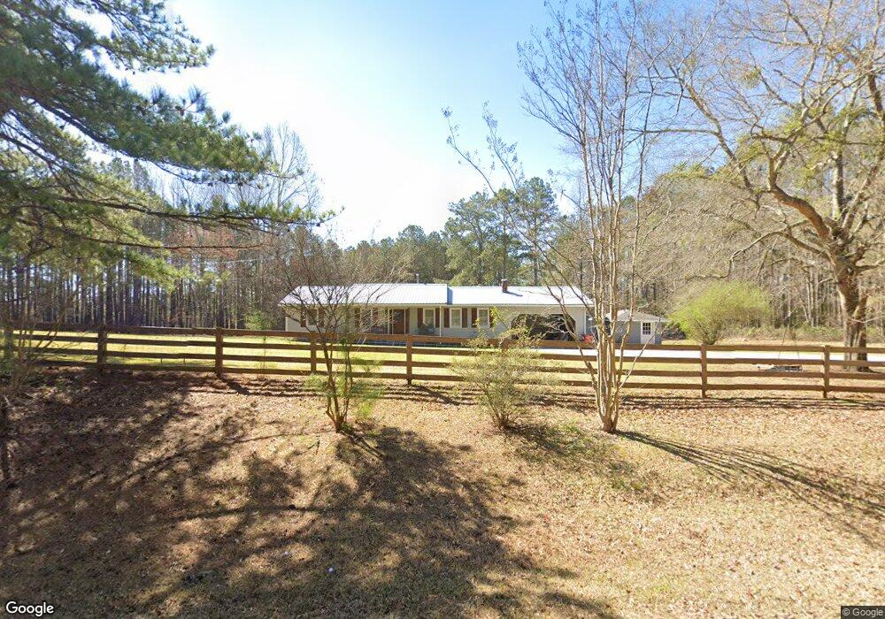
935 Wehadkee Rd Franklin, GA 30217
Estimated Value: $242,119 - $327,000
4
Beds
2
Baths
2,078
Sq Ft
$146/Sq Ft
Est. Value
About This Home
This home is located at 935 Wehadkee Rd, Franklin, GA 30217 and is currently estimated at $302,780, approximately $145 per square foot. 935 Wehadkee Rd is a home located in Heard County with nearby schools including Heard County High School.
Ownership History
Date
Name
Owned For
Owner Type
Purchase Details
Closed on
Feb 10, 2009
Sold by
U S Bank National Association
Bought by
Wilkerson Timothy F
Current Estimated Value
Purchase Details
Closed on
Jan 2, 2008
Sold by
Stitt Joe
Bought by
Us Bank National Association
Purchase Details
Closed on
Sep 19, 1995
Sold by
Yarbrough Bobby J
Bought by
Stitt Joe and Stitt Gloria C
Purchase Details
Closed on
Sep 1, 1987
Sold by
Commercial Bank & Tr
Bought by
Yarbrough Bobby J
Purchase Details
Closed on
Jul 1, 1987
Sold by
Webb John T
Bought by
Commercial Bank & Tr
Purchase Details
Closed on
Aug 3, 1982
Bought by
Webb John T
Create a Home Valuation Report for This Property
The Home Valuation Report is an in-depth analysis detailing your home's value as well as a comparison with similar homes in the area
Home Values in the Area
Average Home Value in this Area
Purchase History
| Date | Buyer | Sale Price | Title Company |
|---|---|---|---|
| Wilkerson Timothy F | $50,000 | -- | |
| Us Bank National Association | $129,900 | -- | |
| Stitt Joe | $75,900 | -- | |
| Yarbrough Bobby J | $40,000 | -- | |
| Commercial Bank & Tr | $54,300 | -- | |
| Webb John T | -- | -- |
Source: Public Records
Tax History Compared to Growth
Tax History
| Year | Tax Paid | Tax Assessment Tax Assessment Total Assessment is a certain percentage of the fair market value that is determined by local assessors to be the total taxable value of land and additions on the property. | Land | Improvement |
|---|---|---|---|---|
| 2024 | $1,479 | $73,344 | $4,142 | $69,202 |
| 2023 | $1,390 | $66,588 | $3,452 | $63,136 |
| 2022 | $1,239 | $59,365 | $2,140 | $57,225 |
| 2021 | $1,036 | $47,137 | $2,140 | $44,997 |
| 2020 | $1,012 | $45,591 | $2,140 | $43,451 |
| 2019 | $1,012 | $45,591 | $2,140 | $43,451 |
| 2018 | $1,032 | $45,591 | $2,140 | $43,451 |
| 2017 | $981 | $43,420 | $1,966 | $41,454 |
| 2016 | $759 | $33,618 | $1,966 | $31,652 |
| 2015 | -- | $24,962 | $3,612 | $21,350 |
| 2014 | -- | $24,996 | $3,612 | $21,384 |
| 2013 | -- | $34,731 | $3,611 | $31,120 |
Source: Public Records
Map
Nearby Homes
- 0 Drummond Rd Unit 10576586
- 0 Drummond Rd Unit 7642521
- 0 County Road 655 Unit 25188732
- 0 County Road 655
- 0 County Road 655 Unit 177093
- 2485 Georgia 34
- 14.8 +/- AC Bethel Rd W
- 18 +/- AC Bethel Rd W
- 11 + - Ac Awebreys Gin Rd
- 13.9 + - Ac Awebreys Gin Rd
- 18+/- Ac Bethel Rd W
- 13.9 +/- AC Awbreys Gin Rd
- 24.5+/- AC Awbreys Gin Rd
- 24.5 +/- AC Awbreys Gin Rd
- 11 +/- AC Awbreys Gin Rd
- 24.3 + - Ac Awebreys Gin Rd
- 24.5+/- Ac Awebreys Gin Rd
- 14.8 + - Ac Bethel Rd W
- 57+/- Ac Victory Rd
- 0 County Road 632 Unit 105.96 acres
- 439 County Road 296
- 4767 County Road 30
- 393 Wehadkee Rd
- 4677 County Road 30
- 4499 County Road 30
- 4443 County Road 30
- 4367 County Road 30
- 4227 County Road 30
- 130 County Road 656
- 130 County Road 656
- 0 Drummond Rd Unit 7197952
- 0 Drummond Rd Unit 10145725
- 0 Drummond Rd Unit 7516670
- 0 Drummond Rd Unit 3199827
- 0 Drummond Rd Unit 7285691
- 0 Drummond Rd Unit 3154796
- 0 Drummond Rd Unit 3280974
- 0 Drummond Rd Unit 7285657
- 0 Drummond Rd Unit 8098798
- 0 Drummond Rd Unit 8327598