Estimated Value: $269,000 - $359,000
3
Beds
2
Baths
1,710
Sq Ft
$177/Sq Ft
Est. Value
About This Home
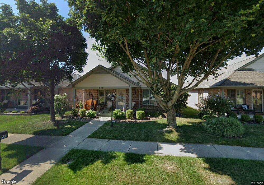
This home is located at 935 Wright Ave, Xenia, OH 45385 and is currently estimated at $302,509, approximately $176 per square foot. 935 Wright Ave is a home located in Greene County with nearby schools including Xenia High School, Summit Academy Community School for Alternative Learners - Xenia, and Legacy Christian Academy.
Ownership History
Date
Name
Owned For
Owner Type
Purchase Details
Closed on
Aug 15, 2024
Sold by
Dunn Donald D
Bought by
Caron Joint Revocable Living Trust and Caron
Current Estimated Value
Purchase Details
Closed on
Dec 18, 2020
Sold by
Dunn Ellen E and Dunn Donald D
Bought by
Dunn Donald D
Purchase Details
Closed on
Jun 27, 2003
Sold by
Be Am Co Inc
Bought by
Dunn Donald D and Dunn Ellen E
Home Financials for this Owner
Home Financials are based on the most recent Mortgage that was taken out on this home.
Original Mortgage
$152,900
Interest Rate
6.5%
Mortgage Type
Purchase Money Mortgage
Create a Home Valuation Report for This Property
The Home Valuation Report is an in-depth analysis detailing your home's value as well as a comparison with similar homes in the area
Home Values in the Area
Average Home Value in this Area
Purchase History
| Date | Buyer | Sale Price | Title Company |
|---|---|---|---|
| Caron Joint Revocable Living Trust | $289,900 | None Listed On Document | |
| Dunn Donald D | -- | None Available | |
| Dunn Donald D | $152,900 | -- |
Source: Public Records
Mortgage History
| Date | Status | Borrower | Loan Amount |
|---|---|---|---|
| Previous Owner | Dunn Donald D | $152,900 |
Source: Public Records
Tax History
| Year | Tax Paid | Tax Assessment Tax Assessment Total Assessment is a certain percentage of the fair market value that is determined by local assessors to be the total taxable value of land and additions on the property. | Land | Improvement |
|---|---|---|---|---|
| 2025 | $3,346 | $76,840 | $10,500 | $66,340 |
| 2024 | $3,346 | $76,840 | $10,500 | $66,340 |
| 2023 | $2,795 | $76,840 | $10,500 | $66,340 |
| 2022 | $2,428 | $58,400 | $7,000 | $51,400 |
| 2021 | $2,461 | $58,400 | $7,000 | $51,400 |
| 2020 | $2,355 | $58,400 | $7,000 | $51,400 |
| 2019 | $2,059 | $49,610 | $6,430 | $43,180 |
| 2018 | $2,067 | $49,610 | $6,430 | $43,180 |
| 2017 | $1,911 | $49,610 | $6,430 | $43,180 |
| 2016 | $1,911 | $45,840 | $6,430 | $39,410 |
| 2015 | $1,916 | $45,840 | $6,430 | $39,410 |
| 2014 | $1,833 | $45,840 | $6,430 | $39,410 |
Source: Public Records
Map
Nearby Homes
- 938 Wright Ave
- 1978 Lakeview Dr
- 2102 High Wheel Dr
- 920 Wright Cycle Blvd
- 926 Wright Cycle Blvd
- 2276 Tandem Dr
- 2352 Pembury Dr
- 1955 Roxbury Dr
- 2516 Jenny Marie Dr
- 0 Berkshire Dr Unit 949217
- 1321 Massachusetts Dr
- 2813 Raxit Ct
- 2936 W Barnhill Place
- 1772 Pueblo Dr
- 2096 Alabama Dr
- 1001 Glen Kegley Dr
- 1068 Hedges Rd
- 1715 Sioux Dr
- 1317 Baybury Ave
- 1861 Nebraska Dr
- 939 Wright Ave
- 931 Wright Ave
- 927 Wright Ave
- 943 Wright Ave
- 923 Wright Ave
- 949 Wright Ave
- 934 Cannondale Ave
- 938 Cannondale Ave
- 930 Cannondale Ave
- 919 Wright Ave
- 942 Cannondale Ave
- 926 Cannondale Ave
- 934 Wright Ave
- 930 Wright Ave
- 922 Cannondale Ave
- 926 Wright Ave
- 942 Wright Ave
- 948 Cannondale Ave
- 915 Wright Ave
- lot #173 Tandem Dr
Your Personal Tour Guide
Ask me questions while you tour the home.