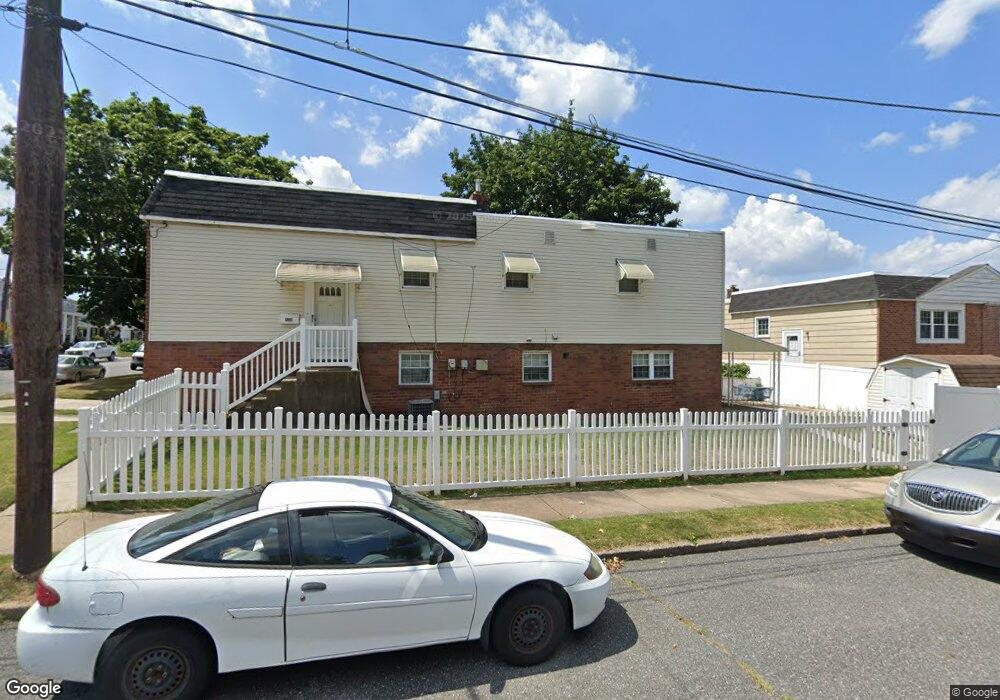
9350 Marsden St Philadelphia, PA 19114
Torresdale NeighborhoodEstimated Value: $276,000 - $351,000
2
Beds
2
Baths
884
Sq Ft
$363/Sq Ft
Est. Value
About This Home
This home is located at 9350 Marsden St, Philadelphia, PA 19114 and is currently estimated at $321,277, approximately $363 per square foot. 9350 Marsden St is a home located in Philadelphia County with nearby schools including Thomas Holme School, Lincoln High School, and Meehan Austin Middle School.
Ownership History
Date
Name
Owned For
Owner Type
Purchase Details
Closed on
Aug 10, 2022
Sold by
Anderson Dolores V
Bought by
Veneziale Barbara and Veneziale Frank
Current Estimated Value
Purchase Details
Closed on
Apr 22, 2010
Sold by
Quinn Lisa
Bought by
Anderson Dolores V
Purchase Details
Closed on
Nov 11, 2004
Sold by
Mekolsky Margaret F
Bought by
Quinn Lisa
Home Financials for this Owner
Home Financials are based on the most recent Mortgage that was taken out on this home.
Original Mortgage
$110,500
Interest Rate
5.8%
Mortgage Type
Purchase Money Mortgage
Create a Home Valuation Report for This Property
The Home Valuation Report is an in-depth analysis detailing your home's value as well as a comparison with similar homes in the area
Home Values in the Area
Average Home Value in this Area
Purchase History
| Date | Buyer | Sale Price | Title Company |
|---|---|---|---|
| Veneziale Barbara | -- | -- | |
| Anderson Dolores V | $245,000 | None Available | |
| Quinn Lisa | $170,000 | Stewart Title Guaranty Compa |
Source: Public Records
Mortgage History
| Date | Status | Borrower | Loan Amount |
|---|---|---|---|
| Previous Owner | Quinn Lisa | $110,500 |
Source: Public Records
Tax History Compared to Growth
Tax History
| Year | Tax Paid | Tax Assessment Tax Assessment Total Assessment is a certain percentage of the fair market value that is determined by local assessors to be the total taxable value of land and additions on the property. | Land | Improvement |
|---|---|---|---|---|
| 2025 | $3,229 | $280,100 | $56,020 | $224,080 |
| 2024 | $3,229 | $280,100 | $56,020 | $224,080 |
| 2023 | $3,229 | $230,700 | $46,140 | $184,560 |
| 2022 | $2,175 | $185,700 | $46,140 | $139,560 |
| 2021 | $2,805 | $0 | $0 | $0 |
| 2020 | $2,805 | $0 | $0 | $0 |
| 2019 | $2,641 | $0 | $0 | $0 |
| 2018 | $2,221 | $0 | $0 | $0 |
| 2017 | $2,221 | $0 | $0 | $0 |
| 2016 | $1,802 | $0 | $0 | $0 |
| 2015 | $1,725 | $0 | $0 | $0 |
| 2014 | -- | $158,700 | $35,530 | $123,170 |
| 2012 | -- | $22,624 | $2,695 | $19,929 |
Source: Public Records
Map
Nearby Homes
- 4529 Pearson Ave
- 9321 Jackson St
- 4512 Convent Ln
- 5100 Convent Ln Unit 313
- 9246 Edmund St
- 9401 Tulip St
- 9321 Walker St
- 4000-2 Fitler St
- 9176 Frankford Ave
- 9301 State Rd
- 5100 00 Convent Ln Unit 118
- 6311 00 Delaire Landing Rd Unit 311
- 4538 Carwithan St
- 9216 Melrose St
- 3204 00 Delaire Landing Rd Unit 3204
- 62004 00 Delaire Landing Rd Unit 4
- 53304 00 Delaire Landing Rd Unit 304
- 4501 Aberdale Rd
- 4953 Fitler St Units #K & #L
- 5010 N Convent Ln Unit 130
- 9348 Marsden St
- 9344 Marsden St
- 4612 Pearson Ave
- 4610 Pearson Ave
- 9338 Marsden St
- 4600 Pearson Ave Unit 8
- 4626 Pearson Ave
- 4613 Pearson Ave
- 4611 Pearson Ave
- 4607 Pearson Ave
- 4615 Pearson Ave
- 4609 Pearson Ave
- 9343 Ditman St
- 4617 Pearson Ave
- 9334 Marsden St
- 4603 Pearson Ave
- 4619 Pearson Ave Unit B
- 4619 Pearson Ave Unit A
- 4630 Pearson Ave
- 9339 Ditman St