Estimated Value: $701,000 - $723,885
5
Beds
3
Baths
2,379
Sq Ft
$299/Sq Ft
Est. Value
About This Home
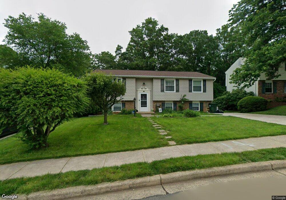
This home is located at 9352 Kite St, Burke, VA 22015 and is currently estimated at $711,721, approximately $299 per square foot. 9352 Kite St is a home located in Fairfax County with nearby schools including Kings Park Elementary School, Kings Glen Elementary School, and Lake Braddock Secondary School.
Ownership History
Date
Name
Owned For
Owner Type
Purchase Details
Closed on
Dec 20, 2004
Sold by
Fornes William L
Bought by
Bonnano John A
Current Estimated Value
Home Financials for this Owner
Home Financials are based on the most recent Mortgage that was taken out on this home.
Original Mortgage
$326,250
Outstanding Balance
$163,604
Interest Rate
5.75%
Mortgage Type
New Conventional
Estimated Equity
$548,117
Purchase Details
Closed on
May 6, 2003
Sold by
Giddens Cecil D
Bought by
Fornes William L
Home Financials for this Owner
Home Financials are based on the most recent Mortgage that was taken out on this home.
Original Mortgage
$260,000
Interest Rate
5.82%
Mortgage Type
New Conventional
Purchase Details
Closed on
Apr 26, 2000
Sold by
Mnamazi Nazy
Bought by
Giddens Vivian E
Home Financials for this Owner
Home Financials are based on the most recent Mortgage that was taken out on this home.
Original Mortgage
$201,000
Interest Rate
8.23%
Create a Home Valuation Report for This Property
The Home Valuation Report is an in-depth analysis detailing your home's value as well as a comparison with similar homes in the area
Home Values in the Area
Average Home Value in this Area
Purchase History
| Date | Buyer | Sale Price | Title Company |
|---|---|---|---|
| Bonnano John A | $435,000 | -- | |
| Fornes William L | $325,000 | -- | |
| Giddens Vivian E | $203,000 | -- |
Source: Public Records
Mortgage History
| Date | Status | Borrower | Loan Amount |
|---|---|---|---|
| Open | Bonnano John A | $326,250 | |
| Previous Owner | Fornes William L | $260,000 | |
| Previous Owner | Giddens Vivian E | $201,000 |
Source: Public Records
Tax History
| Year | Tax Paid | Tax Assessment Tax Assessment Total Assessment is a certain percentage of the fair market value that is determined by local assessors to be the total taxable value of land and additions on the property. | Land | Improvement |
|---|---|---|---|---|
| 2025 | $7,062 | $667,460 | $285,000 | $382,460 |
| 2024 | $7,062 | $609,560 | $260,000 | $349,560 |
| 2023 | $6,976 | $618,200 | $260,000 | $358,200 |
| 2022 | $6,277 | $548,930 | $240,000 | $308,930 |
| 2021 | $5,739 | $489,050 | $195,000 | $294,050 |
| 2020 | $5,685 | $480,360 | $195,000 | $285,360 |
| 2019 | $5,355 | $452,480 | $185,000 | $267,480 |
| 2018 | $5,028 | $437,190 | $180,000 | $257,190 |
| 2017 | $5,076 | $437,190 | $180,000 | $257,190 |
| 2016 | $5,007 | $432,200 | $180,000 | $252,200 |
Source: Public Records
Map
Nearby Homes
- 5829 Parakeet Dr
- 5840 Burke Manor Ct
- 5822 Burke Manor Ct
- 5802 Silchester St
- 6008 Mill Cove Ct
- 9145 Schoolcraft Ln
- 9329 Raintree Rd
- 9225 Sand Creek Ct
- 5844 Kara Place
- 9634 Blincoe Ct
- 5513 Westcliff Ct
- 9101 Blue Jug Landing
- 5406 Midship Ct
- 9662 Westport Ln
- 5460 Truxion Ct
- 5482 Midship Ct
- 5635 Sutherland Ct
- 9078 Brook Ford Rd
- 9056 Brook Ford Rd
- 9075 Andromeda Dr
- 9354 Kite St
- 9350 Kite St
- 9348 Kite St
- 5819 Parakeet Dr
- 9353 Kite St
- 5817 Parakeet Dr
- 9351 Kite St
- 9346 Kite St
- 5823 Parakeet Dr
- 9344 Kite St
- 5825 Parakeet Dr
- 5822 Kestrell Ct
- 9345 Kite St
- 5820 Parakeet Dr
- 5822 Parakeet Dr
- 5818 Parakeet Dr
- 5827 Parakeet Dr
- 5824 Kestrell Ct
- 5824 Parakeet Dr
- 9343 Kite St
Your Personal Tour Guide
Ask me questions while you tour the home.