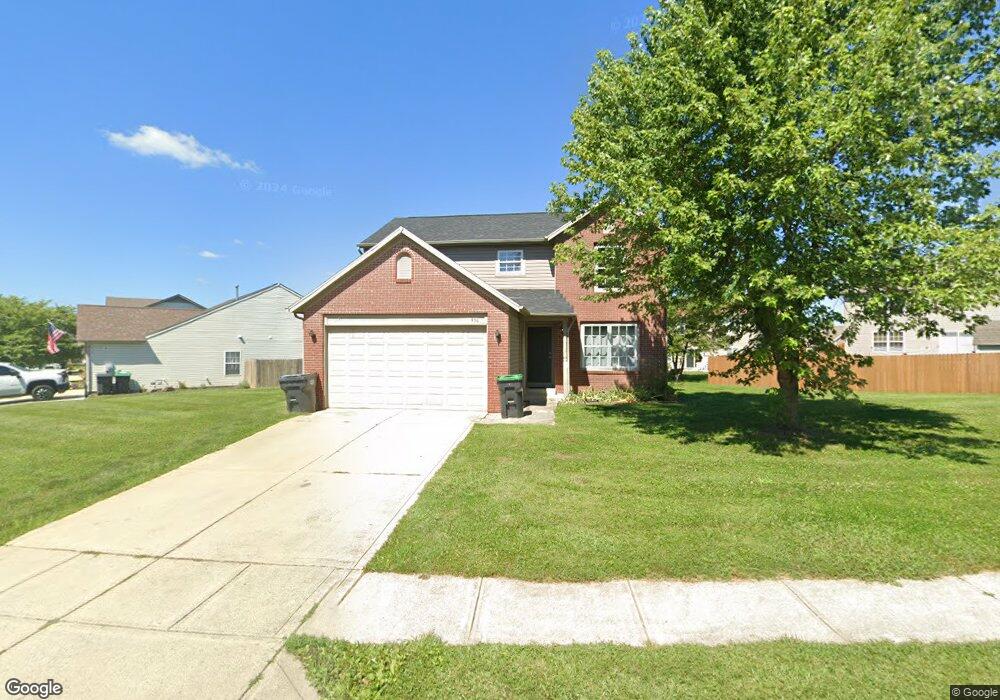
936 Nicole Way Whiteland, IN 46184
Estimated Value: $255,000 - $282,000
4
Beds
3
Baths
2,033
Sq Ft
$134/Sq Ft
Est. Value
About This Home
This home is located at 936 Nicole Way, Whiteland, IN 46184 and is currently estimated at $272,420, approximately $133 per square foot. 936 Nicole Way is a home located in Johnson County with nearby schools including Break-O-Day Elementary School, Clark-Pleasant Middle School, and Whiteland Community High School.
Ownership History
Date
Name
Owned For
Owner Type
Purchase Details
Closed on
Jul 6, 2010
Sold by
Emc Mortgage Corp
Bought by
Baumann Michael
Current Estimated Value
Purchase Details
Closed on
Jan 21, 2009
Sold by
Custom Mortgage Inc
Bought by
Emc Mortgage Corp
Purchase Details
Closed on
Mar 24, 2006
Sold by
Olivares Manual and Johnson Merrie
Bought by
Baker Brandon and Baker Natalie
Home Financials for this Owner
Home Financials are based on the most recent Mortgage that was taken out on this home.
Original Mortgage
$21,900
Interest Rate
6.33%
Mortgage Type
Stand Alone Second
Create a Home Valuation Report for This Property
The Home Valuation Report is an in-depth analysis detailing your home's value as well as a comparison with similar homes in the area
Home Values in the Area
Average Home Value in this Area
Purchase History
| Date | Buyer | Sale Price | Title Company |
|---|---|---|---|
| Baumann Michael | -- | Prism Title & Closing Servic | |
| Emc Mortgage Corp | $93,792 | None Available | |
| Baker Brandon | -- | None Available |
Source: Public Records
Mortgage History
| Date | Status | Borrower | Loan Amount |
|---|---|---|---|
| Previous Owner | Baker Brandon | $21,900 | |
| Previous Owner | Baker Brandon | $87,600 |
Source: Public Records
Tax History Compared to Growth
Tax History
| Year | Tax Paid | Tax Assessment Tax Assessment Total Assessment is a certain percentage of the fair market value that is determined by local assessors to be the total taxable value of land and additions on the property. | Land | Improvement |
|---|---|---|---|---|
| 2025 | $2,241 | $221,700 | $56,000 | $165,700 |
| 2024 | $2,241 | $216,200 | $56,000 | $160,200 |
| 2023 | $2,225 | $214,000 | $56,000 | $158,000 |
| 2022 | $1,890 | $182,100 | $29,900 | $152,200 |
| 2021 | $1,622 | $156,000 | $29,900 | $126,100 |
| 2020 | $1,441 | $138,100 | $29,900 | $108,200 |
| 2019 | $1,376 | $132,000 | $29,900 | $102,100 |
| 2018 | $1,304 | $131,900 | $23,300 | $108,600 |
| 2017 | $1,242 | $123,200 | $23,300 | $99,900 |
| 2016 | $1,222 | $122,200 | $23,300 | $98,900 |
| 2014 | $1,254 | $124,400 | $28,500 | $95,900 |
| 2013 | $1,254 | $125,400 | $28,500 | $96,900 |
Source: Public Records
Map
Nearby Homes
- 12 Rypma Row
- 647 Bluestem Cir
- 731 W 600 N
- Liberty Plan at Crossroads at Southport
- 7331 Deerberg Dr
- Jefferson Plan at Crossroads at Southport
- 7338 Deerberg Dr
- Rushmore Plan at Crossroads at Southport
- Lincoln Plan at Crossroads at Southport
- Washington Plan at Crossroads at Southport
- 76 Fernleaf Dr
- 821 Princeton Dr
- 346 Switchgrass Ln
- 143 Tracy Ridge Blvd
- 106 Tracy Ridge Blvd
- 190 Tracy Ridge Blvd
- 1119 Chateaugay Ct
- 250 Southlane Dr
- 239 Shelton Place
- 230 Parkview Dr