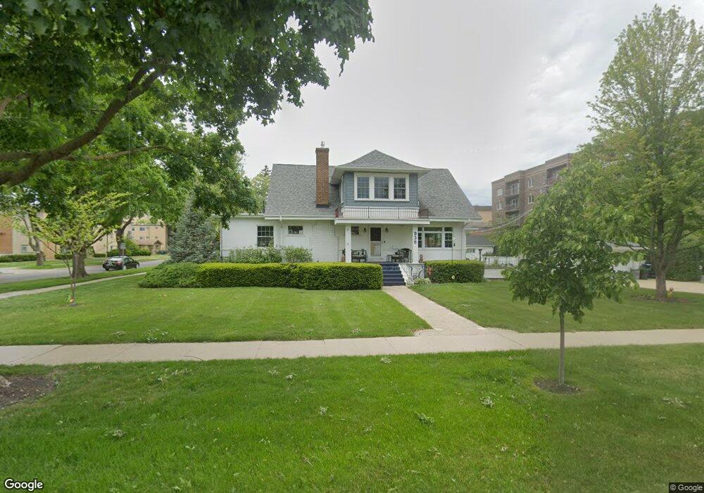
936 S Cora St Des Plaines, IL 60016
Estimated Value: $494,000 - $668,000
4
Beds
3
Baths
3,000
Sq Ft
$191/Sq Ft
Est. Value
About This Home
This home is located at 936 S Cora St, Des Plaines, IL 60016 and is currently estimated at $572,462, approximately $190 per square foot. 936 S Cora St is a home located in Cook County with nearby schools including Central Elementary School, Chippewa Middle School, and Maine West High School.
Ownership History
Date
Name
Owned For
Owner Type
Purchase Details
Closed on
Aug 1, 2012
Sold by
Keil Thomas P and Keil Margaret A
Bought by
Keil Thomas P and Keil Margaret A
Current Estimated Value
Purchase Details
Closed on
Jul 28, 2008
Sold by
Quiniff Mark A
Bought by
Keil Thomas P and Keil Margaret A
Home Financials for this Owner
Home Financials are based on the most recent Mortgage that was taken out on this home.
Original Mortgage
$250,000
Outstanding Balance
$164,805
Interest Rate
6.42%
Mortgage Type
Unknown
Estimated Equity
$407,657
Create a Home Valuation Report for This Property
The Home Valuation Report is an in-depth analysis detailing your home's value as well as a comparison with similar homes in the area
Home Values in the Area
Average Home Value in this Area
Purchase History
| Date | Buyer | Sale Price | Title Company |
|---|---|---|---|
| Keil Thomas P | -- | None Available | |
| Keil Thomas P | $390,000 | First American Title |
Source: Public Records
Mortgage History
| Date | Status | Borrower | Loan Amount |
|---|---|---|---|
| Open | Keil Thomas P | $250,000 |
Source: Public Records
Tax History Compared to Growth
Tax History
| Year | Tax Paid | Tax Assessment Tax Assessment Total Assessment is a certain percentage of the fair market value that is determined by local assessors to be the total taxable value of land and additions on the property. | Land | Improvement |
|---|---|---|---|---|
| 2024 | $9,935 | $38,761 | $8,890 | $29,871 |
| 2023 | $9,670 | $41,000 | $8,890 | $32,110 |
| 2022 | $9,670 | $41,000 | $8,890 | $32,110 |
| 2021 | $7,298 | $27,071 | $7,223 | $19,848 |
| 2020 | $7,243 | $27,071 | $7,223 | $19,848 |
| 2019 | $7,172 | $30,079 | $7,223 | $22,856 |
| 2018 | $7,761 | $29,385 | $6,389 | $22,996 |
| 2017 | $7,641 | $29,385 | $6,389 | $22,996 |
| 2016 | $7,991 | $31,255 | $6,389 | $24,866 |
| 2015 | $7,990 | $29,051 | $5,556 | $23,495 |
| 2014 | $7,837 | $29,051 | $5,556 | $23,495 |
| 2013 | $7,625 | $29,051 | $5,556 | $23,495 |
Source: Public Records
Map
Nearby Homes
- 1524 Oakwood Ave
- 905 Center St Unit B507
- 905 Center St Unit B208
- 843 Lexington Cir E
- 1365 Ashland Ave Unit 302
- 821 Lexington Cir E
- 750 Pearson St Unit 904
- 960 S River Rd Unit 410
- 960 S River Rd Unit 208
- 799 Graceland Ave Unit 504A
- 799 Graceland Ave Unit 404A
- 915 Graceland Ave Unit 1E
- 711 S River Rd Unit 401
- 1489 E Algonquin Rd
- 1685 Mill St Unit 605
- 1374 Jefferson St
- 501 Alles St Unit 501A
- 501 Alles St Unit 302A
- 1389 Perry St Unit 303
- 1363 Perry St Unit 1B
- 1474 Ashland Ave
- 1491 Ashland Ave Unit 5SW
- 1491 Ashland Ave Unit 5SE
- 1491 Ashland Ave Unit 6NW
- 1491 Ashland Ave Unit 2NW
- 1491 Ashland Ave Unit 6SE
- 1491 Ashland Ave Unit 4SW
- 1491 Ashland Ave Unit 7NW
- 1491 Ashland Ave Unit 5NE
- 1491 Ashland Ave Unit 2SW
- 1491 Ashland Ave Unit 4SE
- 1491 Ashland Ave Unit 3SE
- 1491 Ashland Ave Unit 6NE
- 1491 Ashland Ave Unit 3SW
- 1491 Ashland Ave Unit 6SW
- 1491 Ashland Ave Unit 7NE
- 1491 Ashland Ave Unit 4NW
- 1491 Ashland Ave Unit 3NE
- 1491 Ashland Ave Unit 4NE