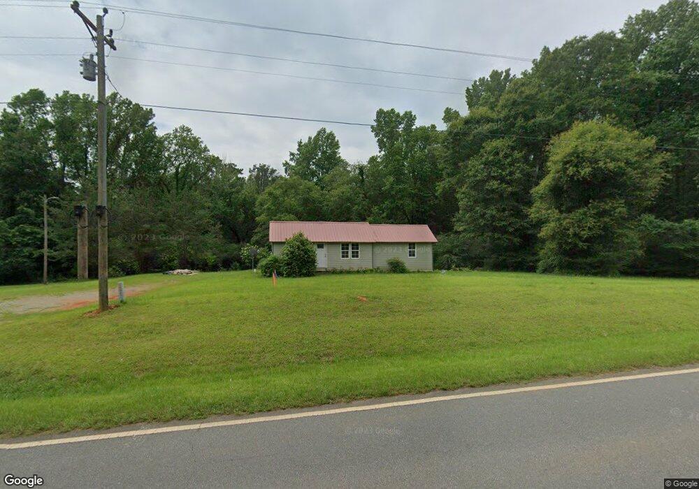
9368 Ga Highway 74 Macon, GA 31220
Estimated Value: $92,562 - $162,000
2
Beds
1
Bath
802
Sq Ft
$146/Sq Ft
Est. Value
About This Home
This home is located at 9368 Ga Highway 74, Macon, GA 31220 and is currently estimated at $116,891, approximately $145 per square foot. 9368 Ga Highway 74 is a home with nearby schools including Samuel E. Hubbard Elementary School and Mary Persons High School.
Ownership History
Date
Name
Owned For
Owner Type
Purchase Details
Closed on
May 12, 2014
Sold by
Mccallum Preston Duke
Bought by
Lizella Properties Llc
Current Estimated Value
Home Financials for this Owner
Home Financials are based on the most recent Mortgage that was taken out on this home.
Original Mortgage
$45,000
Interest Rate
4.37%
Mortgage Type
New Conventional
Purchase Details
Closed on
Feb 21, 2012
Sold by
Mccallum Preston
Bought by
Mccallum Dusty
Purchase Details
Closed on
May 10, 2010
Sold by
Jarriel Margaret Raines
Bought by
Mccallum Preston
Purchase Details
Closed on
Aug 25, 1994
Sold by
Raines William Thomas and Mary Raines Calh
Bought by
Jarriel Margaret Raines
Purchase Details
Closed on
Jul 3, 1986
Sold by
Raines G T Jr Mrs
Bought by
Calhoun Mary Raines Etal
Purchase Details
Closed on
Dec 28, 1972
Sold by
Johnson Annie Ruth Mosely
Bought by
Raines G T Jr Mrs
Create a Home Valuation Report for This Property
The Home Valuation Report is an in-depth analysis detailing your home's value as well as a comparison with similar homes in the area
Home Values in the Area
Average Home Value in this Area
Purchase History
| Date | Buyer | Sale Price | Title Company |
|---|---|---|---|
| Lizella Properties Llc | $45,000 | -- | |
| Mccallum Dusty | -- | -- | |
| Mccallum Preston | -- | -- | |
| Jarriel Margaret Raines | -- | -- | |
| Calhoun Mary Raines Etal | -- | -- | |
| Raines G T Jr Mrs | -- | -- |
Source: Public Records
Mortgage History
| Date | Status | Borrower | Loan Amount |
|---|---|---|---|
| Closed | Lizella Properties Llc | $45,000 |
Source: Public Records
Tax History Compared to Growth
Tax History
| Year | Tax Paid | Tax Assessment Tax Assessment Total Assessment is a certain percentage of the fair market value that is determined by local assessors to be the total taxable value of land and additions on the property. | Land | Improvement |
|---|---|---|---|---|
| 2024 | $601 | $21,360 | $9,560 | $11,800 |
| 2023 | $577 | $19,400 | $9,560 | $9,840 |
| 2022 | $525 | $19,400 | $9,560 | $9,840 |
| 2021 | $544 | $19,400 | $9,560 | $9,840 |
| 2020 | $557 | $19,400 | $9,560 | $9,840 |
| 2019 | $562 | $19,400 | $9,560 | $9,840 |
| 2018 | $564 | $19,400 | $9,560 | $9,840 |
| 2017 | $564 | $19,400 | $9,560 | $9,840 |
| 2016 | $536 | $19,400 | $9,560 | $9,840 |
| 2015 | $472 | $19,400 | $9,560 | $9,840 |
| 2014 | $392 | $15,508 | $9,560 | $5,948 |
Source: Public Records
Map
Nearby Homes
- 137 Shady Dale Dr
- 2198 Dennis Rd
- 8294 Shelley Trail
- 104 Peninsula Ave
- 104 Peninsula Ave Unit LOT 49
- 402 Harbor Cove Dr
- 402 Harbor Cove Dr Unit 32
- 519 Bluewater Bay Dr
- 112 Peninsula Ave
- 511 Bluewater Bay Dr
- 140 Peninsula Ave
- 156 Peninsula Ave
- Plan 3040 at Barrington Place
- Plan 2700 at Barrington Place
- Plan 2620 at Barrington Place
- Plan 2100 at Barrington Place
- Plan 2604 at Barrington Place
- Plan 2316 at Barrington Place
- 1302 Barrington Place Cove
- 2550 Midway Rd
- 0 Lower Simmons Rd
- 0 Lower Simmons Rd Unit 20084072
- 0 Lower Simmons Rd Unit 226811
- 0 Lower Simmons Rd Unit 226810
- 0 Lower Simmons Rd Unit 226809
- 0 Lower Simmons Rd Unit 226808
- 0 Lower Simmons Rd Unit 226807
- 0 Lower Simmons Rd Unit 226806
- 0 Lower Simmons Rd Unit 226805
- 0 Lower Simmons Rd Unit 226803
- 0 Lower Simmons Rd Unit 226804
- 0 Lower Simmons Rd Unit 226802
- 0 Lower Simmons Rd Unit 226801
- 0 Lower Simmons Rd Unit 226800
- 0 Lower Simmons Rd Unit 139022
- 0 Lower Simmons Rd Unit 226793
- 0 Lower Simmons Rd Unit 8073606
- 0 Lower Simmons Rd Unit 8157691
- 0 Lower Simmons Rd Unit 8380250
- 0 Lower Simmons Rd Unit 19 M136968