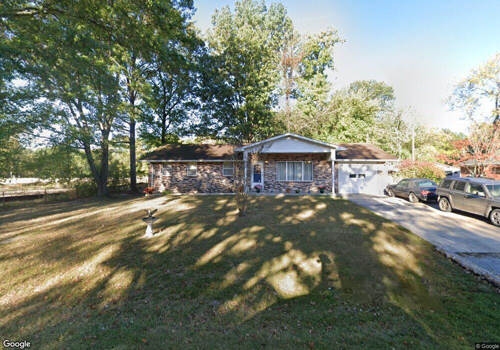
937 Hawthorne Rd Cape Girardeau, MO 63701
Estimated Value: $163,000 - $211,282
3
Beds
2
Baths
1,344
Sq Ft
$142/Sq Ft
Est. Value
About This Home
This home is located at 937 Hawthorne Rd, Cape Girardeau, MO 63701 and is currently estimated at $191,321, approximately $142 per square foot. 937 Hawthorne Rd is a home located in Cape Girardeau County with nearby schools including Clippard Elementary School, Central Middle School, and Central Junior High School.
Ownership History
Date
Name
Owned For
Owner Type
Purchase Details
Closed on
Sep 29, 2014
Sold by
Mallory Mary Lea
Bought by
Mallory Trust
Current Estimated Value
Purchase Details
Closed on
Jun 23, 2011
Sold by
Patterson Judith K
Bought by
Mallory Mary Lea
Home Financials for this Owner
Home Financials are based on the most recent Mortgage that was taken out on this home.
Original Mortgage
$68,000
Interest Rate
4.7%
Mortgage Type
New Conventional
Create a Home Valuation Report for This Property
The Home Valuation Report is an in-depth analysis detailing your home's value as well as a comparison with similar homes in the area
Home Values in the Area
Average Home Value in this Area
Purchase History
| Date | Buyer | Sale Price | Title Company |
|---|---|---|---|
| Mallory Trust | -- | -- | |
| Mallory Mary Lea | -- | None Available |
Source: Public Records
Mortgage History
| Date | Status | Borrower | Loan Amount |
|---|---|---|---|
| Previous Owner | Mallory Mary Lea | $68,000 |
Source: Public Records
Tax History Compared to Growth
Tax History
| Year | Tax Paid | Tax Assessment Tax Assessment Total Assessment is a certain percentage of the fair market value that is determined by local assessors to be the total taxable value of land and additions on the property. | Land | Improvement |
|---|---|---|---|---|
| 2025 | $11 | $22,360 | $1,500 | $20,860 |
| 2024 | $11 | $21,290 | $1,420 | $19,870 |
| 2023 | $1,107 | $21,290 | $1,420 | $19,870 |
| 2022 | $1,020 | $19,620 | $1,310 | $18,310 |
| 2021 | $1,020 | $19,620 | $1,310 | $18,310 |
| 2020 | $1,023 | $19,620 | $1,310 | $18,310 |
| 2019 | $1,022 | $19,620 | $0 | $0 |
| 2018 | $1,020 | $19,620 | $0 | $0 |
| 2017 | $1,022 | $19,620 | $0 | $0 |
| 2016 | $1,018 | $19,620 | $0 | $0 |
| 2015 | $1,019 | $19,620 | $0 | $0 |
| 2014 | $1,024 | $19,620 | $0 | $0 |
Source: Public Records
Map
Nearby Homes
- 835 Lochinvar Ln
- 3269 Hopper Rd
- 1000 N Mount Auburn Rd
- 1070 Dorothy St
- 1107 Dorothy St
- 769 Cedar Ln
- 3022 Wisteria Dr
- 1246 Marilyn Dr
- 2629 Hopper Rd
- 3027 Wisteria Dr
- 3014 Keystone Dr
- 901 Pheasant Cove Dr
- 3036 Keystone Dr
- 2615 Maria Louise Ln
- 3106 Mimosa St
- 3552 Mill View Crossing
- 3466 Hopper Rd
- 725 Old Mill Dr
- 807 Caribou Ct
- 3022 Beavercreek Dr
- 2871 Hopper Rd
- 3010 Hawthorne Place Dr
- 2873 Hopper Rd
- 2869 Hopper Rd
- 2992 Hawthorne Rd
- 2879 Hopper Rd
- 2938 Shadow Wood Ln
- 3007 Hawthorne Place Dr
- 2865 Hopper Rd
- 2936 Shadow Wood Ln
- 3011 Hawthorne Place Dr
- 2883 Hopper Rd
- 0 Shadow Wood Lane & Shadow Cir Unit 22046542
- 0 Shadow Wood Lane & Shadow Cir Unit 21004586
- 2861 Hopper Rd
- 2860 Hopper Rd
- 2935 Shadow Wood
- 2854 Hopper Rd
- 2924 Shadow Wood Ln