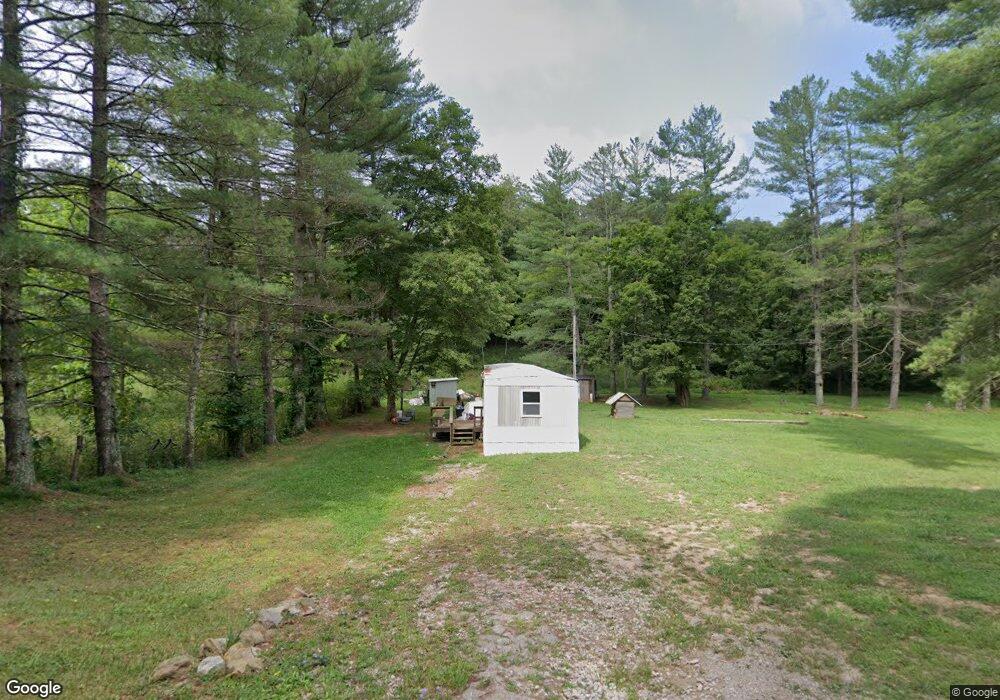
937 McClaskey Rd Vinton, OH 45686
Estimated Value: $23,946 - $84,000
--
Bed
--
Bath
672
Sq Ft
$86/Sq Ft
Est. Value
About This Home
This home is located at 937 McClaskey Rd, Vinton, OH 45686 and is currently estimated at $57,987, approximately $86 per square foot. 937 McClaskey Rd is a home located in Gallia County with nearby schools including Vinton Elementary School.
Ownership History
Date
Name
Owned For
Owner Type
Purchase Details
Closed on
Feb 5, 2024
Sold by
Halfhill Lowell
Bought by
Casey William Keith
Current Estimated Value
Purchase Details
Closed on
Sep 22, 2020
Sold by
Mcfarland William F
Bought by
Halfhill Lowell
Home Financials for this Owner
Home Financials are based on the most recent Mortgage that was taken out on this home.
Original Mortgage
$15,000
Interest Rate
2.8%
Mortgage Type
New Conventional
Purchase Details
Closed on
Feb 20, 2009
Sold by
Ferrell Harve and Ferrell Gertrude
Bought by
Hunt Scott M and Hunt Angela M
Purchase Details
Closed on
Oct 1, 1985
Create a Home Valuation Report for This Property
The Home Valuation Report is an in-depth analysis detailing your home's value as well as a comparison with similar homes in the area
Home Values in the Area
Average Home Value in this Area
Purchase History
| Date | Buyer | Sale Price | Title Company |
|---|---|---|---|
| Casey William Keith | -- | None Listed On Document | |
| Casey William Keith | -- | None Listed On Document | |
| Halfhill Lowell | $15,000 | None Listed On Document | |
| Halfhill Lowell | $15,000 | None Listed On Document | |
| Halfhill Lowell | $15,000 | None Available | |
| Hunt Scott M | $20,000 | None Available | |
| -- | $2,500 | -- |
Source: Public Records
Mortgage History
| Date | Status | Borrower | Loan Amount |
|---|---|---|---|
| Previous Owner | Halfhill Lowell | $15,000 |
Source: Public Records
Tax History Compared to Growth
Tax History
| Year | Tax Paid | Tax Assessment Tax Assessment Total Assessment is a certain percentage of the fair market value that is determined by local assessors to be the total taxable value of land and additions on the property. | Land | Improvement |
|---|---|---|---|---|
| 2024 | $204 | $5,950 | $5,950 | $0 |
| 2023 | $326 | $5,950 | $5,950 | $0 |
| 2022 | $190 | $5,040 | $5,040 | $0 |
| 2021 | $189 | $5,040 | $5,040 | $0 |
| 2020 | $189 | $5,040 | $5,040 | $0 |
| 2019 | $171 | $4,580 | $4,580 | $0 |
| 2018 | $171 | $4,580 | $4,580 | $0 |
| 2017 | $173 | $4,580 | $4,580 | $0 |
| 2016 | $167 | $4,540 | $4,270 | $270 |
| 2015 | $168 | $4,540 | $4,270 | $270 |
| 2013 | $253 | $4,520 | $4,270 | $250 |
| 2012 | $253 | $4,520 | $4,270 | $250 |
Source: Public Records
Map
Nearby Homes
- 31166 Edmundson Rd
- 3229 Painter Ridge Rd
- 7710 Bull Run Rd
- 31152 Edmundson Rd
- 0 Edmundson Rd Unit 23607169
- 0 Edmundson Rd Unit (Tract 2 at Big Timb
- 0 Edmundson Rd Unit 23597084
- 0 Edmundson Rd Unit 23463048
- 0 Edmundson Rd Unit (Tract 5 at Big Timb
- 0 Edmundson Rd Unit (Tract 6 at Big Timb
- 0 Edmundson Rd Unit 2429533
- 46400 Ohio 160
- 32319 Red Hill Rd Unit (Overlook Cabin at B
- 31845 Red Hill Rd
- 0 Edmundson Rd Unit Tract 1 Phase 2 Big
- 0 Red Hill Rd Unit 22347212
- 30285 Briar Ridge Rd
- 30286 Briar Ridge Rd
- 28033 State Route 124
- 28600 Ohio 124
- 733 McClaskey Rd
- 730 McClaskey Rd
- 0 Keesee Rd Unit 1555417
- 0 Keesee Rd Unit 1555413
- 0 Keesee Rd Unit 1817733
- 0 Keesee Rd Unit 165990
- 0 Keesee Rd Unit 2432228
- 0 Keesee Rd Unit 2428600
- 0 Keesee Rd Unit H128803
- 115 Shady Ln
- 1117 Keesee Rd
- 0 McClaskey Rd
- 100 Walters Rd
- 658 McClaskey Rd
- 280 Walters Rd
- 704 Keesee Rd
- 553 McClaskey Rd
- 1349 Keesee Rd
- 1345 Walters Rd
- 1345 Walters Rd