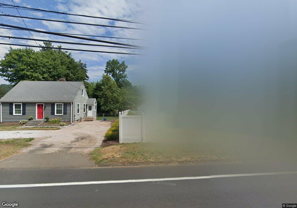
937 N High St East Haven, CT 06512
Estimated Value: $393,904 - $461,000
5
Beds
2
Baths
1,796
Sq Ft
$238/Sq Ft
Est. Value
About This Home
This home is located at 937 N High St, East Haven, CT 06512 and is currently estimated at $427,726, approximately $238 per square foot. 937 N High St is a home located in New Haven County with nearby schools including Deer Run School, East Haven High School, and Pathway School.
Ownership History
Date
Name
Owned For
Owner Type
Purchase Details
Closed on
Apr 7, 2000
Sold by
Ge Capital Mtg Svc Inc
Bought by
Vogt Michael P and Vogt Lori A
Current Estimated Value
Home Financials for this Owner
Home Financials are based on the most recent Mortgage that was taken out on this home.
Original Mortgage
$84,000
Outstanding Balance
$28,923
Interest Rate
8.3%
Estimated Equity
$398,803
Create a Home Valuation Report for This Property
The Home Valuation Report is an in-depth analysis detailing your home's value as well as a comparison with similar homes in the area
Home Values in the Area
Average Home Value in this Area
Purchase History
| Date | Buyer | Sale Price | Title Company |
|---|---|---|---|
| Vogt Michael P | $105,000 | -- |
Source: Public Records
Mortgage History
| Date | Status | Borrower | Loan Amount |
|---|---|---|---|
| Open | Vogt Michael P | $84,000 | |
| Previous Owner | Vogt Michael P | $99,000 | |
| Previous Owner | Vogt Michael P | $101,000 | |
| Previous Owner | Vogt Michael P | $93,000 |
Source: Public Records
Tax History Compared to Growth
Tax History
| Year | Tax Paid | Tax Assessment Tax Assessment Total Assessment is a certain percentage of the fair market value that is determined by local assessors to be the total taxable value of land and additions on the property. | Land | Improvement |
|---|---|---|---|---|
| 2025 | $6,344 | $189,700 | $41,370 | $148,330 |
| 2024 | $6,344 | $189,700 | $41,370 | $148,330 |
| 2023 | $5,919 | $189,700 | $41,370 | $148,330 |
| 2022 | $5,919 | $189,700 | $41,370 | $148,330 |
| 2021 | $5,534 | $161,580 | $39,210 | $122,370 |
| 2020 | $5,534 | $161,580 | $39,210 | $122,370 |
| 2019 | $5,238 | $161,580 | $39,210 | $122,370 |
| 2018 | $5,243 | $161,580 | $39,210 | $122,370 |
| 2017 | $5,098 | $161,580 | $39,210 | $122,370 |
| 2016 | $5,169 | $163,840 | $44,760 | $119,080 |
| 2015 | $5,104 | $161,770 | $44,760 | $117,010 |
| 2014 | $5,185 | $161,770 | $44,760 | $117,010 |
Source: Public Records
Map
Nearby Homes
- 965 N High St
- 983 N High St
- 91 Angela Dr
- 153 Grannis St
- 161 Grannis St
- 118 Hellstrom Rd
- 12 Corbin Rd
- 72 Gene St
- 1192 N High St
- 547 Laurel St
- 173 Russo Ave Unit 409
- 173 Russo Ave Unit 609
- 173 Russo Ave Unit 410
- 642 Bradley St
- 66 John St
- 24 Laura Cir
- 31 Marie St Unit B
- 570 Bradley St
- 30 Thompson St
- 560 Bradley St