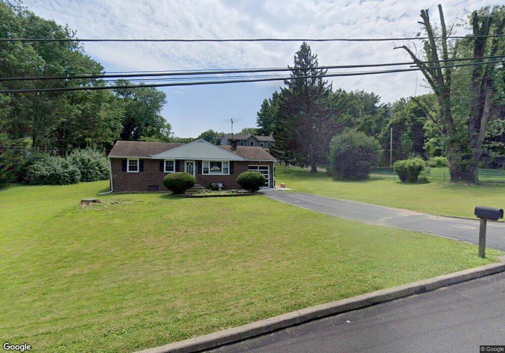
937 Wheatsheaf Ln Feasterville Trevose, PA 19053
Estimated Value: $369,577 - $413,000
3
Beds
1
Bath
1,000
Sq Ft
$395/Sq Ft
Est. Value
About This Home
This home is located at 937 Wheatsheaf Ln, Feasterville Trevose, PA 19053 and is currently estimated at $395,144, approximately $395 per square foot. 937 Wheatsheaf Ln is a home located in Bucks County with nearby schools including Tawanka Elementary School, Poquessing Middle School, and Neshaminy High School.
Ownership History
Date
Name
Owned For
Owner Type
Purchase Details
Closed on
Nov 20, 1998
Sold by
Petraitis William J
Bought by
Nicoletti Albert J
Current Estimated Value
Home Financials for this Owner
Home Financials are based on the most recent Mortgage that was taken out on this home.
Original Mortgage
$115,900
Outstanding Balance
$25,833
Interest Rate
6.83%
Estimated Equity
$369,311
Purchase Details
Closed on
Mar 7, 1972
Bought by
Petraitis William J and Petraitis Tessie C
Create a Home Valuation Report for This Property
The Home Valuation Report is an in-depth analysis detailing your home's value as well as a comparison with similar homes in the area
Home Values in the Area
Average Home Value in this Area
Purchase History
| Date | Buyer | Sale Price | Title Company |
|---|---|---|---|
| Nicoletti Albert J | $144,900 | -- | |
| Petraitis William J | -- | -- |
Source: Public Records
Mortgage History
| Date | Status | Borrower | Loan Amount |
|---|---|---|---|
| Open | Nicoletti Albert J | $115,900 |
Source: Public Records
Tax History Compared to Growth
Tax History
| Year | Tax Paid | Tax Assessment Tax Assessment Total Assessment is a certain percentage of the fair market value that is determined by local assessors to be the total taxable value of land and additions on the property. | Land | Improvement |
|---|---|---|---|---|
| 2025 | $4,340 | $20,400 | $3,800 | $16,600 |
| 2024 | $4,340 | $20,400 | $3,800 | $16,600 |
| 2023 | $4,300 | $20,400 | $3,800 | $16,600 |
| 2022 | $4,185 | $20,400 | $3,800 | $16,600 |
| 2021 | $4,185 | $20,400 | $3,800 | $16,600 |
| 2020 | $4,134 | $20,400 | $3,800 | $16,600 |
| 2019 | $4,040 | $20,400 | $3,800 | $16,600 |
| 2018 | $3,964 | $20,400 | $3,800 | $16,600 |
| 2017 | $3,861 | $20,400 | $3,800 | $16,600 |
| 2016 | $3,861 | $20,400 | $3,800 | $16,600 |
| 2015 | $2,894 | $20,400 | $3,800 | $16,600 |
| 2014 | $2,894 | $20,400 | $3,800 | $16,600 |
Source: Public Records
Map
Nearby Homes
- 1241 Ridge Rd
- 1128 Hilton Ave
- 1320 Clayton Ave
- 1226 Neshaminy Ave
- 216 Buttonwood Dr
- 1237 Clayton Ave
- 2304 LOT J-3 Brownsville Rd
- 836 E Bristol Rd
- 737 Lynwood Dr
- 2304 Brownsville Rd
- 2304 Brownsville Rd Unit 1216
- 2304 Brownsville Rd Unit P11
- 2053 Christina Ct
- 716 Ross Dr
- 722 Autumn Dr
- 2623 Sunnyside Ave
- 4357 Brownsville Rd
- 0 Grove Ave
- 2067 Herrick Ave
- 812 Green Ridge Cir
- 939 Wheatsheaf Ln
- 1230 Ridge Rd
- 1234 Ridge Rd
- 943 Wheatsheaf Ln
- 935 Wheatsheaf Ln
- 947 Wheatsheaf Ln
- 1160 Ridge Rd
- 1238 Ridge Rd
- 1170 Ridge Rd
- 1150 Ridge Rd
- 940 Wheatsheaf Ln
- 1225 Ridge Rd
- 941 Meadow Ln
- 938 Wheatsheaf Ln
- 1239 Ridge Rd
- 2220 Bent Rd
- 936 Wheatsheaf Ln
- 934 Wheatsheaf Ln
- 2403 Acorn Rd
- 2216 Bent Rd