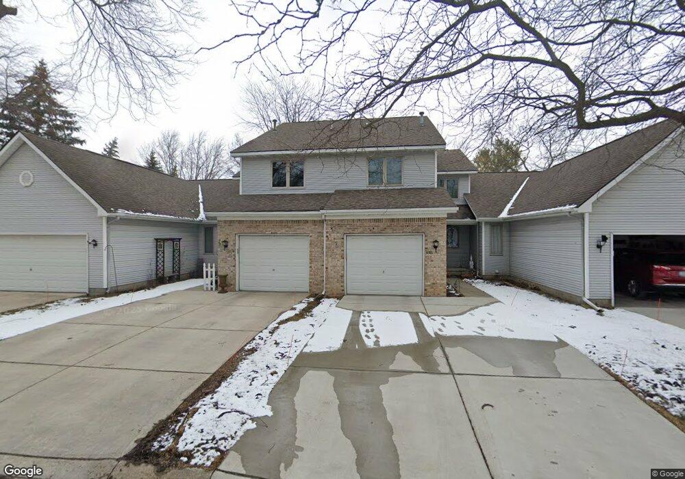
9377 Jamie Dr Unit 7 Davison, MI 48423
Estimated Value: $217,000 - $238,000
--
Bed
2
Baths
1,284
Sq Ft
$176/Sq Ft
Est. Value
About This Home
This home is located at 9377 Jamie Dr Unit 7, Davison, MI 48423 and is currently estimated at $226,343, approximately $176 per square foot. 9377 Jamie Dr Unit 7 is a home located in Genesee County with nearby schools including Thomson Elementary School, Hill Elementary School, and Gates Elementary School.
Ownership History
Date
Name
Owned For
Owner Type
Purchase Details
Closed on
Sep 27, 2024
Sold by
Gary D Eberhardt Family Trust and Burnham Rebecca
Bought by
Burnham Rebecca
Current Estimated Value
Purchase Details
Closed on
Sep 15, 2020
Sold by
Eberhardt Carol A
Bought by
Gary D Eberhardt Family Trust and Eberhardt
Purchase Details
Closed on
Sep 1, 2020
Sold by
Howard Patrick C
Bought by
Eherhardt Carol A
Purchase Details
Closed on
Jul 30, 2018
Sold by
Sylvester Jerald A and Sylvester Margaret A
Bought by
Howard Patricia C
Purchase Details
Closed on
Feb 7, 2013
Sold by
Sylvester Jerald A and Sylvester Margaret A
Bought by
Sylvester Jerald A and Sylvester Margaret A
Create a Home Valuation Report for This Property
The Home Valuation Report is an in-depth analysis detailing your home's value as well as a comparison with similar homes in the area
Home Values in the Area
Average Home Value in this Area
Purchase History
| Date | Buyer | Sale Price | Title Company |
|---|---|---|---|
| Burnham Rebecca | -- | None Listed On Document | |
| Burnham Rebecca | -- | None Listed On Document | |
| Gary D Eberhardt Family Trust | -- | None Listed On Document | |
| Eherhardt Carol A | $148,500 | Title Resource Agency | |
| Howard Patricia C | $137,300 | West Michigan Realtors Title | |
| Sylvester Jerald A | -- | None Available |
Source: Public Records
Tax History Compared to Growth
Tax History
| Year | Tax Paid | Tax Assessment Tax Assessment Total Assessment is a certain percentage of the fair market value that is determined by local assessors to be the total taxable value of land and additions on the property. | Land | Improvement |
|---|---|---|---|---|
| 2025 | $3,510 | $102,300 | $0 | $0 |
| 2024 | $1,023 | $93,900 | $0 | $0 |
| 2023 | $976 | $86,900 | $0 | $0 |
| 2022 | $3,153 | $84,900 | $0 | $0 |
| 2021 | $3,126 | $78,200 | $0 | $0 |
| 2020 | $795 | $74,500 | $0 | $0 |
| 2019 | $782 | $67,400 | $0 | $0 |
| 2018 | $1,896 | $61,800 | $0 | $0 |
| 2017 | $1,824 | $61,800 | $0 | $0 |
| 2016 | $1,789 | $60,400 | $0 | $0 |
| 2015 | -- | $55,900 | $0 | $0 |
| 2012 | -- | $42,800 | $42,800 | $0 |
Source: Public Records
Map
Nearby Homes
- 9469 Parkwood N Unit 2B
- 1067 Julie Dr
- 9417 Linda Dr
- 9448 Linda Dr
- 527 Amesbury Dr
- 530 Hemlock Dr
- 334 E Clark St Unit 340 344
- 330 Rosemore Dr
- 00 Lapeer Rd
- 304 S State Rd
- 9223 Lapeer Rd
- 322 North Dr
- 405 Viet St
- 0 Cal Dr
- 1024 Foxglove Ln
- 000 Foxglove Ln
- 10.63(+/-) Acres Lapeer Rd
- 222 N Davison St
- 1120 Crystal Wood Dr
- 1075 Crystal Wood Dr Unit 24
- 9377 Jamie Dr Unit 7
- 9377 Jamie Dr
- 9381 Jamie Dr Unit 5
- 9375 Jamie Dr Unit 12
- 9383 Jamie Dr Unit 4
- 9373 Jamie Dr Unit 13
- 9365 Jamie Dr
- 9371 Jamie Dr
- 1031 Toni Dr Unit 8
- 1031 Toni Dr
- 1031 Toni Dr Unit 3, 8
- 1030 S Dayton St Unit 1
- 1030 S Dayton St Unit 1 Building 1
- 305 Delzingro Dr
- 309 Delzingro Dr
- 9369 Jamie Dr Unit 15
- 1033 Toni Dr
- 1032 S Dayton St
- 1032 S Dayton St Unit 2
- 1035 Toni Dr