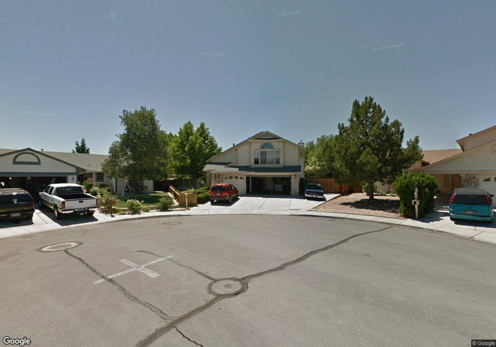
938 Coal Ct Sparks, NV 89434
Reed NeighborhoodEstimated Value: $608,799 - $666,000
5
Beds
3
Baths
2,748
Sq Ft
$230/Sq Ft
Est. Value
About This Home
This home is located at 938 Coal Ct, Sparks, NV 89434 and is currently estimated at $631,200, approximately $229 per square foot. 938 Coal Ct is a home located in Washoe County with nearby schools including Lloyd Diedrichsen Elementary School, Lou Mendive Middle School, and Edward C Reed High School.
Ownership History
Date
Name
Owned For
Owner Type
Purchase Details
Closed on
Jan 11, 2007
Sold by
Harrigan Mitchell W and Harrigan Beverly A
Bought by
Bock Glenn E and Bock Tammy N
Current Estimated Value
Home Financials for this Owner
Home Financials are based on the most recent Mortgage that was taken out on this home.
Original Mortgage
$329,600
Outstanding Balance
$193,971
Interest Rate
6.12%
Mortgage Type
Unknown
Estimated Equity
$437,229
Purchase Details
Closed on
Sep 22, 1994
Sold by
Mcgah Dutton and Mcgah Bailey
Bought by
Harrigan Mitchell W and Harrigan Beverly A
Home Financials for this Owner
Home Financials are based on the most recent Mortgage that was taken out on this home.
Original Mortgage
$89,285
Interest Rate
5.25%
Create a Home Valuation Report for This Property
The Home Valuation Report is an in-depth analysis detailing your home's value as well as a comparison with similar homes in the area
Home Values in the Area
Average Home Value in this Area
Purchase History
| Date | Buyer | Sale Price | Title Company |
|---|---|---|---|
| Bock Glenn E | $412,000 | First Centennial Title Co | |
| Harrigan Mitchell W | $189,500 | Stewart Title |
Source: Public Records
Mortgage History
| Date | Status | Borrower | Loan Amount |
|---|---|---|---|
| Open | Bock Glenn E | $329,600 | |
| Previous Owner | Harrigan Mitchell W | $89,285 |
Source: Public Records
Tax History Compared to Growth
Tax History
| Year | Tax Paid | Tax Assessment Tax Assessment Total Assessment is a certain percentage of the fair market value that is determined by local assessors to be the total taxable value of land and additions on the property. | Land | Improvement |
|---|---|---|---|---|
| 2026 | $2,338 | $104,236 | $31,357 | $72,879 |
| 2025 | $3,044 | $106,996 | $32,508 | $74,488 |
| 2024 | $2,959 | $105,379 | $29,894 | $75,486 |
| 2023 | $2,140 | $103,423 | $31,658 | $71,765 |
| 2022 | $2,871 | $84,067 | $24,066 | $60,001 |
| 2021 | $2,790 | $79,465 | $19,562 | $59,903 |
| 2020 | $2,706 | $78,942 | $18,648 | $60,294 |
| 2019 | $2,628 | $77,327 | $18,648 | $58,679 |
| 2018 | $2,548 | $70,419 | $13,010 | $57,409 |
| 2017 | $2,477 | $70,022 | $12,348 | $57,674 |
| 2016 | $2,415 | $70,115 | $11,025 | $59,090 |
| 2015 | $2,412 | $68,487 | $9,293 | $59,194 |
| 2014 | $2,341 | $64,733 | $8,127 | $56,606 |
| 2013 | -- | $62,305 | $6,517 | $55,788 |
Source: Public Records
Map
Nearby Homes
- 1866 Pocono Ct
- 1332 Coachman Ct
- 1770 Burnside Dr
- 2002 Wabash Cir
- 1290 Highgate Ct
- 1218 Junction Dr
- 1544 Woodhaven Ln
- 1757 Bluehaven Dr
- 1990 Fargo Way
- 1280 O'Callaghan Dr
- 2252 Sycamore Glen Dr
- 1005 Amico Dr
- 675 Parlanti Ln Unit 52
- 675 Parlanti Ln Unit 124
- 675 Parlanti Ln Unit 42
- 675 Parlanti Ln
- 675 Parlanti Ln Unit 88
- 675 Parlanti Ln Unit 63
- 2119 Avella Dr
- 2407 Sunny Slope Dr Unit 1
- 934 Coal Ct
- 944 Coal Ct
- 1515 Rheingold Ct
- 954 Coal Ct
- 1525 Rheingold Ct
- 935 Coal Ct
- 1514 Rheingold Ct
- 945 Coal Ct
- 964 Coal Ct
- 955 Coal Ct
- 1524 Rheingold Ct
- 1535 Rheingold Ct
- 965 Coal Ct
- 944 Locomotive Way
- 974 Caboose Way Unit 11C
- 934 Locomotive Way
- 954 Locomotive Way
- 924 Locomotive Way
- 964 Locomotive Way
- 1534 Rheingold Ct