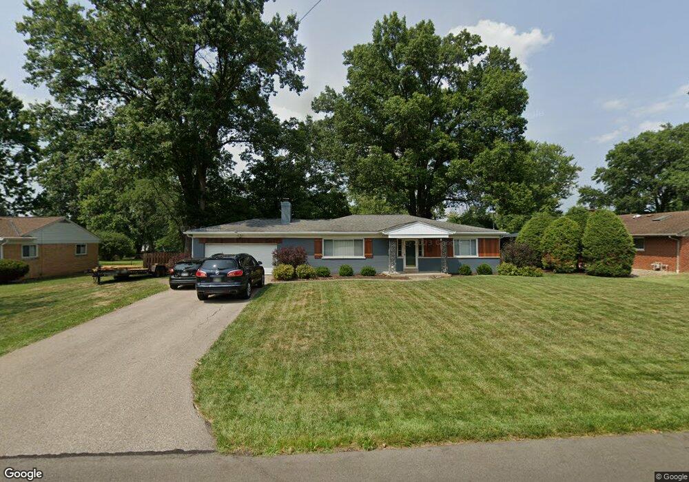
938 Garnoa Dr Cincinnati, OH 45231
Winton Lake NeighborhoodEstimated Value: $239,000 - $282,000
3
Beds
2
Baths
1,504
Sq Ft
$172/Sq Ft
Est. Value
About This Home
This home is located at 938 Garnoa Dr, Cincinnati, OH 45231 and is currently estimated at $259,008, approximately $172 per square foot. 938 Garnoa Dr is a home located in Hamilton County with nearby schools including John Paul II Catholic School.
Ownership History
Date
Name
Owned For
Owner Type
Purchase Details
Closed on
Jan 6, 2012
Sold by
Szczepanski Mariamw and Szczepanski Michael
Bought by
Szczepanski Maria and Szczepanski Michael
Current Estimated Value
Purchase Details
Closed on
Oct 25, 2005
Sold by
Szczepanski Michael and Szczepanski Maria
Bought by
Szczepanski Michael and Szcepanski Maria
Home Financials for this Owner
Home Financials are based on the most recent Mortgage that was taken out on this home.
Original Mortgage
$170,000
Interest Rate
6.36%
Mortgage Type
New Conventional
Create a Home Valuation Report for This Property
The Home Valuation Report is an in-depth analysis detailing your home's value as well as a comparison with similar homes in the area
Home Values in the Area
Average Home Value in this Area
Purchase History
| Date | Buyer | Sale Price | Title Company |
|---|---|---|---|
| Szczepanski Maria | -- | -- | |
| Szczepanski Michael | -- | Titleworks Of Ohio Llc |
Source: Public Records
Mortgage History
| Date | Status | Borrower | Loan Amount |
|---|---|---|---|
| Previous Owner | Szczepanski Michael | $170,000 |
Source: Public Records
Tax History
| Year | Tax Paid | Tax Assessment Tax Assessment Total Assessment is a certain percentage of the fair market value that is determined by local assessors to be the total taxable value of land and additions on the property. | Land | Improvement |
|---|---|---|---|---|
| 2025 | $4,953 | $72,709 | $13,867 | $58,842 |
| 2024 | $4,767 | $72,709 | $13,867 | $58,842 |
| 2023 | $4,578 | $72,709 | $13,867 | $58,842 |
| 2022 | $3,691 | $43,883 | $11,018 | $32,865 |
| 2021 | $3,605 | $43,883 | $11,018 | $32,865 |
| 2020 | $3,657 | $43,883 | $11,018 | $32,865 |
| 2019 | $3,360 | $37,191 | $9,338 | $27,853 |
| 2018 | $3,368 | $37,191 | $9,338 | $27,853 |
| 2017 | $3,240 | $37,191 | $9,338 | $27,853 |
| 2016 | $3,294 | $37,072 | $9,198 | $27,874 |
| 2015 | $3,073 | $37,072 | $9,198 | $27,874 |
| 2014 | $3,062 | $37,072 | $9,198 | $27,874 |
| 2013 | $3,407 | $42,613 | $10,574 | $32,039 |
Source: Public Records
Map
Nearby Homes
- 946 Mckelvey Rd
- 906 Garnoa Dr
- 9732 Woodmill Ln
- 860 Sarbrook Dr
- 9876 Lorelei Dr
- 10022 Lakeside Dr
- 9370 Bridgecreek Dr
- 9382 Stoneybrooke
- 9305 Bridgecreek Dr Unit 14A
- 9367 Stoneybrooke Unit 10G
- 9315 Winton Rd
- 9319 Winton Rd
- 9606 Millbrook Dr
- 1074 Flintlock Dr
- 9458 Leebrook Dr
- 650 Allencrest Ct
- 8491 Daly Rd
- 1115 Compton Rd
- 1283 Bellune Dr
- 1123 Compton Rd
Your Personal Tour Guide
Ask me questions while you tour the home.