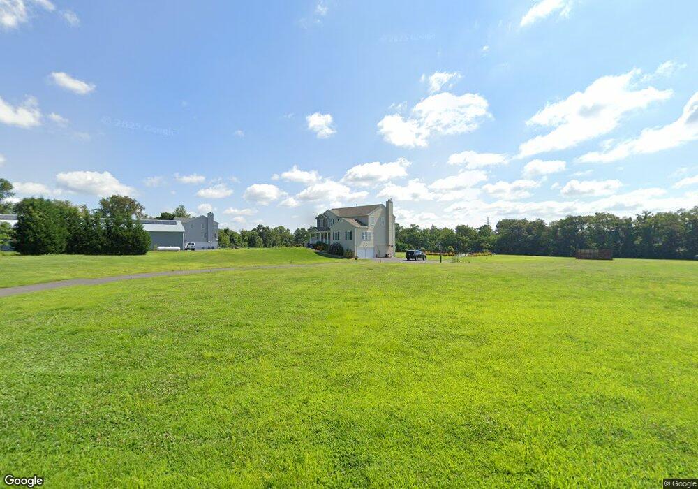
938 Mansfield Rd W Bordentown, NJ 08505
Estimated Value: $485,000 - $782,000
--
Bed
--
Bath
3,181
Sq Ft
$202/Sq Ft
Est. Value
About This Home
This home is located at 938 Mansfield Rd W, Bordentown, NJ 08505 and is currently estimated at $643,755, approximately $202 per square foot. 938 Mansfield Rd W is a home with nearby schools including John Hydock Elementary School, Mansfield Township Elementary School, and Northern Burlington County Regional Middle School.
Ownership History
Date
Name
Owned For
Owner Type
Purchase Details
Closed on
Jun 17, 2011
Sold by
Abv Development Inc
Bought by
Guire Brian L and Guire Shannon M
Current Estimated Value
Home Financials for this Owner
Home Financials are based on the most recent Mortgage that was taken out on this home.
Original Mortgage
$360,000
Outstanding Balance
$255,531
Interest Rate
4.62%
Mortgage Type
New Conventional
Estimated Equity
$388,224
Create a Home Valuation Report for This Property
The Home Valuation Report is an in-depth analysis detailing your home's value as well as a comparison with similar homes in the area
Home Values in the Area
Average Home Value in this Area
Purchase History
| Date | Buyer | Sale Price | Title Company |
|---|---|---|---|
| Guire Brian L | $450,537 | Integrity Title Agency Inc |
Source: Public Records
Mortgage History
| Date | Status | Borrower | Loan Amount |
|---|---|---|---|
| Open | Guire Brian L | $360,000 | |
| Closed | Guire Brian L | $360,000 |
Source: Public Records
Tax History Compared to Growth
Tax History
| Year | Tax Paid | Tax Assessment Tax Assessment Total Assessment is a certain percentage of the fair market value that is determined by local assessors to be the total taxable value of land and additions on the property. | Land | Improvement |
|---|---|---|---|---|
| 2025 | $11,854 | $365,300 | $138,200 | $227,100 |
| 2024 | $11,549 | $365,300 | $138,200 | $227,100 |
| 2023 | $11,549 | $353,400 | $138,200 | $215,200 |
| 2022 | $11,666 | $353,400 | $138,200 | $215,200 |
| 2021 | $11,910 | $353,400 | $138,200 | $215,200 |
| 2020 | $11,782 | $353,400 | $138,200 | $215,200 |
| 2019 | $11,493 | $353,400 | $138,200 | $215,200 |
| 2018 | $11,019 | $353,400 | $138,200 | $215,200 |
| 2017 | $11,012 | $353,400 | $138,200 | $215,200 |
| 2016 | $11,019 | $353,400 | $138,200 | $215,200 |
| 2015 | $10,906 | $353,400 | $138,200 | $215,200 |
| 2014 | $10,454 | $353,400 | $138,200 | $215,200 |
Source: Public Records
Map
Nearby Homes
- 2334 Old York Rd
- 0 Monika Way Unit NJBL2096290
- 62 Meadow Run Rd
- 54 Meadow Run Rd
- 43 Meadow Run Rd
- 66 Seneca Ln
- 43 Allegheny Ln
- 124 Ridgway Dr
- 116 Hedding Rd
- 59 Trainor Cir
- 85 Creekwood Dr
- 105 Maple Ave
- 74 Creekwood Dr
- 8 Sherwood Ln
- 13 Manchester Ct
- 15 Manchester Ct
- 71 Amboy Ave
- 1036 Potts Mill Rd
- 51 Amboy Ave
- 205 2nd St
- 2370 Old York Rd
- 2360 Old York Rd
- 2350 Old York Rd
- 939 Mansfield Rd W
- 918 Mansfield Rd W
- 949 Mansfield Rd W
- 917 Mansfield Rd W Unit LOT A
- 917 Mansfield Rd W
- 959 Mansfield Rd W
- 903 Mansfield Rd W
- 896 Mansfield Rd W
- 2374 Old York Rd
- 2375 Old York Rd
- 2338 Old York Rd
- 2379 Old York Rd
- 2336 Old York Rd
- 2332 Old York Rd
- 866 Mansfield Rd W
- 2329 Old York Rd
- 2324 Old York Rd