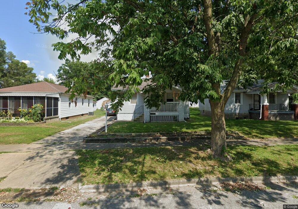
938 N Hill Ave Decatur, IL 62522
Garfield Park NeighborhoodEstimated Value: $32,000 - $50,000
--
Bed
--
Bath
676
Sq Ft
$62/Sq Ft
Est. Value
About This Home
This home is located at 938 N Hill Ave, Decatur, IL 62522 and is currently estimated at $42,005, approximately $62 per square foot. 938 N Hill Ave is a home located in Macon County with nearby schools including Stephen Decatur Middle School and Teen Challenge-Home For Girls.
Ownership History
Date
Name
Owned For
Owner Type
Purchase Details
Closed on
Mar 26, 2012
Sold by
Bering Wilson M
Bought by
Hughes Cynthia Kaye
Current Estimated Value
Purchase Details
Closed on
Mar 8, 2011
Sold by
Bering Catherine E and Brown Catherine E
Bought by
Bering Wilson M
Purchase Details
Closed on
Mar 8, 2001
Purchase Details
Closed on
Apr 28, 2000
Sold by
Young Larry and Young Tina
Bought by
Bering Catherine E and Brown Catherine E
Purchase Details
Closed on
Jun 1, 1987
Create a Home Valuation Report for This Property
The Home Valuation Report is an in-depth analysis detailing your home's value as well as a comparison with similar homes in the area
Home Values in the Area
Average Home Value in this Area
Purchase History
| Date | Buyer | Sale Price | Title Company |
|---|---|---|---|
| Hughes Cynthia Kaye | $8,000 | None Available | |
| Hughes Cynthia Kaye | $8,000 | None Available | |
| Bering Wilson M | -- | None Available | |
| -- | -- | -- | |
| Bering Catherine E | -- | None Available | |
| -- | $20,500 | -- |
Source: Public Records
Tax History Compared to Growth
Tax History
| Year | Tax Paid | Tax Assessment Tax Assessment Total Assessment is a certain percentage of the fair market value that is determined by local assessors to be the total taxable value of land and additions on the property. | Land | Improvement |
|---|---|---|---|---|
| 2024 | $912 | $9,421 | $436 | $8,985 |
| 2023 | $904 | $9,088 | $421 | $8,667 |
| 2022 | $852 | $8,330 | $389 | $7,941 |
| 2021 | $801 | $7,780 | $364 | $7,416 |
| 2020 | $789 | $7,419 | $348 | $7,071 |
| 2019 | $789 | $7,419 | $348 | $7,071 |
| 2018 | $857 | $8,159 | $277 | $7,882 |
| 2017 | $877 | $8,376 | $284 | $8,092 |
| 2016 | $894 | $8,462 | $287 | $8,175 |
| 2015 | $850 | $8,312 | $282 | $8,030 |
| 2014 | $924 | $9,643 | $1,455 | $8,188 |
| 2013 | $955 | $10,006 | $1,510 | $8,496 |
Source: Public Records
Map
Nearby Homes
- 917 N Wilder Ave
- 1065 W Green St
- 1451 W Marietta St
- 1319 W Waggoner St
- 837 W Grand Ave
- 958 W William St
- 1535 N Mcclellan Ave
- 1645 W Center St
- 1530 W Cushing St
- 266 Cobb Ave
- 875 N Monroe St
- 1675 W Center St
- 933 W Division St
- 1415 N Dennis Ave
- 925 W Olive St
- 254 N Pine St
- 1005 W Main St
- 415 W Green St
- 1653 N Maple Ave
- 1545 N Monroe St
- 942 N Hill Ave
- 930 N Hill Ave
- 939 N Hill Ave
- 946 N Hill Ave
- 931 N Hill Ave
- 947 N Hill Ave
- 953 N Hill Ave
- 923 N Hill Ave
- 948 N Hill Ave
- 961 N Hill Ave
- 1128 W King St
- 950 N Hill Ave
- 969 N Hill Ave
- 953 N Oakland Ave
- 1146 W King St
- 1156 W King St
- 977 N Hill Ave
- 954 N Hill Ave
- 1162 W King St
- 1122 W King St