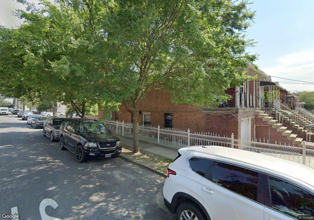
938 Neill Ave Bronx, NY 10462
Morris Park NeighborhoodEstimated Value: $787,199 - $970,000
--
Bed
--
Bath
2,180
Sq Ft
$408/Sq Ft
Est. Value
About This Home
This home is located at 938 Neill Ave, Bronx, NY 10462 and is currently estimated at $888,800, approximately $407 per square foot. 938 Neill Ave is a home located in Bronx County with nearby schools including P.S. 083 The Donald Hertz School and St. Clare of Assisi School.
Ownership History
Date
Name
Owned For
Owner Type
Purchase Details
Closed on
Sep 14, 2007
Sold by
Barnes Cheryl and Barnes Linton
Bought by
Barnes Cheryl
Current Estimated Value
Home Financials for this Owner
Home Financials are based on the most recent Mortgage that was taken out on this home.
Original Mortgage
$245,180
Outstanding Balance
$154,593
Interest Rate
6.49%
Mortgage Type
Purchase Money Mortgage
Estimated Equity
$734,207
Purchase Details
Closed on
Oct 23, 1995
Sold by
Roth Paul and Roth Ella
Bought by
Barnes Linton and Barnes Cheryl
Home Financials for this Owner
Home Financials are based on the most recent Mortgage that was taken out on this home.
Original Mortgage
$188,000
Interest Rate
7.43%
Create a Home Valuation Report for This Property
The Home Valuation Report is an in-depth analysis detailing your home's value as well as a comparison with similar homes in the area
Home Values in the Area
Average Home Value in this Area
Purchase History
| Date | Buyer | Sale Price | Title Company |
|---|---|---|---|
| Barnes Cheryl | -- | -- | |
| Barnes Linton | $235,000 | -- |
Source: Public Records
Mortgage History
| Date | Status | Borrower | Loan Amount |
|---|---|---|---|
| Open | Barnes Cheryl | $245,180 | |
| Previous Owner | Barnes Linton | $188,000 |
Source: Public Records
Tax History Compared to Growth
Tax History
| Year | Tax Paid | Tax Assessment Tax Assessment Total Assessment is a certain percentage of the fair market value that is determined by local assessors to be the total taxable value of land and additions on the property. | Land | Improvement |
|---|---|---|---|---|
| 2025 | $7,458 | $40,435 | $7,211 | $33,224 |
| 2024 | $7,458 | $38,534 | $7,434 | $31,100 |
| 2023 | $7,217 | $36,938 | $7,679 | $29,259 |
| 2022 | $6,670 | $41,520 | $9,480 | $32,040 |
| 2021 | $7,031 | $40,920 | $9,480 | $31,440 |
| 2020 | $6,836 | $41,760 | $9,480 | $32,280 |
| 2019 | $6,425 | $38,400 | $9,480 | $28,920 |
| 2018 | $5,977 | $30,782 | $7,347 | $23,435 |
| 2017 | $5,620 | $29,040 | $9,480 | $19,560 |
| 2016 | $5,640 | $29,764 | $9,114 | $20,650 |
| 2015 | $3,178 | $28,080 | $10,560 | $17,520 |
| 2014 | $3,178 | $26,760 | $10,560 | $16,200 |
Source: Public Records
Map
Nearby Homes
- 1925 Bogart Ave
- 1904 Bronxdale Ave
- 953 Rhinelander Ave
- 928 Rhinelander Ave
- 2037 Radcliff Ave
- 1869 Muliner Ave
- 1916 Barnes Ave
- 1945 Paulding Ave
- 1004 Rhinelander Ave
- 1907 Barnes Ave
- 1963 Hone Ave
- 1961 Wallace Ave
- 2080 Matthews Ave
- 2090 Barnes Ave Unit 4D
- 2090 Barnes Ave Unit 6A
- 2090 Barnes Ave Unit 2H
- 2080 Barnes Ave Unit 5C
- 2080 Barnes Ave Unit 5B
- 2080 Barnes Ave Unit 4C
- 2080 Barnes Ave Unit 4A
- 936 Neill Ave
- 934 Neill Ave
- 932 Neill Ave
- 1961 Bogart Ave
- 930 Neill Ave
- 1959 Bogart Ave
- 954 Neill Ave
- 954 Neill Ave Unit 1
- 928 Neill Ave
- 1957 Bogart Ave
- 958 Neill Ave
- 958 Neill Ave Unit 1
- 1960 Bogart Ave
- 1960 Fowler Ave
- 926 Neill Ave
- 1955 Bogart Ave
- 1955 Bogart Ave Unit 2
- 1958 Bogart Ave
- 925 Neill Ave
- 960 Neill Ave