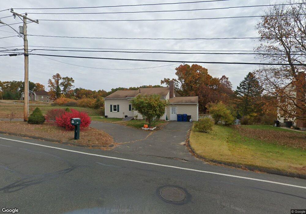
938 Piper Rd West Springfield, MA 01089
Estimated Value: $324,000 - $383,000
3
Beds
1
Bath
1,140
Sq Ft
$304/Sq Ft
Est. Value
About This Home
This home is located at 938 Piper Rd, West Springfield, MA 01089 and is currently estimated at $346,796, approximately $304 per square foot. 938 Piper Rd is a home located in Hampden County with nearby schools including West Springfield High School, Hampden Charter School of Science West, and St Thomas The Apostle School.
Ownership History
Date
Name
Owned For
Owner Type
Purchase Details
Closed on
May 2, 2024
Sold by
Henchey Allen D
Bought by
Henchey Allen D and Henchey Nora K
Current Estimated Value
Purchase Details
Closed on
Sep 5, 2002
Sold by
Elias Aziz S
Bought by
Henchey Allen D
Home Financials for this Owner
Home Financials are based on the most recent Mortgage that was taken out on this home.
Original Mortgage
$130,965
Interest Rate
6.39%
Mortgage Type
Purchase Money Mortgage
Purchase Details
Closed on
Jun 21, 2002
Sold by
Dolan John E
Bought by
Elias Aziz S
Purchase Details
Closed on
Apr 27, 1992
Sold by
Federal National Mortgage Association
Bought by
Dolan John E
Purchase Details
Closed on
Jan 29, 1992
Sold by
Bryant Ernest J
Bought by
Fleet Bk Ma
Create a Home Valuation Report for This Property
The Home Valuation Report is an in-depth analysis detailing your home's value as well as a comparison with similar homes in the area
Home Values in the Area
Average Home Value in this Area
Purchase History
| Date | Buyer | Sale Price | Title Company |
|---|---|---|---|
| Henchey Allen D | -- | None Available | |
| Henchey Allen D | -- | None Available | |
| Henchey Allen D | $132,000 | -- | |
| Henchey Allen D | $132,000 | -- | |
| Elias Aziz S | $91,000 | -- | |
| Elias Aziz S | $91,000 | -- | |
| Dolan John E | $70,000 | -- | |
| Dolan John E | $70,000 | -- | |
| Fleet Bk Ma | $82,000 | -- | |
| Fleet Bk Ma | $82,000 | -- |
Source: Public Records
Mortgage History
| Date | Status | Borrower | Loan Amount |
|---|---|---|---|
| Previous Owner | Fleet Bk Ma | $130,965 |
Source: Public Records
Tax History
| Year | Tax Paid | Tax Assessment Tax Assessment Total Assessment is a certain percentage of the fair market value that is determined by local assessors to be the total taxable value of land and additions on the property. | Land | Improvement |
|---|---|---|---|---|
| 2025 | $3,691 | $248,200 | $113,500 | $134,700 |
| 2024 | $3,763 | $254,100 | $113,500 | $140,600 |
| 2023 | $3,619 | $232,900 | $113,500 | $119,400 |
| 2022 | $3,275 | $207,800 | $103,000 | $104,800 |
| 2021 | $2,983 | $176,500 | $81,700 | $94,800 |
| 2020 | $2,999 | $176,500 | $81,700 | $94,800 |
| 2019 | $2,993 | $176,500 | $81,700 | $94,800 |
| 2018 | $3,009 | $176,500 | $81,700 | $94,800 |
| 2017 | $3,009 | $176,500 | $81,700 | $94,800 |
| 2016 | $2,936 | $172,800 | $76,800 | $96,000 |
| 2015 | $2,880 | $169,500 | $75,300 | $94,200 |
| 2014 | $681 | $165,300 | $75,300 | $90,000 |
Source: Public Records
Map
Nearby Homes
- 404 Brush Hill Ave
- 36 Shady Brook
- 2 Windpath E
- 791 Morgan Rd
- 80 Brush Hill Ave Unit 61
- 0 Ahiska Rd Unit 73477754
- 750 Amostown Rd
- 11 Annie's Way
- 361 Prospect Ave
- 917 Elm St
- 13 Beston St
- 69 Beston St
- 27 Abbey St
- 0 School St
- 34 High Meadow Dr
- 51-53 Abbe Ave
- 21 Depot St
- 61 Clarence St
- 240 Morton St
- 20-22 Gay Terrace
Your Personal Tour Guide
Ask me questions while you tour the home.