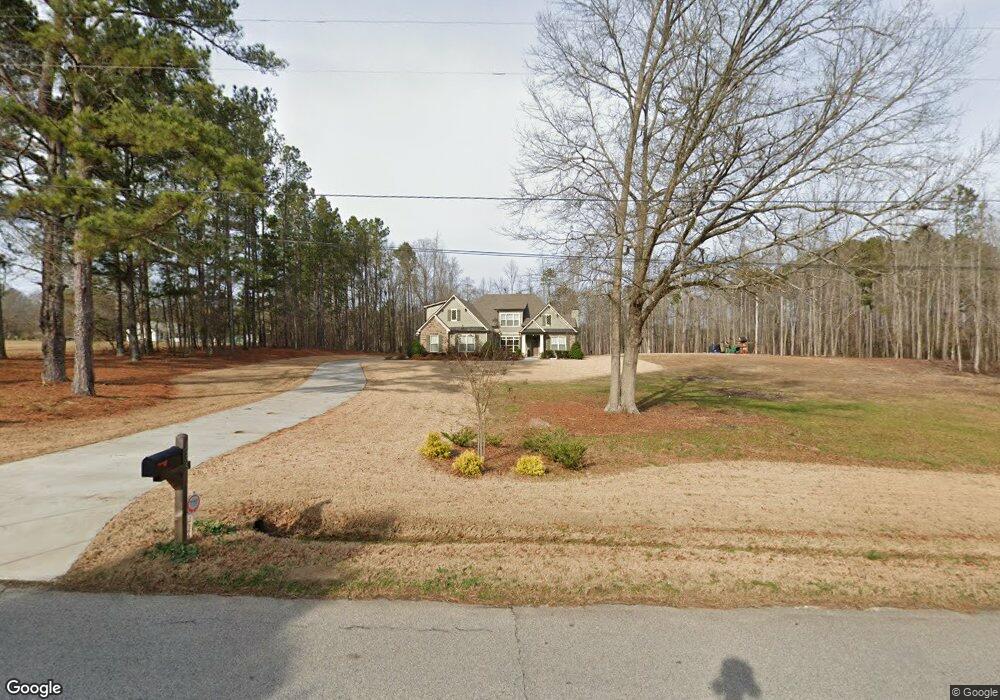
938 Tope Rd Sharpsburg, GA 30277
Estimated Value: $824,868 - $971,000
4
Beds
4
Baths
3,700
Sq Ft
$237/Sq Ft
Est. Value
About This Home
This home is located at 938 Tope Rd, Sharpsburg, GA 30277 and is currently estimated at $875,217, approximately $236 per square foot. 938 Tope Rd is a home located in Coweta County with nearby schools including Poplar Road Elementary School, East Coweta Middle School, and East Coweta High School.
Ownership History
Date
Name
Owned For
Owner Type
Purchase Details
Closed on
Mar 28, 2017
Sold by
Whitton Christopher M
Bought by
Whitton Christopher M and Whitton Leigh Evans
Current Estimated Value
Home Financials for this Owner
Home Financials are based on the most recent Mortgage that was taken out on this home.
Original Mortgage
$424,100
Outstanding Balance
$350,744
Interest Rate
4.16%
Mortgage Type
New Conventional
Estimated Equity
$524,474
Purchase Details
Closed on
Mar 27, 2017
Bought by
Whitton Christopher M
Home Financials for this Owner
Home Financials are based on the most recent Mortgage that was taken out on this home.
Original Mortgage
$424,100
Outstanding Balance
$350,744
Interest Rate
4.16%
Mortgage Type
New Conventional
Estimated Equity
$524,474
Purchase Details
Closed on
Jul 12, 2016
Sold by
Hayes Christie
Bought by
Scott Hayes Construction Inc
Home Financials for this Owner
Home Financials are based on the most recent Mortgage that was taken out on this home.
Original Mortgage
$378,750
Interest Rate
3.54%
Mortgage Type
Commercial
Purchase Details
Closed on
May 13, 2016
Sold by
Hayes Scott
Bought by
Hayes Christie
Home Financials for this Owner
Home Financials are based on the most recent Mortgage that was taken out on this home.
Original Mortgage
$378,750
Interest Rate
3.54%
Mortgage Type
Commercial
Purchase Details
Closed on
May 12, 2016
Sold by
Sims William Donald
Bought by
Hayes Scott
Purchase Details
Closed on
Nov 6, 2001
Sold by
Sims Willie D and Sims Este
Bought by
Sims Estelle M
Purchase Details
Closed on
Jul 31, 1983
Bought by
Sims Willie D and Sims Este
Create a Home Valuation Report for This Property
The Home Valuation Report is an in-depth analysis detailing your home's value as well as a comparison with similar homes in the area
Home Values in the Area
Average Home Value in this Area
Purchase History
| Date | Buyer | Sale Price | Title Company |
|---|---|---|---|
| Whitton Christopher M | -- | -- | |
| Whitton Christopher M | $479,000 | -- | |
| Scott Hayes Construction Inc | $60,000 | -- | |
| Hayes Christie | -- | -- | |
| Hayes Scott | -- | -- | |
| Hayes Scott | -- | -- | |
| Hayes Scott | $40,000 | -- | |
| Sims Estelle M | -- | -- | |
| Sims Willie D | $5,500 | -- |
Source: Public Records
Mortgage History
| Date | Status | Borrower | Loan Amount |
|---|---|---|---|
| Open | Whitton Christopher M | $424,100 | |
| Previous Owner | Scott Hayes Construction Inc | $378,750 |
Source: Public Records
Tax History Compared to Growth
Tax History
| Year | Tax Paid | Tax Assessment Tax Assessment Total Assessment is a certain percentage of the fair market value that is determined by local assessors to be the total taxable value of land and additions on the property. | Land | Improvement |
|---|---|---|---|---|
| 2025 | $7,557 | $341,960 | $61,438 | $280,522 |
| 2024 | $6,616 | $289,611 | $33,914 | $255,697 |
| 2023 | $6,616 | $267,365 | $34,225 | $233,140 |
| 2022 | $5,388 | $223,406 | $31,114 | $192,292 |
| 2021 | $4,830 | $188,160 | $25,770 | $162,390 |
| 2020 | $4,729 | $183,164 | $25,770 | $157,394 |
| 2019 | $3,849 | $136,314 | $24,115 | $112,199 |
| 2018 | $3,857 | $136,314 | $24,115 | $112,199 |
| 2017 | $3,758 | $135,962 | $23,763 | $112,199 |
| 2016 | $688 | $23,763 | $23,763 | $0 |
| 2015 | $677 | $23,763 | $23,763 | $0 |
Source: Public Records
Map
Nearby Homes
- 0 Cannon Rd Unit 7627017
- 0 Cannon Rd Unit 10566028
- 465 Little Rd
- 4083 Highway 54
- 65 Oakhurst Trail
- 69 Oakhurst Trail
- 165 Durham Estates Dr
- 565 Timberbrook Dr
- 2812 Highway 16 E
- 215 Grey Fairs Ave
- 49 Durham Estates Dr
- 46 Lullwater Ct
- 98 Ryeland Dr
- 136 Ryeland Dr
- 143 Ryeland Dr
- 2784 Martin Mill Rd
- 2725 Gordon Rd
- 68 Winchester Dr
- 83 Homesite Slick Ct
- 88 Slick Ct
- 938 Tope Rd Unit 2
- 925 Tope Rd
- 838 Tope Rd
- 984 Tope Rd
- 0 Cannon Rd Unit 8287582
- 0 Cannon Rd Unit 7399323
- 0 Cannon Rd Unit 10313390
- 0 Cannon Rd Unit 20120468
- 0 Cannon Rd Unit 20037229
- 0 Cannon Rd Unit 20012108
- 0 Cannon Rd Unit TR9 7422933
- 0 Cannon Rd Unit 8921563
- 0 Cannon Rd Unit 8753428
- 0 Cannon Rd Unit 8663519
- 0 Cannon Rd Unit 8529361
- 0 Tope Rd Unit B 8076989
- 0 Tope Rd Unit 8282945
- 0 Tope Rd Unit 3272647
- 0 Tope Rd Unit 7536136
- 0 Tope Rd Unit 7543838