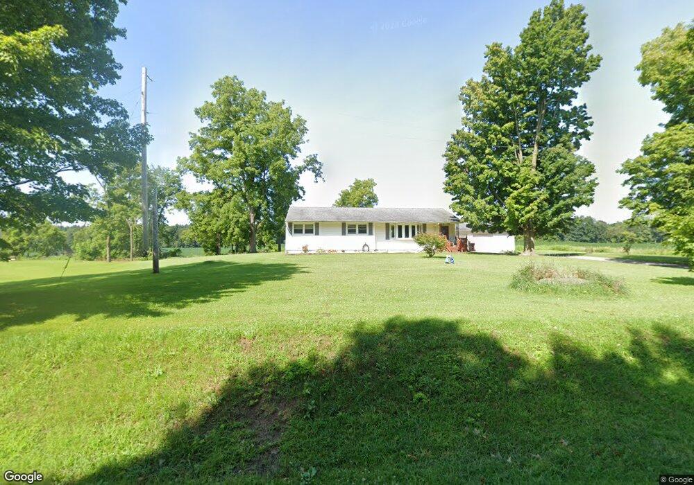
9381 Gibbs Rd Springport, MI 49284
Estimated Value: $190,000 - $210,000
3
Beds
1
Bath
1,412
Sq Ft
$142/Sq Ft
Est. Value
About This Home
This home is located at 9381 Gibbs Rd, Springport, MI 49284 and is currently estimated at $200,109, approximately $141 per square foot. 9381 Gibbs Rd is a home located in Jackson County with nearby schools including Springport Elementary School, Springport Middle School, and Springport High School.
Ownership History
Date
Name
Owned For
Owner Type
Purchase Details
Closed on
Jun 4, 2013
Sold by
Personen Luann M
Bought by
Forner Stephanie D
Current Estimated Value
Purchase Details
Closed on
May 22, 2013
Sold by
Forner Stephanie D and Taber Carol J
Bought by
Taber Christine K and Pesonen Michelle M
Purchase Details
Closed on
Apr 22, 2013
Sold by
Klienschmit Linda L
Bought by
Taber Christine K and Pesonen Michelle M
Purchase Details
Closed on
Apr 19, 2013
Sold by
Roy Brenda S
Bought by
Taber Christine K and Pesonen Michelle M
Purchase Details
Closed on
Feb 22, 2013
Sold by
Forner Stephanie D
Bought by
Forner Stephanie D and Taber Carol J
Purchase Details
Closed on
Dec 29, 2008
Sold by
Taber Maxine M
Bought by
Taber Maxine M and Forner Stephanie D
Create a Home Valuation Report for This Property
The Home Valuation Report is an in-depth analysis detailing your home's value as well as a comparison with similar homes in the area
Home Values in the Area
Average Home Value in this Area
Purchase History
| Date | Buyer | Sale Price | Title Company |
|---|---|---|---|
| Forner Stephanie D | -- | None Available | |
| Taber Christine K | -- | None Available | |
| Taber Christine K | $7,055 | None Available | |
| Taber Christine K | $7,055 | None Available | |
| Forner Stephanie D | -- | None Available | |
| Taber Maxine M | -- | None Available |
Source: Public Records
Tax History Compared to Growth
Tax History
| Year | Tax Paid | Tax Assessment Tax Assessment Total Assessment is a certain percentage of the fair market value that is determined by local assessors to be the total taxable value of land and additions on the property. | Land | Improvement |
|---|---|---|---|---|
| 2025 | $1,556 | $87,300 | $0 | $0 |
| 2024 | $483 | $80,300 | $0 | $0 |
| 2023 | $456 | $74,500 | $0 | $0 |
| 2022 | $973 | $67,500 | $0 | $0 |
| 2021 | $1,386 | $68,400 | $0 | $0 |
| 2020 | $420 | $65,300 | $0 | $0 |
| 2019 | $1,342 | $54,400 | $0 | $0 |
| 2018 | $1,316 | $51,600 | $0 | $0 |
| 2017 | $1,244 | $49,900 | $0 | $0 |
| 2016 | $391 | $49,900 | $49,900 | $0 |
| 2015 | -- | $53,100 | $53,100 | $0 |
| 2014 | -- | $58,300 | $0 | $0 |
| 2013 | -- | $58,300 | $58,300 | $0 |
Source: Public Records
Map
Nearby Homes
- 403 Green St
- 231 Bay Port Cir Unit 68
- 252 Bay Port Cir Unit 19
- 598 E Main St
- 0 Green St
- 261 Mechanic St
- 10870 Eaton Rapids Rd
- 16594 Stark Rd
- 7295 N Gibbs Rd
- 16711 Stark Rd
- 0 R-Drive N
- 29510 S Dr N
- 12441 Town Rd
- 9761 Brown Rd
- 6600 Calhoun Rd
- 6950 Brown Rd
- 6947 Brown Rd
- 19822 27 1 2 Mile Rd
- 9760 Blue Heron
- 9733 Blue Heron
- 0 Gibbs Unit 201700887
- 0 Gibbs Unit VL 201700187
- 0 Gibbs Unit 55021038783
- 0 Gibbs Unit M21038476
- 0 Gibbs Unit 21038783
- 9551 Gibbs Rd
- 9048 Gibbs Rd
- 9450 Ferris Rd
- 300 Bay Port Cir Unit 55
- 407 Green St
- 279 York Harbor Unit 34
- 333 Bay Port Cir Unit 77
- 327 Bay Port Cir Unit 76
- 297 Bay Port Cir Unit 31
- 277 Copper Harbor Unit 40
- 9861 Gibbs Rd
- 301 Bay Port Cir Unit 38
- 399 Green St
- 276 Copper Harbor Unit 47
- 289 Copper Harbor Unit 43