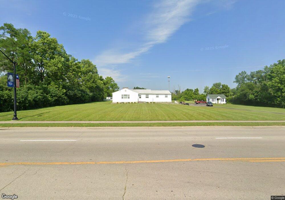
9385 N Dixie Dr Dayton, OH 45414
Estimated Value: $293,659 - $344,000
7
Beds
11
Baths
1,764
Sq Ft
$184/Sq Ft
Est. Value
About This Home
This home is located at 9385 N Dixie Dr, Dayton, OH 45414 and is currently estimated at $324,415, approximately $183 per square foot. 9385 N Dixie Dr is a home located in Montgomery County with nearby schools including Helke Elementary School, Morton Middle School, and Butler High School.
Ownership History
Date
Name
Owned For
Owner Type
Purchase Details
Closed on
Dec 16, 2022
Sold by
Smith Robert W
Bought by
Robert W Smith Revocable Living Trust and Smith
Current Estimated Value
Purchase Details
Closed on
Feb 20, 2018
Sold by
Smith Robert W
Bought by
Smith Robert W
Home Financials for this Owner
Home Financials are based on the most recent Mortgage that was taken out on this home.
Original Mortgage
$148,000
Interest Rate
4.15%
Mortgage Type
New Conventional
Purchase Details
Closed on
Jul 29, 2013
Sold by
Kemper Ronald E
Bought by
Brinnon Keith D and Brinnon Lisa S
Home Financials for this Owner
Home Financials are based on the most recent Mortgage that was taken out on this home.
Original Mortgage
$136,000
Interest Rate
4.49%
Mortgage Type
Future Advance Clause Open End Mortgage
Create a Home Valuation Report for This Property
The Home Valuation Report is an in-depth analysis detailing your home's value as well as a comparison with similar homes in the area
Home Values in the Area
Average Home Value in this Area
Purchase History
| Date | Buyer | Sale Price | Title Company |
|---|---|---|---|
| Robert W Smith Revocable Living Trust | -- | None Listed On Document | |
| Smith Robert W | -- | Fidelity Lawyers Title Agenc | |
| Smith Robert W | $185,000 | Fidelity Lawyers Title Agenc | |
| Brinnon Keith D | $170,000 | Safemark Title Agency Inc |
Source: Public Records
Mortgage History
| Date | Status | Borrower | Loan Amount |
|---|---|---|---|
| Previous Owner | Smith Robert W | $148,000 | |
| Previous Owner | Smith Robert W | $48,000 | |
| Previous Owner | Brinnon Keith D | $136,000 |
Source: Public Records
Tax History
| Year | Tax Paid | Tax Assessment Tax Assessment Total Assessment is a certain percentage of the fair market value that is determined by local assessors to be the total taxable value of land and additions on the property. | Land | Improvement |
|---|---|---|---|---|
| 2025 | $3,661 | $77,160 | $39,030 | $38,130 |
| 2024 | $3,581 | $77,160 | $39,030 | $38,130 |
| 2023 | $3,581 | $77,160 | $39,030 | $38,130 |
| 2022 | $3,152 | $57,120 | $28,880 | $28,240 |
| 2021 | $3,155 | $57,120 | $28,880 | $28,240 |
| 2020 | $3,146 | $57,120 | $28,880 | $28,240 |
| 2019 | $3,118 | $52,660 | $28,880 | $23,780 |
| 2018 | $3,792 | $52,660 | $28,880 | $23,780 |
| 2017 | $3,766 | $52,660 | $28,880 | $23,780 |
| 2016 | $3,653 | $50,170 | $28,880 | $21,290 |
| 2015 | $3,609 | $50,170 | $28,880 | $21,290 |
| 2014 | $3,609 | $50,170 | $28,880 | $21,290 |
| 2012 | -- | $63,310 | $28,880 | $34,430 |
Source: Public Records
Map
Nearby Homes
- 1715 Birnam Wood Ct
- 1727 Ashworth Dr
- 76 Farrell Rd
- 4114 Tangletree Ct
- 7725 Rockwell Dr
- 416 Bent Twig Dr
- 3600 Little York Rd
- 246 Crest Hill Ave
- 7580 Turtle Creek Dr
- 668 Deerhurst Dr
- 664 Deerhurst Dr
- 710 Deerhurst Dr
- 1025 Helke Rd
- 1025 Ronald St
- 7543 Abraham Ct
- 1371 Cornish Dr
- 7531 Turtleback Dr
- 3332 Sea Turtle Dr
- 420 Goldleaf Ave
- 2501 Harrow Ct
- 9375 N Dixie Dr
- 9435 N Dixie Dr
- 9445 N Dixie Dr
- 17 Paddock View Ct
- 19 Paddock View Ct Unit 19
- 19 Paddock View Ct
- 92 Garret St Unit 4
- 9475 N Dixie Dr
- 9201 N Dixie Dr
- 3910 Mulberry Rd
- 3950 Mulberry Rd
- 9475 N Dixie Dr
- 1728 S Dixie Dr
- 1728 Dixie Dr S
- 3940 Mulberry Rd
- 9134 N Dixie Dr
- 1692 S Dixie Dr
- 9130 N Dixie Dr
- 3965 Mulberry Rd
- 4026 Cloverleaf Rd
Your Personal Tour Guide
Ask me questions while you tour the home.