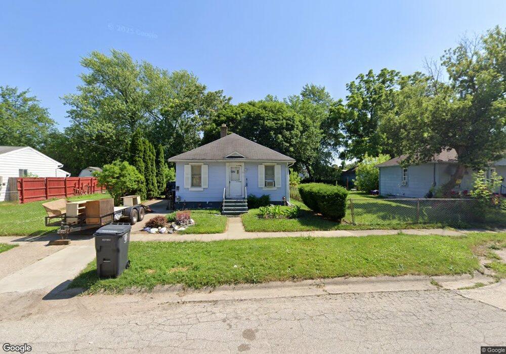
939 Campbell St Flint, MI 48507
South Side NeighborhoodEstimated Value: $42,000 - $65,000
2
Beds
1
Bath
816
Sq Ft
$69/Sq Ft
Est. Value
About This Home
This home is located at 939 Campbell St, Flint, MI 48507 and is currently estimated at $55,995, approximately $68 per square foot. 939 Campbell St is a home located in Genesee County with nearby schools including Neithercut Elementary School, Flint Southwestern Classical Academy, and International Academy of Flint (K-12).
Ownership History
Date
Name
Owned For
Owner Type
Purchase Details
Closed on
Aug 5, 2017
Sold by
Halifax Properties Llc
Bought by
Holmes Elizabeth
Current Estimated Value
Purchase Details
Closed on
Aug 12, 2015
Sold by
Halifax Properties Llc
Bought by
Holmes Elizibeth Ann
Purchase Details
Closed on
Jul 3, 2012
Sold by
Brezezinski Marshall and Brezezinski Ruth
Bought by
Halifax Properties Llc
Purchase Details
Closed on
May 14, 2007
Sold by
Brezezinski Marshall
Bought by
Brezezinski Marshall and Brezezinski Ruth
Purchase Details
Closed on
Aug 25, 1989
Sold by
Dickinson Mary Ann
Bought by
Brezinski Marshall
Create a Home Valuation Report for This Property
The Home Valuation Report is an in-depth analysis detailing your home's value as well as a comparison with similar homes in the area
Home Values in the Area
Average Home Value in this Area
Purchase History
| Date | Buyer | Sale Price | Title Company |
|---|---|---|---|
| Holmes Elizabeth | -- | None Available | |
| Holmes Elizibeth Ann | $5,000 | Attorney | |
| Halifax Properties Llc | $1,000 | Cislo Title Co | |
| Brezezinski Marshall | -- | None Available | |
| Brezinski Marshall | -- | Lawyers Title Insurance Corp |
Source: Public Records
Tax History Compared to Growth
Tax History
| Year | Tax Paid | Tax Assessment Tax Assessment Total Assessment is a certain percentage of the fair market value that is determined by local assessors to be the total taxable value of land and additions on the property. | Land | Improvement |
|---|---|---|---|---|
| 2025 | $1,090 | $16,700 | $0 | $0 |
| 2024 | $1,011 | $17,300 | $0 | $0 |
| 2023 | $989 | $13,800 | $0 | $0 |
| 2022 | $0 | $12,500 | $0 | $0 |
| 2021 | $1,001 | $11,400 | $0 | $0 |
| 2020 | $923 | $11,400 | $0 | $0 |
| 2019 | $903 | $11,700 | $0 | $0 |
| 2018 | $890 | $9,800 | $0 | $0 |
| 2017 | $867 | $0 | $0 | $0 |
| 2016 | $862 | $0 | $0 | $0 |
| 2015 | -- | $0 | $0 | $0 |
| 2014 | -- | $0 | $0 | $0 |
| 2012 | -- | $11,600 | $0 | $0 |
Source: Public Records
Map
Nearby Homes
- 1028 Campbell St
- 822 Campbell St
- 1130 W Atherton Rd
- 936 Lincoln Ave
- 845 Alvord Ave
- 818 Alvord Ave
- 1015 Alvord Ave
- 738 W Atherton Rd
- 1212 Crawford St
- 805 Alvord Ave
- 825 Vermilya Ave
- 1228 Leland St
- 727 Waldman Ave
- 1225 Waldman Ave
- 829 Clinton St
- 1209 Lincoln Ave
- 805 Vermilya Ave
- 4418 Brunswick Ave
- 1225 Vermilya Ave
- 1031 Ingleside Ave
- 927 Campbell St Unit Bldg-Unit
- 927 Campbell St
- 923 Campbell St
- 915 Campbell St
- 932 Leland St
- 936 Leland St Unit Bldg-Unit
- 936 Leland St
- 920 Leland St
- 940 Leland St
- 934 Campbell St
- 924 Campbell St
- 947 Campbell St
- 916 Leland St
- 920 Campbell St
- 940 Campbell St
- 944 Leland St
- 912 Leland St
- 944 Campbell St
- 948 Leland St
- 3902 Brunswick Ave