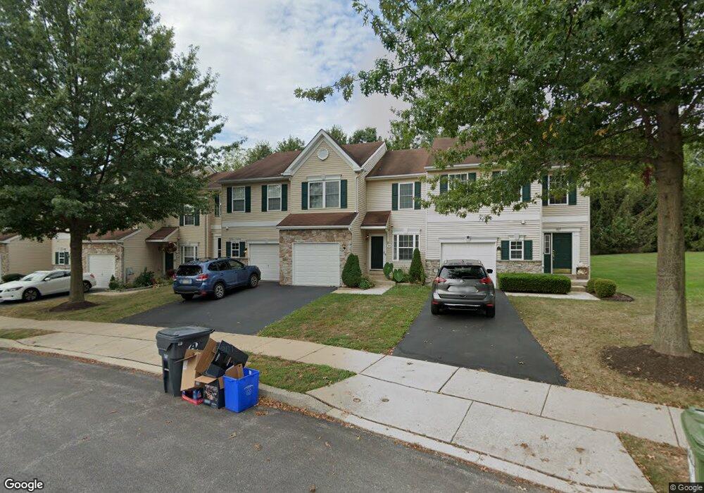
939 Katie Cir Royersford, PA 19468
Estimated Value: $429,000 - $455,000
3
Beds
3
Baths
1,785
Sq Ft
$245/Sq Ft
Est. Value
About This Home
This home is located at 939 Katie Cir, Royersford, PA 19468 and is currently estimated at $438,086, approximately $245 per square foot. 939 Katie Cir is a home located in Montgomery County with nearby schools including Royersford Elementary School, Spring-Ford Middle School 5/6/7 Grade Center, and Spring-Ford Middle School 8th Grade Center.
Ownership History
Date
Name
Owned For
Owner Type
Purchase Details
Closed on
Nov 21, 2018
Sold by
Karambelas Theodore E and Karambelas Iordana M
Bought by
Karambelas Theodore E
Current Estimated Value
Home Financials for this Owner
Home Financials are based on the most recent Mortgage that was taken out on this home.
Original Mortgage
$153,500
Outstanding Balance
$56,763
Interest Rate
4.8%
Mortgage Type
New Conventional
Estimated Equity
$381,323
Purchase Details
Closed on
Apr 28, 2005
Sold by
Century House Lp
Bought by
Karambelas Theodore E and Karambelas Jordana M
Home Financials for this Owner
Home Financials are based on the most recent Mortgage that was taken out on this home.
Original Mortgage
$25,000
Interest Rate
6.05%
Mortgage Type
Stand Alone Second
Create a Home Valuation Report for This Property
The Home Valuation Report is an in-depth analysis detailing your home's value as well as a comparison with similar homes in the area
Home Values in the Area
Average Home Value in this Area
Purchase History
| Date | Buyer | Sale Price | Title Company |
|---|---|---|---|
| Karambelas Theodore E | -- | None Available | |
| Karambelas Theodore E | $225,500 | -- |
Source: Public Records
Mortgage History
| Date | Status | Borrower | Loan Amount |
|---|---|---|---|
| Open | Karambelas Theodore E | $153,500 | |
| Closed | Karambelas Theodore E | $25,000 | |
| Closed | Karambelas Theodore E | $177,900 |
Source: Public Records
Tax History Compared to Growth
Tax History
| Year | Tax Paid | Tax Assessment Tax Assessment Total Assessment is a certain percentage of the fair market value that is determined by local assessors to be the total taxable value of land and additions on the property. | Land | Improvement |
|---|---|---|---|---|
| 2025 | $5,369 | $139,280 | $14,240 | $125,040 |
| 2024 | $5,369 | $139,280 | $14,240 | $125,040 |
| 2023 | $5,125 | $139,280 | $14,240 | $125,040 |
| 2022 | $4,952 | $139,280 | $14,240 | $125,040 |
| 2021 | $4,653 | $139,280 | $14,240 | $125,040 |
| 2020 | $4,530 | $139,280 | $14,240 | $125,040 |
| 2019 | $4,444 | $139,280 | $14,240 | $125,040 |
| 2018 | $3,540 | $139,280 | $14,240 | $125,040 |
| 2017 | $4,359 | $139,280 | $14,240 | $125,040 |
| 2016 | $4,304 | $139,280 | $14,240 | $125,040 |
| 2015 | $4,025 | $139,280 | $14,240 | $125,040 |
| 2014 | $4,025 | $139,280 | $14,240 | $125,040 |
Source: Public Records
Map
Nearby Homes
- 184 Providence Forge Rd
- 96 Providence Forge Rd
- 149 Roboda Blvd
- 36 Roboda Blvd
- 51 Roboda Blvd
- Granton Plan at Lewis Pointe
- 104 Beacon Ct Unit 10403
- 103 Beacon Ct Unit 10102
- 107 Beacon Ct Unit 10104
- 123 Beacon Ct Unit 10205
- 19 Iroquois Dr
- 604 Green St
- 804 Maple Ave
- 335 Arch St
- 484 Fruit Farm Rd
- 518 Walnut St
- 209 Old State Rd
- 0 Main St Unit PAMC2088436
- 414 2nd Ave
- 235 2nd Ave Unit 2
- 941 Katie Cir
- 937 Katie Cir
- 943 Katie Cir
- 945 Katie Cir
- 935 Katie Cir
- 947 Katie Cir
- 933 Katie Cir
- 949 Katie Cir
- 929 Katie Cir
- 188 Providence Forge Rd
- 951 Katie Cir
- 181 Providence Forge Rd
- 192 Providence Forge Rd
- 927 Katie Cir
- 191 Providence Forge Rd
- 953 Katie Cir
- 182 Providence Forge Rd
- 189 Providence Forge Rd
- 190 Providence Forge Rd
- 955 Katie Cir