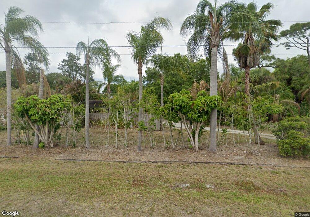
939 Lalonde Rd North Fort Myers, FL 33917
Estimated Value: $197,000 - $310,000
3
Beds
1
Bath
1,547
Sq Ft
$161/Sq Ft
Est. Value
About This Home
This home is located at 939 Lalonde Rd, North Fort Myers, FL 33917 and is currently estimated at $249,146, approximately $161 per square foot. 939 Lalonde Rd is a home located in Lee County with nearby schools including Bayshore Elementary School, Orange River Elementary School, and Tice Elementary School.
Ownership History
Date
Name
Owned For
Owner Type
Purchase Details
Closed on
Nov 16, 2012
Sold by
Fannie Mae
Bought by
Lee Daniel
Current Estimated Value
Purchase Details
Closed on
Apr 19, 2012
Sold by
Safford Stephen T
Bought by
Federal National Mortgage Association
Purchase Details
Closed on
Nov 1, 2004
Sold by
Garringer Shari L
Bought by
Safford Stephen
Purchase Details
Closed on
May 1, 2001
Sold by
Lusby Wade S
Bought by
Safford Stephen T and Stafford Shari L
Home Financials for this Owner
Home Financials are based on the most recent Mortgage that was taken out on this home.
Original Mortgage
$10,000
Interest Rate
6.95%
Purchase Details
Closed on
Dec 8, 1999
Sold by
Lusby Wade S
Bought by
Safford Stephen T and Safford Shari L
Create a Home Valuation Report for This Property
The Home Valuation Report is an in-depth analysis detailing your home's value as well as a comparison with similar homes in the area
Home Values in the Area
Average Home Value in this Area
Purchase History
| Date | Buyer | Sale Price | Title Company |
|---|---|---|---|
| Lee Daniel | $30,100 | Reo Title Co Of Florida Llc | |
| Federal National Mortgage Association | $57,400 | First International Title | |
| Safford Stephen | -- | -- | |
| Safford Stephen T | -- | -- | |
| Safford Stephen T | $35,000 | -- |
Source: Public Records
Mortgage History
| Date | Status | Borrower | Loan Amount |
|---|---|---|---|
| Previous Owner | Safford Stephen T | $10,000 |
Source: Public Records
Tax History Compared to Growth
Tax History
| Year | Tax Paid | Tax Assessment Tax Assessment Total Assessment is a certain percentage of the fair market value that is determined by local assessors to be the total taxable value of land and additions on the property. | Land | Improvement |
|---|---|---|---|---|
| 2025 | $1,980 | $159,161 | -- | -- |
| 2024 | $1,918 | $154,675 | -- | -- |
| 2023 | $1,918 | $150,170 | $19,338 | $122,836 |
| 2022 | $1,949 | $97,243 | $0 | $0 |
| 2021 | $1,665 | $97,949 | $15,544 | $82,405 |
| 2020 | $1,577 | $91,243 | $12,600 | $78,643 |
| 2019 | $1,471 | $85,595 | $9,408 | $76,187 |
| 2018 | $1,390 | $79,130 | $9,408 | $69,722 |
| 2017 | $1,289 | $69,438 | $9,408 | $60,030 |
| 2016 | $1,110 | $57,950 | $11,059 | $46,891 |
| 2015 | $1,023 | $49,901 | $7,804 | $42,097 |
| 2014 | $351 | $62,107 | $8,224 | $53,883 |
| 2013 | -- | $29,648 | $6,531 | $23,117 |
Source: Public Records
Map
Nearby Homes
- 7178 Coon Rd
- 6471 P G A Dr
- 15456 Admiralty Cir Unit 7
- 15456 Admiralty Cir Unit 10
- 15570 Paper Tree Ct
- 15448 Admiralty Cir Unit 10
- 15448 Admiralty Cir Unit 8
- 1922 Flamingo Dr
- 6414 Ben Hogan Cir
- 2271 Flamingo Dr
- 15121 Piping Plover Ct Unit 104
- 15444 Admiralty Cir Unit 4
- 1939 Flamingo Dr
- 15466 Admiralty Cir Unit 4
- 6419 Ben Hogan Cir
- 6390 Brant Bay Blvd Unit 106
- 6360 Brant Bay Blvd Unit 104
- 1081 Butler Rd
- 6371 Brant Bay Blvd Unit 102
- 6361 Brant Bay Blvd Unit 101
- 949 Lalonde Rd
- 929 Lalonde Rd
- 7306/7308 Coon Rd
- 7300 Coon Rd
- 919 Lalonde Rd
- 940 Lalonde Rd
- 6440 Pine View Rd
- 6460 Pine View Rd
- 7288 Coon Rd
- 910 Lalonde Rd
- 7314 Coon Rd
- 6420 Pine View Rd
- 7274 Coon Rd
- 6400 Pine View Rd
- 900 Lalonde Rd
- 7390 Coon Rd
- 7182 Coon Rd
- 7182 & 7178 Coon Rd
- 7329 Coon Rd
- 7335 Coon Rd
