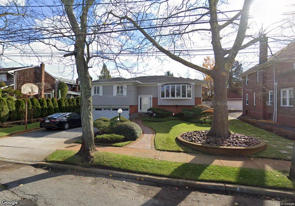
939 Mayfield Rd Woodmere, NY 11598
Estimated Value: $1,054,221 - $1,102,000
--
Bed
3
Baths
1,676
Sq Ft
$643/Sq Ft
Est. Value
About This Home
This home is located at 939 Mayfield Rd, Woodmere, NY 11598 and is currently estimated at $1,078,111, approximately $643 per square foot. 939 Mayfield Rd is a home located in Nassau County with nearby schools including George W Hewlett High School, Lawrence Woodmere Academy, and Shulamith High School for Girls.
Ownership History
Date
Name
Owned For
Owner Type
Purchase Details
Closed on
Jun 9, 2000
Current Estimated Value
Purchase Details
Closed on
Jul 23, 1996
Sold by
Weisman Joel
Bought by
Bernstein Michael and Loran-Bernstein Shelly
Home Financials for this Owner
Home Financials are based on the most recent Mortgage that was taken out on this home.
Original Mortgage
$100,000
Outstanding Balance
$7,230
Interest Rate
8.24%
Estimated Equity
$1,070,881
Create a Home Valuation Report for This Property
The Home Valuation Report is an in-depth analysis detailing your home's value as well as a comparison with similar homes in the area
Home Values in the Area
Average Home Value in this Area
Purchase History
| Date | Buyer | Sale Price | Title Company |
|---|---|---|---|
| -- | -- | -- | |
| Bernstein Michael | $268,000 | -- |
Source: Public Records
Mortgage History
| Date | Status | Borrower | Loan Amount |
|---|---|---|---|
| Open | Bernstein Michael | $100,000 |
Source: Public Records
Tax History Compared to Growth
Tax History
| Year | Tax Paid | Tax Assessment Tax Assessment Total Assessment is a certain percentage of the fair market value that is determined by local assessors to be the total taxable value of land and additions on the property. | Land | Improvement |
|---|---|---|---|---|
| 2025 | $18,791 | $621 | $266 | $355 |
| 2024 | $4,443 | $628 | $269 | $359 |
| 2023 | $14,611 | $627 | $268 | $359 |
| 2022 | $14,611 | $657 | $281 | $376 |
| 2021 | $14,033 | $650 | $264 | $386 |
| 2020 | $5,716 | $672 | $635 | $37 |
| 2019 | $13,275 | $720 | $638 | $82 |
| 2018 | $13,356 | $768 | $0 | $0 |
| 2017 | $10,146 | $816 | $642 | $174 |
| 2016 | $13,826 | $864 | $612 | $252 |
| 2015 | $3,827 | $912 | $646 | $266 |
| 2014 | $3,827 | $912 | $646 | $266 |
| 2013 | $3,776 | $960 | $680 | $280 |
Source: Public Records
Map
Nearby Homes
- 924 Northfield Rd
- 917 Greenfield Rd
- 909 Greenfield Rd
- 905 Greenfield Rd
- 339 Midwood Rd
- 504 Saddle Ridge Rd
- 988 Westwood Rd
- 526 Hazel Dr
- 1016 Westwood Rd
- 369 Longacre Ave
- 553 Amherst Dr
- 508 Longacre Ave
- 972 S End
- 1053 Quentin Place
- 874 W Broadway Unit 3C
- 862 Peninsula Blvd
- 1064 Mora Place
- 850 Ibsen St
- 559 Linda Ln
- 528 Longacre Ave
- 933 Mayfield Rd
- 381 Westwood Rd
- 945 Mayfield Rd
- 936 Greenfield Rd
- 942 Greenfield Rd
- 929 Mayfield Rd
- 932 Greenfield Rd
- 375 Westwood Rd
- 940 Mayfield Rd
- 928 Greenfield Rd
- 934 Mayfield Rd
- 925 Mayfield Rd
- 937 Greenfield Rd
- 391 Westwood Rd
- 391 Westwood Rd
- 930 Mayfield Rd
- 920 Greenfield Rd
- 926 Mayfield Rd
- 921 Mayfield Rd
- 927 Greenfield Rd