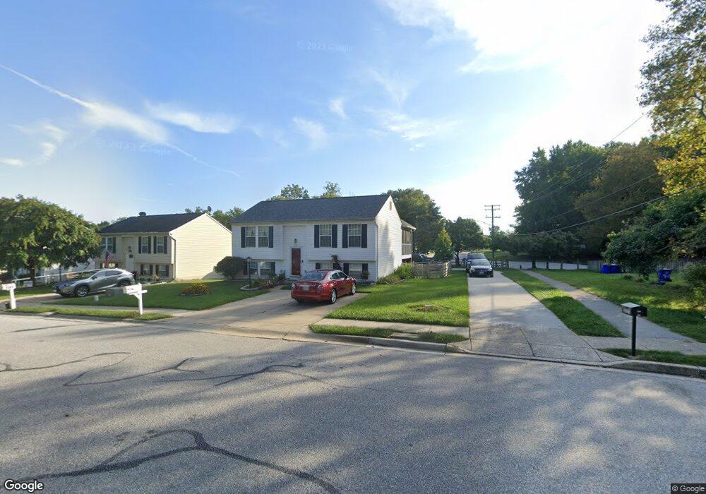
9391 Kings Grant Rd Laurel, MD 20723
North Laurel NeighborhoodEstimated Value: $509,877 - $614,000
--
Bed
3
Baths
1,568
Sq Ft
$363/Sq Ft
Est. Value
About This Home
This home is located at 9391 Kings Grant Rd, Laurel, MD 20723 and is currently estimated at $569,219, approximately $363 per square foot. 9391 Kings Grant Rd is a home located in Howard County with nearby schools including Forest Ridge Elementary School, Patuxent Valley Middle School, and Hammond High School.
Ownership History
Date
Name
Owned For
Owner Type
Purchase Details
Closed on
Oct 1, 1993
Sold by
Ryland Grp
Bought by
Gates David M
Current Estimated Value
Home Financials for this Owner
Home Financials are based on the most recent Mortgage that was taken out on this home.
Original Mortgage
$72,000
Interest Rate
7%
Purchase Details
Closed on
Sep 4, 1990
Sold by
Security Development Corporation
Bought by
Ryland Group Inc The
Create a Home Valuation Report for This Property
The Home Valuation Report is an in-depth analysis detailing your home's value as well as a comparison with similar homes in the area
Home Values in the Area
Average Home Value in this Area
Purchase History
| Date | Buyer | Sale Price | Title Company |
|---|---|---|---|
| Gates David M | $167,000 | -- | |
| Ryland Group Inc The | $231,000 | -- |
Source: Public Records
Mortgage History
| Date | Status | Borrower | Loan Amount |
|---|---|---|---|
| Closed | Gates David M | $72,000 |
Source: Public Records
Tax History Compared to Growth
Tax History
| Year | Tax Paid | Tax Assessment Tax Assessment Total Assessment is a certain percentage of the fair market value that is determined by local assessors to be the total taxable value of land and additions on the property. | Land | Improvement |
|---|---|---|---|---|
| 2025 | $6,902 | $462,700 | $239,400 | $223,300 |
| 2024 | $6,902 | $440,600 | $0 | $0 |
| 2023 | $6,440 | $418,500 | $0 | $0 |
| 2022 | $6,111 | $396,400 | $229,400 | $167,000 |
| 2021 | $5,648 | $380,300 | $0 | $0 |
| 2020 | $5,648 | $364,200 | $0 | $0 |
| 2019 | $5,417 | $348,100 | $127,400 | $220,700 |
| 2018 | $4,937 | $334,467 | $0 | $0 |
| 2017 | $4,733 | $348,100 | $0 | $0 |
| 2016 | -- | $307,200 | $0 | $0 |
| 2015 | -- | $304,700 | $0 | $0 |
| 2014 | -- | $302,200 | $0 | $0 |
Source: Public Records
Map
Nearby Homes
- 9079 Manorwood Rd
- 9087 Manorwood Rd
- 9300 Ridings Way
- 9508 Mellow Ct
- 9321 Kenbrooke Ct
- 9279 Brewington Ln
- 9110 Canterbury Riding
- 9200 Brewington Ln
- 9409 Chippenham Dr
- 9304 Canterbury Riding
- 9284 Canterbury Riding
- 9303 Kendal Cir
- 9743 Whiskey Run
- 9384 Rock Ripple Ln
- 9380 Rock Ripple Ln
- 9339 Kendal Cir
- 9220 Bridle Path Ln Unit E
- 9225 Bridle Path Ln Unit K
- 9786 Whiskey Run
- 8605 Jennifer Ct
- 9383 Kings Grant Rd
- 9387 Kings Grant Rd
- 9375 Kings Grant Rd
- 9379 Kings Grant Rd
- 9881 Harmony Ln
- 9409 Kings Grant Rd
- 9407 Kings Grant Rd
- 9405 Kings Grant Rd
- 9403 Kings Grant Rd
- 9371 Kings Grant Rd
- 9873 Harmony Ln
- 9401 Kings Grant Rd
- 9319 Morgans Landing
- 9315 Morgans Landing
- 9315 Morgans Landing Way
- 9875 Harmony Ln
- 9367 Kings Grant Rd
- 9317 Morgans Landing Way
- 9877 Harmony Ln
- 9317 Morgans Landing