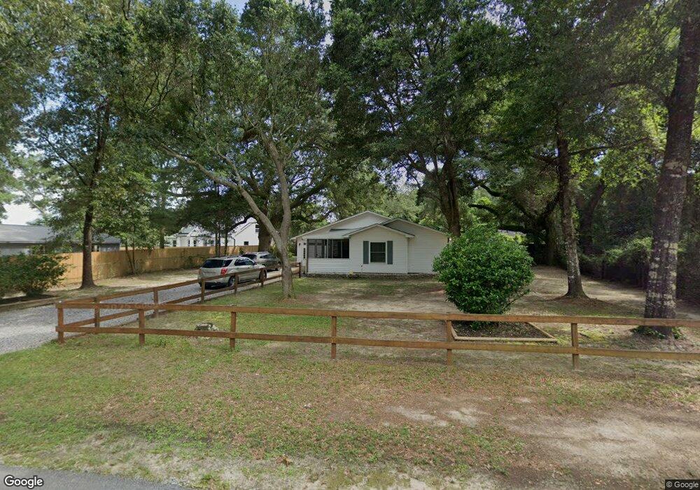
9392 Link Cir Pensacola, FL 32514
Estimated Value: $224,000 - $240,000
--
Bed
2
Baths
1,391
Sq Ft
$169/Sq Ft
Est. Value
About This Home
This home is located at 9392 Link Cir, Pensacola, FL 32514 and is currently estimated at $235,033, approximately $168 per square foot. 9392 Link Cir is a home located in Escambia County with nearby schools including Ferry Pass Elementary School, Ferry Pass Middle School, and Booker T. Washington High School.
Ownership History
Date
Name
Owned For
Owner Type
Purchase Details
Closed on
Nov 28, 2006
Sold by
Luckie Harry Donald and Luckie Sarah
Bought by
Gilleran William R and Blanton Charles D
Current Estimated Value
Home Financials for this Owner
Home Financials are based on the most recent Mortgage that was taken out on this home.
Original Mortgage
$107,200
Outstanding Balance
$64,164
Interest Rate
6.33%
Mortgage Type
New Conventional
Estimated Equity
$170,869
Purchase Details
Closed on
Apr 30, 2004
Sold by
King James L and King Loriann L
Bought by
Luckie Harry Donald and Luckie Harry
Home Financials for this Owner
Home Financials are based on the most recent Mortgage that was taken out on this home.
Original Mortgage
$63,000
Interest Rate
5.49%
Mortgage Type
Purchase Money Mortgage
Create a Home Valuation Report for This Property
The Home Valuation Report is an in-depth analysis detailing your home's value as well as a comparison with similar homes in the area
Home Values in the Area
Average Home Value in this Area
Purchase History
| Date | Buyer | Sale Price | Title Company |
|---|---|---|---|
| Gilleran William R | $134,000 | Security First Title Partner | |
| Luckie Harry Donald | $90,000 | Gulf Coast Title Partners Ll |
Source: Public Records
Mortgage History
| Date | Status | Borrower | Loan Amount |
|---|---|---|---|
| Open | Gilleran William R | $107,200 | |
| Previous Owner | Luckie Harry Donald | $63,000 |
Source: Public Records
Tax History Compared to Growth
Tax History
| Year | Tax Paid | Tax Assessment Tax Assessment Total Assessment is a certain percentage of the fair market value that is determined by local assessors to be the total taxable value of land and additions on the property. | Land | Improvement |
|---|---|---|---|---|
| 2024 | $1,085 | $116,013 | -- | -- |
| 2023 | $1,085 | $112,634 | $0 | $0 |
| 2022 | $1,052 | $109,354 | $0 | $0 |
| 2021 | $1,045 | $106,169 | $0 | $0 |
| 2020 | $1,019 | $104,704 | $0 | $0 |
| 2019 | $995 | $102,350 | $0 | $0 |
| 2018 | $991 | $100,442 | $0 | $0 |
| 2017 | $984 | $98,377 | $0 | $0 |
| 2016 | $973 | $96,354 | $0 | $0 |
| 2015 | $954 | $95,685 | $0 | $0 |
| 2014 | $943 | $94,926 | $0 | $0 |
Source: Public Records
Map
Nearby Homes
- 2719 Copter Rd
- 345 Mirabelle Dr
- 139 Mirabelle Cir
- 364 Mirabelle Dr
- 49 Crabapple Ln
- 2371 Le Ruth Dr
- 9400 Mabel St
- 3465 River Gardens Cir
- 2300 BLK Gloria Cir
- 2393 Shoal Creek Dr
- 2360 Shoal Creek Dr
- 2354 Shoal Creek Dr
- 8573 Westview Ln
- 9965 Scenic Hwy
- 8560 Westview Ln
- 10091 Hillview Dr
- 2308 Shoal Creek Dr
- 2150 Academy Dr
- 3411 Edinborough Ct
- 8511 Sawmill Run
- 9326 Loomis St
- 9324 Loomis St
- 9405 Link Cir
- 808 Wickwood Place
- 9418 Link Cir
- 808 Wickwood Cir
- 809 Wickwood Place
- 804 Wickwood Place
- 2734 Kelso Rd Unit A
- 807 Wickwood Place
- 2763 Monroe St
- 9320 Loomis St
- 9415 Link Cir
- 2730 Kelso Rd
- 9314 Loomis St
- 805 Wickwood Place
- 800 Wickwood Place
- 2757 Monroe St
- 9316 Loomis St
- 712 Thornwood Place