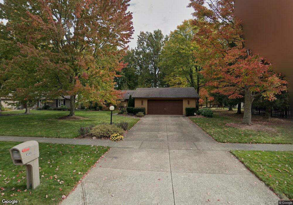
9393 Barton Dr Strongsville, OH 44149
Estimated Value: $329,547 - $361,000
3
Beds
2
Baths
2,224
Sq Ft
$158/Sq Ft
Est. Value
About This Home
This home is located at 9393 Barton Dr, Strongsville, OH 44149 and is currently estimated at $350,887, approximately $157 per square foot. 9393 Barton Dr is a home located in Cuyahoga County with nearby schools including Strongsville High School, St Mary School, and Sts Joseph & John Interparochial School.
Ownership History
Date
Name
Owned For
Owner Type
Purchase Details
Closed on
Oct 27, 1995
Sold by
Zavesky James R
Bought by
Morgan Thomas W and Morgan Sharon L
Current Estimated Value
Home Financials for this Owner
Home Financials are based on the most recent Mortgage that was taken out on this home.
Original Mortgage
$146,750
Interest Rate
7.65%
Mortgage Type
New Conventional
Purchase Details
Closed on
Jul 27, 1990
Sold by
Crissinger Debra L
Bought by
Zavesky James R
Purchase Details
Closed on
Jun 5, 1989
Sold by
Crissinger Robert A
Bought by
Crissinger Debra L
Purchase Details
Closed on
Nov 15, 1985
Sold by
Harper Ronald R
Bought by
Crissinger Robert A
Purchase Details
Closed on
Apr 18, 1985
Bought by
Harper Ronald R
Purchase Details
Closed on
Jul 31, 1980
Bought by
The Title Guarantee And
Purchase Details
Closed on
Jan 1, 1978
Bought by
Bob Schmitt Homes Inc
Create a Home Valuation Report for This Property
The Home Valuation Report is an in-depth analysis detailing your home's value as well as a comparison with similar homes in the area
Home Values in the Area
Average Home Value in this Area
Purchase History
| Date | Buyer | Sale Price | Title Company |
|---|---|---|---|
| Morgan Thomas W | $154,500 | -- | |
| Zavesky James R | $135,000 | -- | |
| Crissinger Debra L | -- | -- | |
| Crissinger Robert A | $109,000 | -- | |
| Harper Ronald R | $98,100 | -- | |
| The Title Guarantee And | -- | -- | |
| Bob Schmitt Homes Inc | -- | -- |
Source: Public Records
Mortgage History
| Date | Status | Borrower | Loan Amount |
|---|---|---|---|
| Previous Owner | Morgan Thomas W | $146,750 |
Source: Public Records
Tax History Compared to Growth
Tax History
| Year | Tax Paid | Tax Assessment Tax Assessment Total Assessment is a certain percentage of the fair market value that is determined by local assessors to be the total taxable value of land and additions on the property. | Land | Improvement |
|---|---|---|---|---|
| 2024 | $4,364 | $92,960 | $19,040 | $73,920 |
| 2023 | $4,727 | $75,500 | $16,630 | $58,870 |
| 2022 | $4,693 | $75,500 | $16,630 | $58,870 |
| 2021 | $4,656 | $75,500 | $16,630 | $58,870 |
| 2020 | $4,617 | $66,220 | $14,600 | $51,630 |
| 2019 | $4,481 | $189,200 | $41,700 | $147,500 |
| 2018 | $3,995 | $66,220 | $14,600 | $51,630 |
| 2017 | $3,996 | $60,240 | $13,020 | $47,220 |
| 2016 | $3,964 | $60,240 | $13,020 | $47,220 |
| 2015 | $3,903 | $60,240 | $13,020 | $47,220 |
| 2014 | $3,903 | $58,490 | $12,640 | $45,850 |
Source: Public Records
Map
Nearby Homes
- 9598 Pebble Brook Ln
- 8746 Barton Dr
- 9829 Plum Brook Ln
- 10001 N Marks Rd
- 22300 Rock Creek Cir
- 9384 N Marks Rd
- 8902 Lincolnshire Blvd
- 0 Priem Rd
- 10800 Meadow Trail
- 10824 Watercress Rd
- 10842 Fence Row Dr
- 10353 Oak Branch Trail
- 11030 Southwind Ct
- 8896 Firethorne Dr
- 8627 Courtland Dr
- 8981 Leatherleaf Dr
- 21292 Creekside Dr
- 8960 Leatherleaf Dr
- 8809 Leatherleaf Dr
- 8839 Leatherleaf Dr
- 9321 Barton Dr
- 22568 Creek Bend Ct
- 22536 Creek Bend Ct
- 9249 Barton Dr
- 9630 Pebble Brook Ln
- 9662 Pebble Brook Ln
- 22305 Needlewood Cir
- 9177 Barton Dr
- 22630 Creek Bend Ct
- 9566 Pebble Brook Ln
- 22494 Creek Bend Ct
- 9534 Pebble Brook Ln
- 22662 Creek Bend Ct
- 9105 Barton Dr
- 22309 Needlewood Cir
- 22304 Needlewood Cir
- 22521 Creek Bend Ct
- 22585 Creek Bend Ct
- 9502 Pebble Brook Ln
- 9758 Pebble Brook Ln