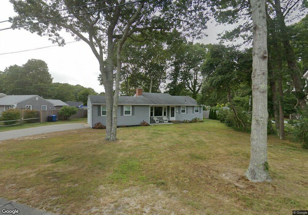
94 Alcott Rd East Falmouth, MA 02536
Estimated Value: $615,000 - $724,000
3
Beds
1
Bath
800
Sq Ft
$845/Sq Ft
Est. Value
About This Home
This home is located at 94 Alcott Rd, East Falmouth, MA 02536 and is currently estimated at $675,655, approximately $844 per square foot. 94 Alcott Rd is a home located in Barnstable County with nearby schools including Teaticket Elementary School, Morse Pond School, and Lawrence School.
Ownership History
Date
Name
Owned For
Owner Type
Purchase Details
Closed on
Mar 17, 2010
Sold by
Howe Laura B and Cardoza Wilson E
Bought by
Alpert Howard K and Alpert Lisa A
Current Estimated Value
Home Financials for this Owner
Home Financials are based on the most recent Mortgage that was taken out on this home.
Original Mortgage
$141,600
Outstanding Balance
$94,177
Interest Rate
5.05%
Mortgage Type
Purchase Money Mortgage
Estimated Equity
$581,478
Purchase Details
Closed on
Oct 30, 1998
Sold by
Brennan Cliff J and Brennan Cheryl A
Bought by
Cardoza Wilson E and Howe Laura B
Home Financials for this Owner
Home Financials are based on the most recent Mortgage that was taken out on this home.
Original Mortgage
$88,420
Interest Rate
6.68%
Mortgage Type
Purchase Money Mortgage
Create a Home Valuation Report for This Property
The Home Valuation Report is an in-depth analysis detailing your home's value as well as a comparison with similar homes in the area
Home Values in the Area
Average Home Value in this Area
Purchase History
| Date | Buyer | Sale Price | Title Company |
|---|---|---|---|
| Alpert Howard K | $177,000 | -- | |
| Alpert Howard K | $177,000 | -- | |
| Cardoza Wilson E | $117,900 | -- | |
| Cardoza Wilson E | $117,900 | -- |
Source: Public Records
Mortgage History
| Date | Status | Borrower | Loan Amount |
|---|---|---|---|
| Open | Alpert Howard K | $141,600 | |
| Closed | Cardoza Wilson E | $141,600 | |
| Previous Owner | Cardoza Wilson E | $88,420 |
Source: Public Records
Tax History Compared to Growth
Tax History
| Year | Tax Paid | Tax Assessment Tax Assessment Total Assessment is a certain percentage of the fair market value that is determined by local assessors to be the total taxable value of land and additions on the property. | Land | Improvement |
|---|---|---|---|---|
| 2025 | $3,154 | $537,300 | $296,700 | $240,600 |
| 2024 | $3,002 | $478,000 | $258,300 | $219,700 |
| 2023 | $2,740 | $396,000 | $206,600 | $189,400 |
| 2022 | $2,875 | $357,100 | $193,200 | $163,900 |
| 2021 | $2,766 | $325,400 | $193,200 | $132,200 |
| 2020 | $2,644 | $307,800 | $175,600 | $132,200 |
| 2019 | $2,579 | $301,300 | $175,600 | $125,700 |
| 2018 | $2,539 | $295,200 | $175,600 | $119,600 |
| 2017 | $2,480 | $290,700 | $175,600 | $115,100 |
| 2016 | $2,430 | $290,300 | $175,600 | $114,700 |
| 2015 | $2,378 | $290,300 | $175,600 | $114,700 |
| 2014 | $2,378 | $291,800 | $175,700 | $116,100 |
Source: Public Records
Map
Nearby Homes
- 21 Kilmer Rd
- 58 Striper Ln
- 37 Seashell Ln
- LOTA Commodore Ln
- 16 Edgewood Dr
- Lot 2 Pine Grove Ave
- 473 Davisville Rd
- 472 & 474 Davisville Rd
- 69 Reynolds St
- 50 Palm St
- 52 Bacon Farm Rd
- 224 Menauhant Rd
- 231 Great Bay St
- 214 Menauhant Rd
- 49 Rivers End Rd
- 19 Moniz Way
- 5 Massasoit St
- 13 Suncrest Dr
- 7 Montauk St
- 7 Dexter Mill Dr