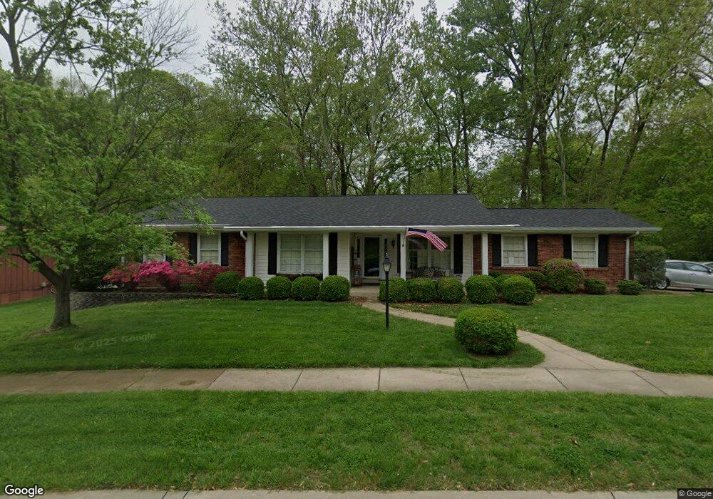
94 Burning Tree Dr Chesterfield, MO 63017
Estimated Value: $443,000 - $483,000
3
Beds
2
Baths
1,868
Sq Ft
$245/Sq Ft
Est. Value
About This Home
This home is located at 94 Burning Tree Dr, Chesterfield, MO 63017 and is currently estimated at $457,177, approximately $244 per square foot. 94 Burning Tree Dr is a home located in St. Louis County with nearby schools including River Bend Elementary School, Parkway Central Middle School, and Parkway Central High School.
Ownership History
Date
Name
Owned For
Owner Type
Purchase Details
Closed on
Oct 23, 2019
Sold by
Frazier Georgene
Bought by
Sala Juan and Sala Maria
Current Estimated Value
Home Financials for this Owner
Home Financials are based on the most recent Mortgage that was taken out on this home.
Original Mortgage
$294,500
Outstanding Balance
$257,997
Interest Rate
3.5%
Mortgage Type
New Conventional
Estimated Equity
$199,180
Purchase Details
Closed on
Jul 6, 2007
Sold by
Gibson David
Bought by
Frazier Carey and Frazier Georgene
Home Financials for this Owner
Home Financials are based on the most recent Mortgage that was taken out on this home.
Original Mortgage
$175,000
Interest Rate
6.41%
Mortgage Type
Purchase Money Mortgage
Create a Home Valuation Report for This Property
The Home Valuation Report is an in-depth analysis detailing your home's value as well as a comparison with similar homes in the area
Home Values in the Area
Average Home Value in this Area
Purchase History
| Date | Buyer | Sale Price | Title Company |
|---|---|---|---|
| Sala Juan | $310,000 | Freedom Title Llc St Louis | |
| Frazier Carey | $275,000 | Fa |
Source: Public Records
Mortgage History
| Date | Status | Borrower | Loan Amount |
|---|---|---|---|
| Open | Sala Juan | $294,500 | |
| Previous Owner | Frazier Carey | $175,000 |
Source: Public Records
Tax History
| Year | Tax Paid | Tax Assessment Tax Assessment Total Assessment is a certain percentage of the fair market value that is determined by local assessors to be the total taxable value of land and additions on the property. | Land | Improvement |
|---|---|---|---|---|
| 2025 | $4,755 | $82,930 | $39,480 | $43,450 |
| 2024 | $4,755 | $71,840 | $29,050 | $42,790 |
| 2023 | $4,561 | $71,840 | $29,050 | $42,790 |
| 2022 | $4,161 | $59,620 | $29,050 | $30,570 |
| 2021 | $4,144 | $59,620 | $29,050 | $30,570 |
| 2020 | $4,025 | $55,610 | $24,890 | $30,720 |
| 2019 | $3,938 | $55,610 | $24,890 | $30,720 |
| 2018 | $4,067 | $53,280 | $22,820 | $30,460 |
| 2016 | $3,888 | $49,750 | $18,680 | $31,070 |
Source: Public Records
Map
Nearby Homes
- 357 N Woods Mill Rd
- 170 Saddleford Dr
- 13579 Coliseum Dr Unit G
- 13515 Coliseum Dr Unit A
- 13337 Bragstadt Dr
- 13503 Coliseum Dr
- 295 Ridge Trail Dr
- 13304 Wood Chapel Dr Unit 35
- 14327 Bramblewood Ct
- 13305 Woodlake Village Ct E
- 14065 Boxford Ct
- 1121 Matador Dr Unit 1
- 13232 Dartagnan Ct
- 135 Greentrails Dr S
- 114 Trailswest Dr
- 765 Turrentine Trail
- 13222 Cantina Dr Unit 2
- 1239 Creve Coeur Crossing Ln Unit D
- 1231 Creve Coeur Crossing Ln Unit J
- 1104 Cantina Dr
- 431 Madewood Ln
- 435 Madewood Ln
- 427 Madewood Ln
- 219 Glen Cove Dr
- 93 Burning Tree Dr
- 96 La Gorce Dr
- 439 Madewood Ln
- 184 Glen Cove Dr
- 423 Madewood Ln
- 112 La Gorce Dr
- 418 Madewood Ln
- 113 Del Monte Ct
- 95 La Gorce Dr
- 97 La Gorce Dr
- 432 Madewood Ln
- 419 Madewood Ln
- 443 Madewood Ln
- 185 Glen Cove Dr
- 92 Burning Tree Dr
- 406 Madewood Ln
Your Personal Tour Guide
Ask me questions while you tour the home.