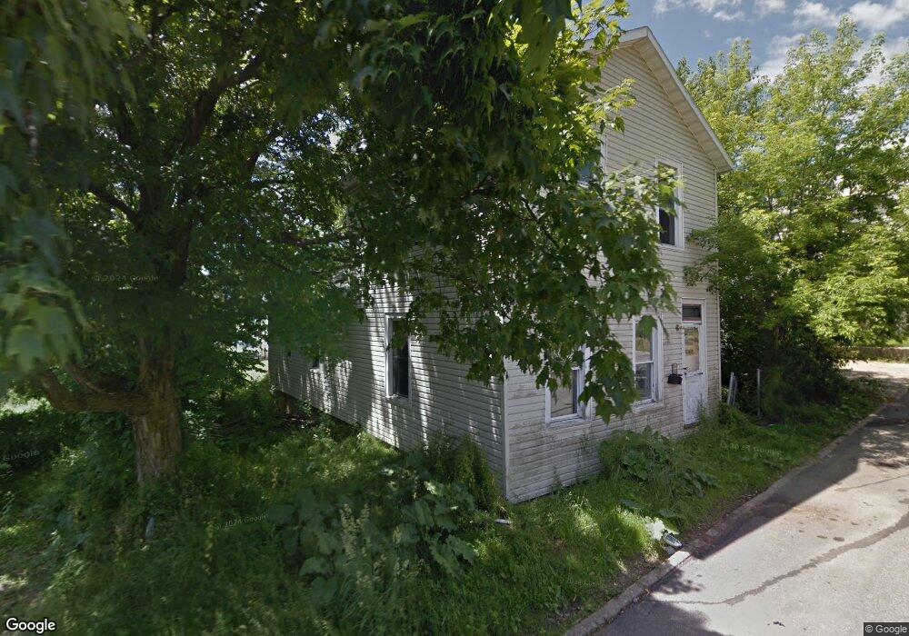
94 Dale Ave Mansfield, OH 44902
Estimated Value: $55,000 - $73,000
2
Beds
1
Bath
1,206
Sq Ft
$53/Sq Ft
Est. Value
About This Home
This home is located at 94 Dale Ave, Mansfield, OH 44902 and is currently estimated at $63,327, approximately $52 per square foot. 94 Dale Ave is a home located in Richland County with nearby schools including St. Peter's Elementary/Montessori School, St. Peter's High School/Junior High, and Discovery School.
Ownership History
Date
Name
Owned For
Owner Type
Purchase Details
Closed on
Oct 20, 2014
Sold by
Grose Ali B
Bought by
Catchings Tony and Catchings Annine
Current Estimated Value
Purchase Details
Closed on
Dec 29, 2005
Sold by
Malone Sophia and Rebel Anna
Bought by
Grose Alix S
Home Financials for this Owner
Home Financials are based on the most recent Mortgage that was taken out on this home.
Original Mortgage
$5,490
Interest Rate
6.4%
Mortgage Type
Fannie Mae Freddie Mac
Purchase Details
Closed on
Jul 14, 1999
Sold by
Rebel Anna M
Bought by
Malone Sophie A
Purchase Details
Closed on
Jul 1, 1986
Create a Home Valuation Report for This Property
The Home Valuation Report is an in-depth analysis detailing your home's value as well as a comparison with similar homes in the area
Home Values in the Area
Average Home Value in this Area
Purchase History
| Date | Buyer | Sale Price | Title Company |
|---|---|---|---|
| Catchings Tony | $5,583 | Chicago Title Agency Of Nort | |
| Grose Alix S | $6,000 | None Available | |
| Malone Sophie A | $25,000 | -- | |
| -- | $2,500 | -- |
Source: Public Records
Mortgage History
| Date | Status | Borrower | Loan Amount |
|---|---|---|---|
| Previous Owner | Grose Alix S | $5,490 |
Source: Public Records
Tax History Compared to Growth
Tax History
| Year | Tax Paid | Tax Assessment Tax Assessment Total Assessment is a certain percentage of the fair market value that is determined by local assessors to be the total taxable value of land and additions on the property. | Land | Improvement |
|---|---|---|---|---|
| 2024 | $169 | $3,530 | $1,800 | $1,730 |
| 2023 | $169 | $3,530 | $1,800 | $1,730 |
| 2022 | $178 | $3,110 | $1,740 | $1,370 |
| 2021 | $179 | $3,110 | $1,740 | $1,370 |
| 2020 | $183 | $3,110 | $1,740 | $1,370 |
| 2019 | $172 | $2,630 | $1,470 | $1,160 |
| 2018 | $169 | $2,630 | $1,470 | $1,160 |
| 2017 | $726 | $11,590 | $1,470 | $10,120 |
| 2016 | $608 | $9,420 | $1,570 | $7,850 |
| 2015 | $581 | $9,420 | $1,570 | $7,850 |
| 2014 | $573 | $9,420 | $1,570 | $7,850 |
| 2012 | $440 | $9,430 | $1,660 | $7,770 |
Source: Public Records
Map
Nearby Homes
- 319 Altamont Ave
- 327 Hammond Ave
- 259 S Main St
- 286 S Main St
- 212 S Main St
- 394 S Main St
- 0 N Adams St
- 137 Lexington Ave
- 175 S Mulberry St
- 186 S Mulberry St
- 96 Glenwood Heights
- 305 Home Ave
- 172 -172 1 2 Lexington Ave
- 519 S Diamond St
- 120 Grover St
- 261 Superior St
- 430 Beethoven St
- 353 Sturges Ave
- 69 Reba Ave
- 209 Second
- 100 Dale Ave
- 97 Dale Ave
- 93 Dale Ave
- 276 S Adams St
- 268 S Adams St
- 260 S Adams St
- 274 S Adams St
- 269 S Diamond St
- 256 S Adams St
- 291 S Diamond St Unit 293
- 265 S Diamond St
- 280 S Adams St
- 254 S Adams St
- 259 S Diamond St
- 305 S Diamond St Unit 307
- 247 Wempless Ave
- 278 S Diamond St
- 269 S Adams St
- 244 S Adams St
- 253 S Diamond St