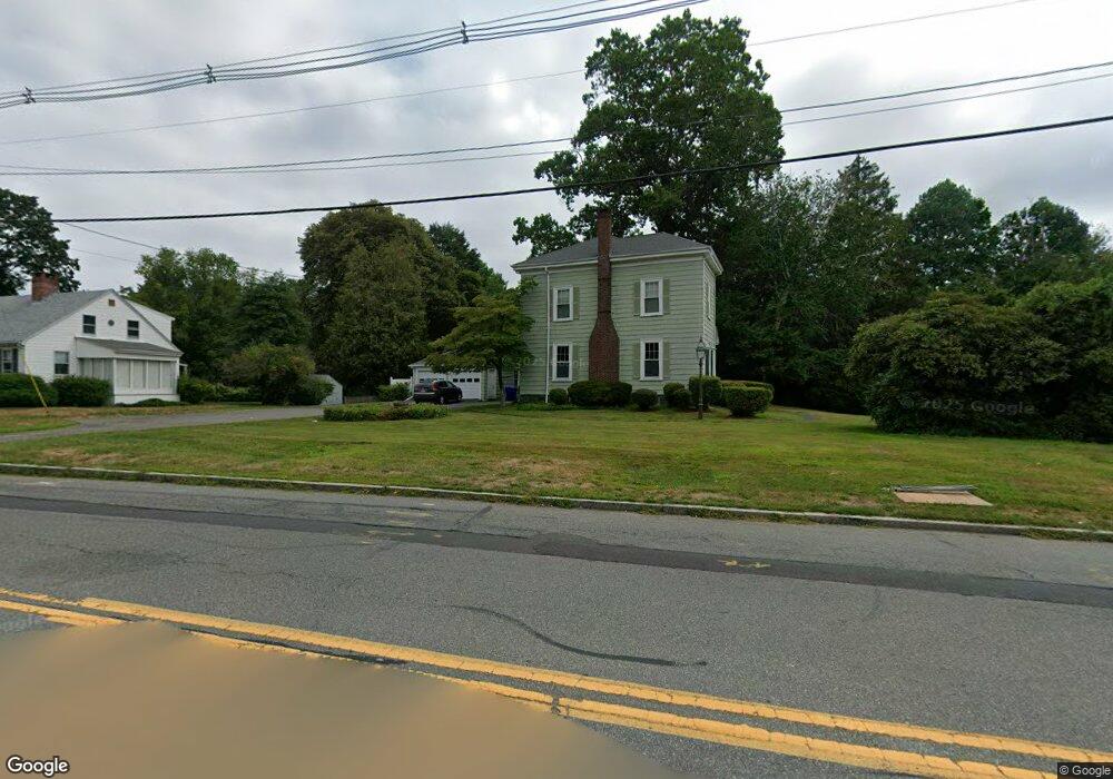
94 Dean St Taunton, MA 02780
City Center NeighborhoodEstimated Value: $519,000 - $611,029
4
Beds
3
Baths
2,535
Sq Ft
$220/Sq Ft
Est. Value
About This Home
This home is located at 94 Dean St, Taunton, MA 02780 and is currently estimated at $556,757, approximately $219 per square foot. 94 Dean St is a home located in Bristol County with nearby schools including Elizabeth Pole School, Taunton High School, and John F. Parker Middle School.
Ownership History
Date
Name
Owned For
Owner Type
Purchase Details
Closed on
May 1, 2017
Sold by
Amaral Barry J
Bought by
Amaral Barry J and Amaral Toni M
Current Estimated Value
Purchase Details
Closed on
Jul 26, 2001
Sold by
Amaral Virginia
Bought by
Amaral Barry
Home Financials for this Owner
Home Financials are based on the most recent Mortgage that was taken out on this home.
Original Mortgage
$50,000
Interest Rate
7.18%
Mortgage Type
Purchase Money Mortgage
Purchase Details
Closed on
Dec 1, 1988
Sold by
Costa Alfred
Bought by
Longmeadow Dean Rt
Purchase Details
Closed on
Jan 6, 1987
Sold by
Fairbanks Paul J
Bought by
Costa Alfred
Create a Home Valuation Report for This Property
The Home Valuation Report is an in-depth analysis detailing your home's value as well as a comparison with similar homes in the area
Home Values in the Area
Average Home Value in this Area
Purchase History
| Date | Buyer | Sale Price | Title Company |
|---|---|---|---|
| Amaral Barry J | -- | -- | |
| Amaral Barry | $130,000 | -- | |
| Longmeadow Dean Rt | $275,000 | -- | |
| Costa Alfred | $175,000 | -- |
Source: Public Records
Mortgage History
| Date | Status | Borrower | Loan Amount |
|---|---|---|---|
| Previous Owner | Costa Alfred | $70,000 | |
| Previous Owner | Costa Alfred | $50,000 | |
| Previous Owner | Costa Alfred | $127,500 |
Source: Public Records
Tax History Compared to Growth
Tax History
| Year | Tax Paid | Tax Assessment Tax Assessment Total Assessment is a certain percentage of the fair market value that is determined by local assessors to be the total taxable value of land and additions on the property. | Land | Improvement |
|---|---|---|---|---|
| 2025 | $5,324 | $486,700 | $132,500 | $354,200 |
| 2024 | $4,870 | $435,200 | $132,500 | $302,700 |
| 2023 | $4,854 | $402,800 | $132,500 | $270,300 |
| 2022 | $4,620 | $350,500 | $110,500 | $240,000 |
| 2021 | $4,518 | $318,200 | $100,500 | $217,700 |
| 2020 | $4,437 | $298,600 | $100,500 | $198,100 |
| 2019 | $4,589 | $291,200 | $105,500 | $185,700 |
| 2018 | $4,463 | $283,900 | $106,500 | $177,400 |
| 2017 | $4,283 | $272,600 | $101,500 | $171,100 |
| 2016 | $4,204 | $268,100 | $98,500 | $169,600 |
| 2015 | $4,017 | $267,600 | $98,500 | $169,100 |
| 2014 | $3,952 | $270,500 | $98,500 | $172,000 |
Source: Public Records
Map
Nearby Homes
- 110 Dean St Unit 102
- 215 Longmeadow Rd Unit 604
- 78 Arlington St Unit 2
- 78 Arlington St Unit 3
- 78 Arlington St Unit 1
- 0 S Main St Unit 73443212
- 12 Chestnut St Unit A
- 30 Buffington St
- 31 Church Green Unit 303
- 222 Harris St
- 11 Williams St
- 6 W Summer St
- 13 Benefit St
- 55 Donna Terrace
- 0, M64 L51 Knapp St
- 0 M64 L39 Knapp St
- 0, M64 L49 Knapp St
- 0, M64 L50 Knapp St
- 208 S Main St
- 14 Wilbur St
- 100 Dean St
- Lot B Longmeadow Rd
- 88 Dean St
- 0 Dean St
- 138 Dean St
- 104 Dean St
- 30 Longmeadow Rd
- 36 Longmeadow Rd
- 109 Dean St Unit 2
- 49 Longmeadow Rd
- 54 Longmeadow Rd
- 54 Longmeadow Rd Unit 4
- 54 Longmeadow Rd Unit 8
- 55 Longmeadow Rd
- 17 Titus Way Unit B
- 62 Longmeadow Rd Unit A
- 79 Longmeadow Rd
- 86 Longmeadow Rd
- 93 Longmeadow Rd
- 110 Dean St Unit 99