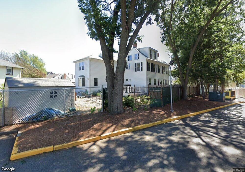
94 Grove St Unit 94A Melrose, MA 02176
Downtown Melrose NeighborhoodEstimated Value: $1,129,000 - $1,321,371
7
Beds
4
Baths
4,386
Sq Ft
$277/Sq Ft
Est. Value
About This Home
This home is located at 94 Grove St Unit 94A, Melrose, MA 02176 and is currently estimated at $1,213,593, approximately $276 per square foot. 94 Grove St Unit 94A is a home located in Middlesex County with nearby schools including Lincoln Elementary School, Winthrop Elementary School, and Hoover Elementary School.
Ownership History
Date
Name
Owned For
Owner Type
Purchase Details
Closed on
Aug 11, 2016
Sold by
Danna Francine A
Bought by
Francine A Danna Ft and Danna
Current Estimated Value
Purchase Details
Closed on
May 1, 2003
Sold by
Carroll Barbara Est and Carroll
Bought by
Danna Francine A
Create a Home Valuation Report for This Property
The Home Valuation Report is an in-depth analysis detailing your home's value as well as a comparison with similar homes in the area
Home Values in the Area
Average Home Value in this Area
Purchase History
| Date | Buyer | Sale Price | Title Company |
|---|---|---|---|
| Francine A Danna Ft | -- | -- | |
| Danna Francine A | $380,000 | -- |
Source: Public Records
Tax History Compared to Growth
Tax History
| Year | Tax Paid | Tax Assessment Tax Assessment Total Assessment is a certain percentage of the fair market value that is determined by local assessors to be the total taxable value of land and additions on the property. | Land | Improvement |
|---|---|---|---|---|
| 2025 | $103 | $1,042,300 | $357,800 | $684,500 |
| 2024 | $8,810 | $887,200 | $334,700 | $552,500 |
| 2023 | $8,499 | $815,600 | $311,600 | $504,000 |
| 2022 | $7,187 | $679,900 | $300,100 | $379,800 |
| 2021 | $6,927 | $632,600 | $300,100 | $332,500 |
| 2020 | $6,691 | $605,500 | $277,000 | $328,500 |
| 2019 | $6,185 | $572,200 | $253,900 | $318,300 |
| 2018 | $5,878 | $518,800 | $210,600 | $308,200 |
| 2017 | $5,709 | $483,800 | $201,900 | $281,900 |
| 2016 | $5,235 | $424,600 | $173,100 | $251,500 |
| 2015 | $5,369 | $414,300 | $164,400 | $249,900 |
| 2014 | $5,008 | $377,100 | $150,000 | $227,100 |
Source: Public Records
Map
Nearby Homes
- 16-18 Beacon Place
- 58 Summer St
- 20 Herbert St
- 333 Main St
- 16 Willow St Unit 207
- 12 Mount Vernon St Unit 27
- 36 Waverly Place Unit 2
- 23 Waverly Place
- 447 Pleasant St
- 407 Pleasant St Unit 1A
- 8 Crystal St Unit 3
- 8 Crystal St Unit 2
- 218 Upham St
- 42 Fairfield Ave
- 16 Baxter St
- 12 Sylvan St Unit 4
- 12 Sylvan St Unit 3
- 22 Adams St
- 9 Crescent Ave
- 46 Youle St
- 94 Grove St Unit 1
- 94 Grove St Unit 1
- 94-94A Grove St
- 98 Grove St
- 98 Grove St Unit behind96
- 98 Grove St Unit 98
- 21 Leonard Rd
- 21 Leonard Rd Unit 1
- 21 Leonard Rd Unit 2
- 102 Grove St
- 100 Grove St
- 96 Grove St
- 29 Leonard Rd
- 10 Beacon Place
- 106 Grove St Unit 108
- 106 Grove St Unit 1
- 22 Leonard Rd
- 31 Leonard Rd
- 110 Grove St
- 9 Beacon Place