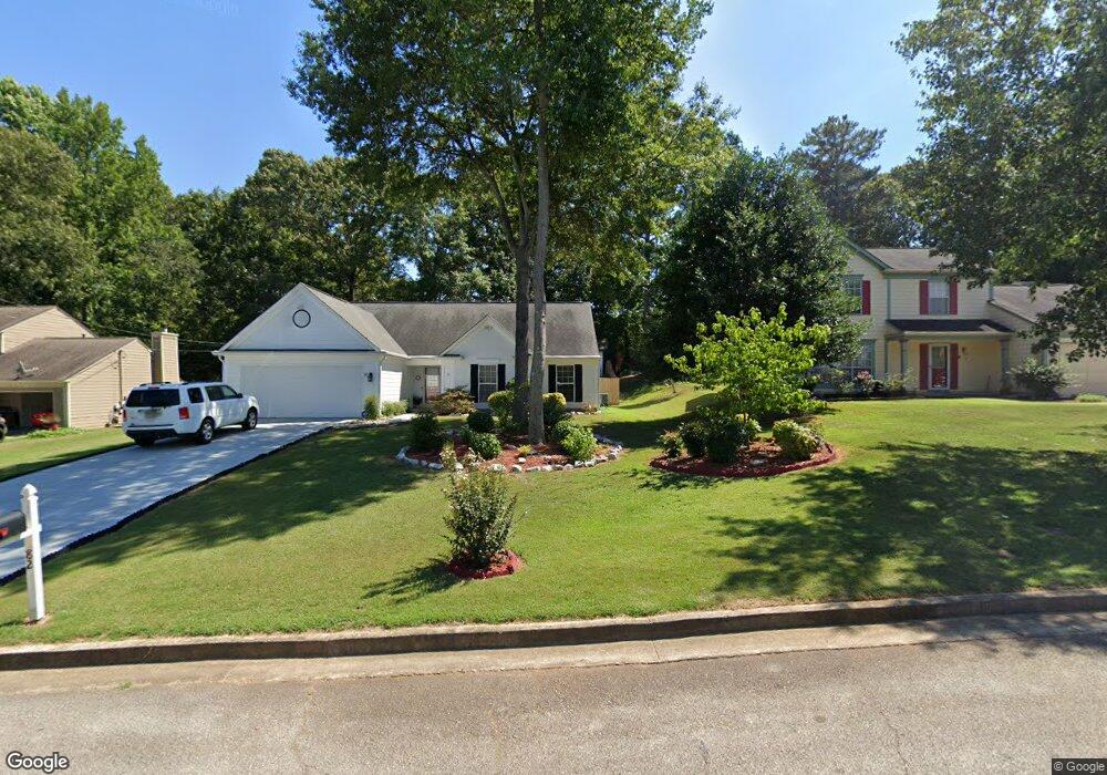
94 Heathrow Dr Riverdale, GA 30274
Estimated Value: $233,439 - $272,000
4
Beds
3
Baths
1,640
Sq Ft
$151/Sq Ft
Est. Value
About This Home
This home is located at 94 Heathrow Dr, Riverdale, GA 30274 and is currently estimated at $247,860, approximately $151 per square foot. 94 Heathrow Dr is a home located in Clayton County with nearby schools including Harper Elementary School, Sequoyah Middle School, and Charles R. Drew High School.
Ownership History
Date
Name
Owned For
Owner Type
Purchase Details
Closed on
Jun 30, 1999
Sold by
Anumudu Edmund U
Bought by
Vu Mat N and Vu Gon T
Current Estimated Value
Home Financials for this Owner
Home Financials are based on the most recent Mortgage that was taken out on this home.
Original Mortgage
$80,400
Interest Rate
7.66%
Mortgage Type
New Conventional
Purchase Details
Closed on
Feb 16, 1996
Sold by
Gower James Sylvia
Bought by
Anumudu Edmund
Create a Home Valuation Report for This Property
The Home Valuation Report is an in-depth analysis detailing your home's value as well as a comparison with similar homes in the area
Home Values in the Area
Average Home Value in this Area
Purchase History
| Date | Buyer | Sale Price | Title Company |
|---|---|---|---|
| Vu Mat N | $107,300 | -- | |
| Anumudu Edmund | $93,000 | -- |
Source: Public Records
Mortgage History
| Date | Status | Borrower | Loan Amount |
|---|---|---|---|
| Closed | Vu Mat N | $80,400 | |
| Closed | Anumudu Edmund | $0 |
Source: Public Records
Tax History Compared to Growth
Tax History
| Year | Tax Paid | Tax Assessment Tax Assessment Total Assessment is a certain percentage of the fair market value that is determined by local assessors to be the total taxable value of land and additions on the property. | Land | Improvement |
|---|---|---|---|---|
| 2024 | $1,381 | $81,160 | $5,600 | $75,560 |
| 2023 | $2,625 | $82,120 | $5,600 | $76,520 |
| 2022 | $715 | $59,320 | $5,600 | $53,720 |
| 2021 | $583 | $49,560 | $5,600 | $43,960 |
| 2020 | $516 | $44,170 | $5,600 | $38,570 |
| 2019 | $472 | $40,293 | $5,600 | $34,693 |
| 2018 | $431 | $37,648 | $5,600 | $32,048 |
| 2017 | $0 | $34,223 | $5,600 | $28,623 |
| 2016 | $325 | $29,589 | $5,600 | $23,989 |
| 2015 | $315 | $0 | $0 | $0 |
| 2014 | $219 | $24,698 | $5,600 | $19,098 |
Source: Public Records
Map
Nearby Homes
- 6671 Gano Dr
- 6860 Mountain Cir
- 6763 Valley Hill Ct
- 6605 Black Bend Ct
- 6888 Mountain Cir
- 242 Shenandoah Dr
- 90 Jonathan Rd
- 6643 Westfield Dr
- 123 Oldenburg Dr
- 239 Slicky Rock Ct
- 226 Stayman Dr
- 255 Tara Woods Dr
- 371 Roxbury Dr
- 295 Valley Hill Rd SW
- 175 Slicky Rock Ct
- 290 Valley Hill Rd SW
- 6847 Oak View Ct
- 7017 Sun Valley Way
- 200 Sunrise Cir
- 100 Heathrow Dr
- 82 Heathrow Dr
- 6757 Winesap Ct
- 108 Heathrow Dr
- 76 Heathrow Dr
- 585 Roxbury Dr
- 89 Heathrow Dr
- 6753 Winesap Ct Unit 2
- 97 Heathrow Dr
- 581 Roxbury Dr
- 81 Heathrow Dr
- 116 Heathrow Dr
- 105 Heathrow Dr
- 70 Heathrow Dr
- 589 Roxbury Dr
- 6756 Winesap Ct
- 0 Winesap Ct Unit 7161711
- 0 Winesap Ct Unit 7212388
- 0 Winesap Ct Unit 7170920
- 0 Winesap Ct