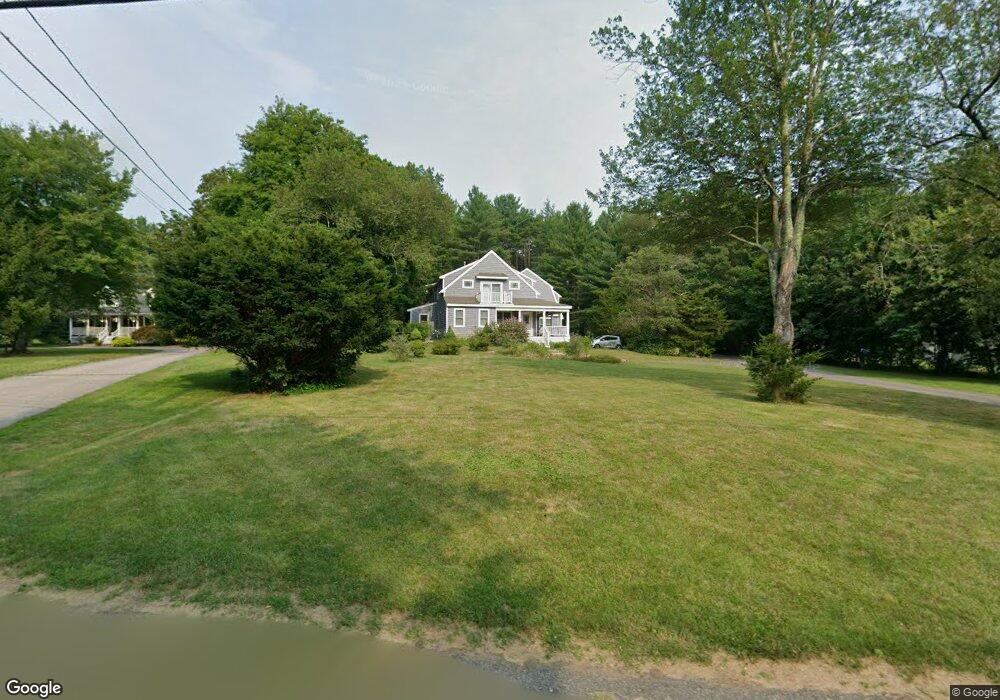
94 Jewell St Mansfield, MA 02048
Estimated Value: $1,011,000 - $1,299,000
3
Beds
3
Baths
3,717
Sq Ft
$311/Sq Ft
Est. Value
About This Home
This home is located at 94 Jewell St, Mansfield, MA 02048 and is currently estimated at $1,154,539, approximately $310 per square foot. 94 Jewell St is a home located in Bristol County with nearby schools including Everett W. Robinson Elementary School, Jordan/Jackson Elementary School, and Harold L. Qualters Middle School.
Ownership History
Date
Name
Owned For
Owner Type
Purchase Details
Closed on
Feb 28, 2002
Sold by
Campbell Frederick S and Oberlander Anna
Bought by
Asnes Howard P and Asnes Jean A
Current Estimated Value
Home Financials for this Owner
Home Financials are based on the most recent Mortgage that was taken out on this home.
Original Mortgage
$45,000
Outstanding Balance
$18,520
Interest Rate
6.85%
Mortgage Type
Purchase Money Mortgage
Estimated Equity
$1,136,019
Create a Home Valuation Report for This Property
The Home Valuation Report is an in-depth analysis detailing your home's value as well as a comparison with similar homes in the area
Home Values in the Area
Average Home Value in this Area
Purchase History
| Date | Buyer | Sale Price | Title Company |
|---|---|---|---|
| Asnes Howard P | $205,000 | -- |
Source: Public Records
Mortgage History
| Date | Status | Borrower | Loan Amount |
|---|---|---|---|
| Open | Asnes Howard P | $45,000 |
Source: Public Records
Tax History Compared to Growth
Tax History
| Year | Tax Paid | Tax Assessment Tax Assessment Total Assessment is a certain percentage of the fair market value that is determined by local assessors to be the total taxable value of land and additions on the property. | Land | Improvement |
|---|---|---|---|---|
| 2025 | $12,132 | $921,200 | $278,800 | $642,400 |
| 2024 | $12,023 | $890,600 | $278,800 | $611,800 |
| 2023 | $11,435 | $811,600 | $278,800 | $532,800 |
| 2022 | $10,956 | $722,200 | $260,100 | $462,100 |
| 2021 | $6,688 | $717,700 | $226,100 | $491,600 |
| 2020 | $10,669 | $694,600 | $216,300 | $478,300 |
| 2019 | $10,141 | $666,300 | $183,600 | $482,700 |
| 2018 | $5,977 | $650,100 | $176,200 | $473,900 |
| 2017 | $5,758 | $632,500 | $171,900 | $460,600 |
| 2016 | $9,086 | $589,600 | $164,400 | $425,200 |
| 2015 | $8,796 | $567,500 | $164,400 | $403,100 |
Source: Public Records
Map
Nearby Homes
- 4 Buckskin Dr
- 150 Gilbert St
- 24 Maverick Dr
- 176 Elm St
- 255 Mckeon Dr
- 2 Oak St Unit 2D
- 2 Oak St Unit 2A
- 2 Oak St Unit 2C
- 2 Oak St Unit 2B
- 451R Gilbert St
- 196 Donald Tennant Cir
- 37 Oakleaf Dr
- 450 West St
- 231 Spring St
- 11 Landry Ave
- 116 George St
- 406 South St
- 115 Westfield Dr
- 11 Buckthorn Ln
- 57 Vine St