J
Seller's Agent in 2019
Julianna Flanders
Flanders Real Estate

Estimated Value: $1,037,000 - $1,512,000
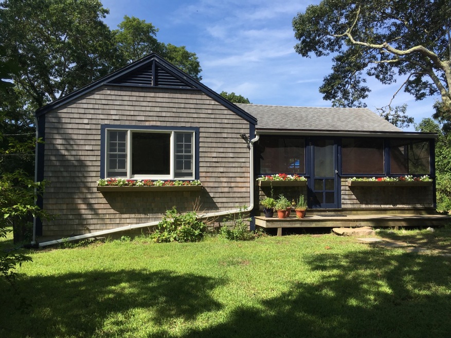
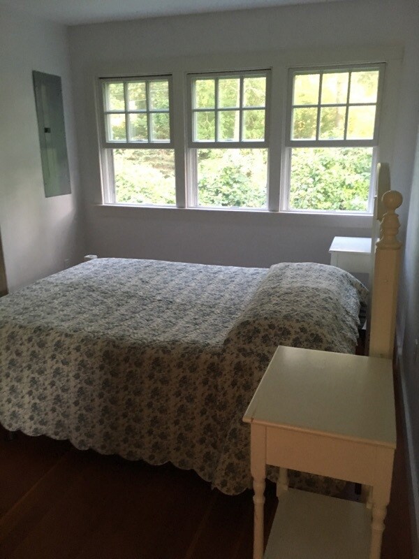
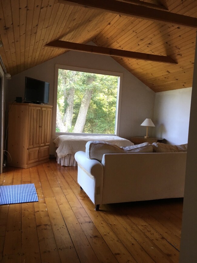
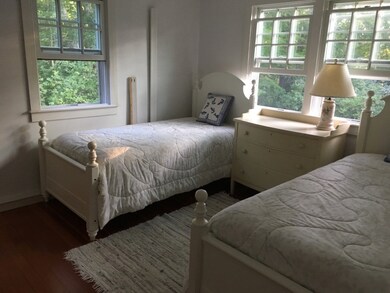
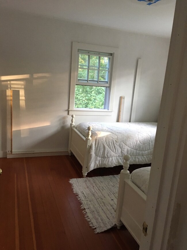
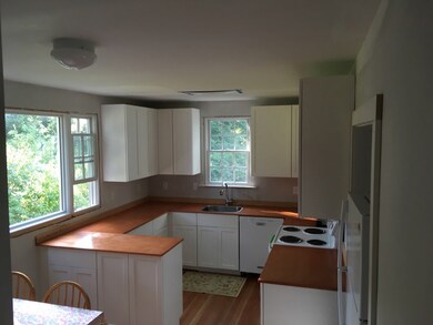
Lovely Chilmark cottage set back off of the Menemsha Crossroad. An easy distance to Menemsha and Chilmark center! Enter through the bright and airy screened porch into a large living area, with picture window and beautiful wood floors. Sliding door from living area leads to the spacious back deck and peaceful yard area. A large eat-in kitchen with breakfast bar and picture window. Two bedrooms, a full bathroom and first floor laundry room complete this well maintained home. Noteworthy improvements include new Andersen 400 series windows throughout, remodeled and updated kitchen and bathroom, new two bedroom septic installed 2014, upgraded electrical and plumbing, House is being sold as is.
Last Agent to Sell the Property
Julianna Flanders
Flanders Real Estate Listed on: 09/03/2019
Last Buyer's Agent
Julianna Flanders
Flanders Real Estate Listed on: 09/03/2019
| Date | Buyer | Sale Price | Title Company |
|---|---|---|---|
| Mary E Larsen 2016 Ret | $710,000 | -- | |
| Abigail F Howland Ret | -- | -- | |
| Howland Abigail F | $327,750 | -- |
| Date | Status | Borrower | Loan Amount |
|---|---|---|---|
| Previous Owner | Howland Abigail F | $212,417 | |
| Previous Owner | Howland Abigail F | $212,417 | |
| Previous Owner | Howland Abigail F | $200,000 |
| Date | Event | Price | List to Sale | Price per Sq Ft |
|---|---|---|---|---|
| 11/08/2019 11/08/19 | Sold | $710,000 | -5.3% | $707 / Sq Ft |
| 09/23/2019 09/23/19 | Pending | -- | -- | -- |
| 09/03/2019 09/03/19 | For Sale | $750,000 | -- | $747 / Sq Ft |
| Year | Tax Paid | Tax Assessment Tax Assessment Total Assessment is a certain percentage of the fair market value that is determined by local assessors to be the total taxable value of land and additions on the property. | Land | Improvement |
|---|---|---|---|---|
| 2025 | $1,930 | $857,600 | $578,600 | $279,000 |
| 2024 | $1,630 | $768,900 | $503,100 | $265,800 |
| 2023 | $1,564 | $594,700 | $386,900 | $207,800 |
| 2022 | $1,589 | $563,300 | $386,900 | $176,400 |
| 2021 | $1,559 | $535,900 | $386,900 | $149,000 |
| 2020 | $1,465 | $512,400 | $379,400 | $133,000 |
| 2019 | $1,441 | $500,400 | $379,400 | $121,000 |
| 2018 | $1,376 | $500,400 | $379,400 | $121,000 |
| 2017 | $1,339 | $499,700 | $379,400 | $120,300 |
| 2016 | $1,348 | $497,300 | $379,400 | $117,900 |
| 2015 | $1,308 | $497,300 | $379,400 | $117,900 |
| 2014 | $1,206 | $486,100 | $401,000 | $85,100 |
J
Seller's Agent in 2019
Julianna Flanders
Flanders Real Estate
Source: LINK (Vineyard)
MLS Number: 35807
APN: CHIL-000026-000000-000063
Ask me questions while you tour the home.