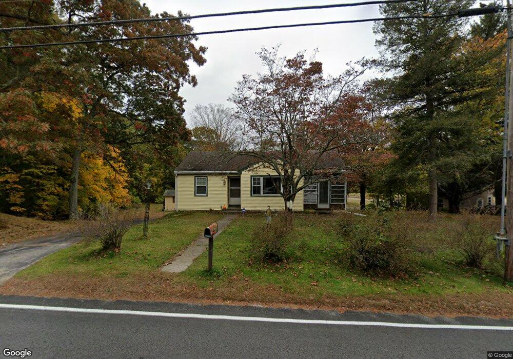
94 Mill St Hopedale, MA 01747
Estimated Value: $445,000 - $600,000
2
Beds
1
Bath
1,270
Sq Ft
$421/Sq Ft
Est. Value
About This Home
This home is located at 94 Mill St, Hopedale, MA 01747 and is currently estimated at $534,196, approximately $420 per square foot. 94 Mill St is a home located in Worcester County with nearby schools including Memorial Elementary School, Hopedale Jr Sr High School, and Bethany Christian Academy.
Ownership History
Date
Name
Owned For
Owner Type
Purchase Details
Closed on
Dec 14, 1999
Sold by
Luce Jennifer J
Bought by
Ryon Anthony L
Current Estimated Value
Purchase Details
Closed on
Aug 31, 1994
Sold by
Umlic One Inc
Bought by
Luce Erik H and Luce Jennifer
Purchase Details
Closed on
Jul 2, 1987
Sold by
Gettinger George
Bought by
Wright Bradley W
Create a Home Valuation Report for This Property
The Home Valuation Report is an in-depth analysis detailing your home's value as well as a comparison with similar homes in the area
Home Values in the Area
Average Home Value in this Area
Purchase History
| Date | Buyer | Sale Price | Title Company |
|---|---|---|---|
| Ryon Anthony L | $165,000 | -- | |
| Luce Erik H | $110,000 | -- | |
| Wright Bradley W | $144,000 | -- |
Source: Public Records
Mortgage History
| Date | Status | Borrower | Loan Amount |
|---|---|---|---|
| Open | Wright Bradley W | $133,300 | |
| Closed | Wright Bradley W | $25,000 |
Source: Public Records
Tax History
| Year | Tax Paid | Tax Assessment Tax Assessment Total Assessment is a certain percentage of the fair market value that is determined by local assessors to be the total taxable value of land and additions on the property. | Land | Improvement |
|---|---|---|---|---|
| 2025 | $6,554 | $394,600 | $179,800 | $214,800 |
| 2024 | $6,243 | $376,100 | $171,400 | $204,700 |
| 2023 | $5,727 | $354,600 | $169,200 | $185,400 |
| 2022 | $5,646 | $330,000 | $155,100 | $174,900 |
| 2021 | $10,924 | $296,800 | $141,000 | $155,800 |
| 2020 | $5,115 | $293,800 | $141,000 | $152,800 |
| 2019 | $4,793 | $272,800 | $135,000 | $137,800 |
| 2018 | $4,590 | $261,100 | $129,000 | $132,100 |
| 2017 | $4,240 | $245,200 | $122,200 | $123,000 |
| 2016 | $4,083 | $242,600 | $122,200 | $120,400 |
| 2015 | $3,943 | $237,800 | $122,200 | $115,600 |
Source: Public Records
Map
Nearby Homes
Your Personal Tour Guide
Ask me questions while you tour the home.