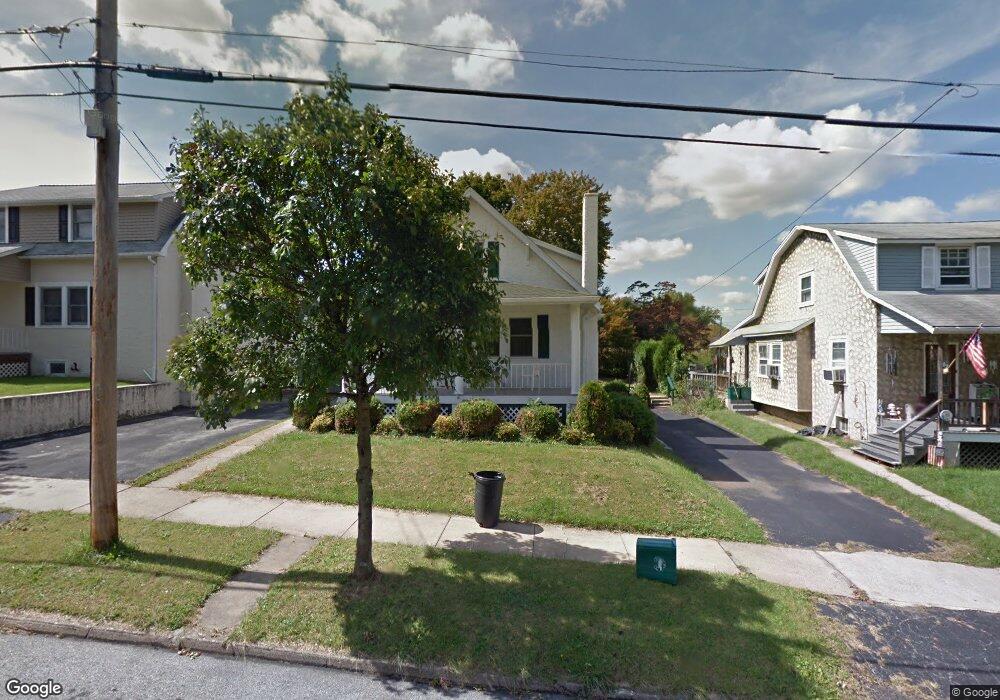
94 S 12th Ave Coatesville, PA 19320
Estimated Value: $270,000 - $310,000
3
Beds
3
Baths
1,736
Sq Ft
$167/Sq Ft
Est. Value
About This Home
This home is located at 94 S 12th Ave, Coatesville, PA 19320 and is currently estimated at $290,733, approximately $167 per square foot. 94 S 12th Ave is a home located in Chester County with nearby schools including Caln Elementary School, Coatesville Intermediate High School, and Coatesville Area Senior High School.
Ownership History
Date
Name
Owned For
Owner Type
Purchase Details
Closed on
Jun 9, 2010
Sold by
Desimone David S
Bought by
Midiri Marie T
Current Estimated Value
Purchase Details
Closed on
Mar 31, 1999
Sold by
Lyons Richard F
Bought by
Desimone David S
Create a Home Valuation Report for This Property
The Home Valuation Report is an in-depth analysis detailing your home's value as well as a comparison with similar homes in the area
Home Values in the Area
Average Home Value in this Area
Purchase History
| Date | Buyer | Sale Price | Title Company |
|---|---|---|---|
| Midiri Marie T | $203,000 | None Available | |
| Desimone David S | $39,000 | T A Title Insurance Company |
Source: Public Records
Tax History Compared to Growth
Tax History
| Year | Tax Paid | Tax Assessment Tax Assessment Total Assessment is a certain percentage of the fair market value that is determined by local assessors to be the total taxable value of land and additions on the property. | Land | Improvement |
|---|---|---|---|---|
| 2025 | $4,906 | $81,590 | $21,960 | $59,630 |
| 2024 | $4,906 | $81,590 | $21,960 | $59,630 |
| 2023 | $4,857 | $81,590 | $21,960 | $59,630 |
| 2022 | $4,732 | $81,590 | $21,960 | $59,630 |
| 2021 | $4,611 | $81,590 | $21,960 | $59,630 |
| 2020 | $4,596 | $81,590 | $21,960 | $59,630 |
| 2019 | $4,478 | $81,590 | $21,960 | $59,630 |
| 2018 | $4,328 | $81,590 | $21,960 | $59,630 |
| 2017 | $4,209 | $81,590 | $21,960 | $59,630 |
| 2016 | $3,457 | $81,590 | $21,960 | $59,630 |
| 2015 | $3,457 | $81,590 | $21,960 | $59,630 |
| 2014 | $3,457 | $81,590 | $21,960 | $59,630 |
Source: Public Records
Map
Nearby Homes
- 1263 E Diamond St
- 826 Stirling St
- 824 Stirling St
- 1050 Wayne Ave
- 901 Merchant St Unit 60
- 69 Palmer Ave
- 124 Chester Ave
- 440 Oak St
- 131 Pennsylvania Ave
- 420 Glendale Ave
- 298 N Chester Ave
- 622 Walnut St
- 499 Prospect Ave
- 215 Kennedy Dr
- 213 Kennedy Dr
- 65 Lukens Mill Dr Unit 154
- 209 Kendig Ln
- 111 Lukens Mill Dr Unit 50
- 214 Andrew Rd
- 43 S 5th Ave
- 92 S 12th Ave
- 96 S 12th Ave
- 1121 Walnut St
- 91 S 12th Ave
- 100 S 12th Ave
- 1150 Stirling St
- 1148 Stirling St
- 1152 Stirling St
- 1146 Stirling St
- 1124 Walnut St
- 1144 Stirling St
- 1142 Stirling St
- 1202 Stirling St
- 1140 Stirling St
- 1111 Walnut St
- 1138 Stirling St
- 102 S 12th Ave
- 1204 Stirling St
- 1136 Stirling St
- 1122 Walnut St