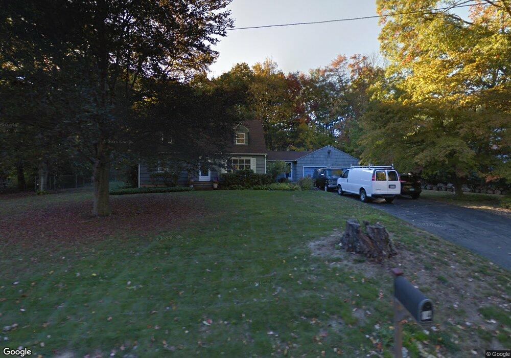
94 Union City Rd Naugatuck, CT 06770
Estimated Value: $394,000 - $505,000
4
Beds
2
Baths
2,112
Sq Ft
$214/Sq Ft
Est. Value
About This Home
This home is located at 94 Union City Rd, Naugatuck, CT 06770 and is currently estimated at $452,232, approximately $214 per square foot. 94 Union City Rd is a home located in New Haven County with nearby schools including City Hill Middle School and Naugatuck High School.
Ownership History
Date
Name
Owned For
Owner Type
Purchase Details
Closed on
Sep 17, 2003
Sold by
Slezak Linda M
Bought by
Mears Beryl and Mears Binns
Current Estimated Value
Home Financials for this Owner
Home Financials are based on the most recent Mortgage that was taken out on this home.
Original Mortgage
$100,000
Interest Rate
5.59%
Mortgage Type
Purchase Money Mortgage
Purchase Details
Closed on
Feb 21, 1995
Sold by
Brazicki-Kerr Carol
Bought by
Slezak Linda
Home Financials for this Owner
Home Financials are based on the most recent Mortgage that was taken out on this home.
Original Mortgage
$105,700
Interest Rate
9.5%
Mortgage Type
Purchase Money Mortgage
Create a Home Valuation Report for This Property
The Home Valuation Report is an in-depth analysis detailing your home's value as well as a comparison with similar homes in the area
Home Values in the Area
Average Home Value in this Area
Purchase History
| Date | Buyer | Sale Price | Title Company |
|---|---|---|---|
| Mears Beryl | $260,000 | -- | |
| Slezak Linda | $151,000 | -- |
Source: Public Records
Mortgage History
| Date | Status | Borrower | Loan Amount |
|---|---|---|---|
| Closed | Slezak Linda | $100,000 | |
| Previous Owner | Slezak Linda | $144,500 | |
| Previous Owner | Slezak Linda | $105,700 |
Source: Public Records
Tax History Compared to Growth
Tax History
| Year | Tax Paid | Tax Assessment Tax Assessment Total Assessment is a certain percentage of the fair market value that is determined by local assessors to be the total taxable value of land and additions on the property. | Land | Improvement |
|---|---|---|---|---|
| 2025 | $8,743 | $219,730 | $54,460 | $165,270 |
| 2024 | $9,183 | $219,730 | $54,460 | $165,270 |
| 2023 | $9,833 | $219,730 | $54,460 | $165,270 |
| 2022 | $7,613 | $159,430 | $57,110 | $102,320 |
| 2021 | $7,613 | $159,430 | $57,110 | $102,320 |
| 2020 | $7,613 | $159,430 | $57,110 | $102,320 |
| 2019 | $7,533 | $159,430 | $57,110 | $102,320 |
| 2018 | $7,414 | $153,340 | $69,130 | $84,210 |
| 2017 | $7,445 | $153,340 | $69,130 | $84,210 |
| 2016 | $7,310 | $153,340 | $69,130 | $84,210 |
| 2015 | $6,988 | $153,340 | $69,130 | $84,210 |
| 2014 | $6,910 | $153,340 | $69,130 | $84,210 |
| 2012 | $6,713 | $200,090 | $80,150 | $119,940 |
Source: Public Records
Map
Nearby Homes
- 29 Ramsey Ave
- 223 E Waterbury Rd
- 219 Union City Rd
- 333 Wooster St
- 38 Tyler Hill Rd
- 15 Neagle St
- 142 Applewood Ln
- 92 Quentin St
- 21 Acushnet St
- 101 Adella St
- 20 Charlene Dr
- 51 Brook St Unit 7A
- 51 Brook St Unit 6A
- 317 City Hill St
- 465 N Main St
- 39 Alma St
- 11 Shadee Ln
- 4 Florence Dr
- 426 City Hill St
- 17 Meadowbrook Dr
- 104 Union City Rd
- 82 Union City Rd
- 14 Tidmouth Ct
- Lot 6 Tidmouth Ct
- Lot 2 Tidmouth Ct
- Lot 8 Tidmouth Ct
- Lot 4 Tidmouth Ct
- Lot 9 Tidmouth Ct
- 20 Tidmouth Ct
- LOT 1 Tidmouth
- 7 Tidmouth Ct
- 67 Union City Rd
- 78 Union City Rd
- Lot 3 Tidmouth Ct
- 3 Tidmouth Ct
- 4 Tidmouth Ct
- 3 Tidmouth Ct
- 0 Tidmouth Ct Unit W10044965
- 0 Tidmouth Ct Unit W1070686
- 0 Tidmouth Ct